OpenStreetMap

EdLoach's Diary

Recent diary entries

Addressing

Posted by EdLoach on 15 January 2015 in English. Last updated on 14 August 2015.

I’m writing this entry because what began as typing a comment on this diary entry started getting a bit long.

Addressing is a lot of work. Not just the initial collection, but then you get into the whole “map gardening” discussion - maintaining what has already been mapped as opposed to (or perhaps as well as) mapping new stuff. Locally we’ve started watching local authority planning decisions and using the relatively new notes feature to record where needs surveying to see if and when things change. But we’ve been collecting addresses for about 5 years, and weren’t doing this at the start. Only today in a discussion about non-shop laundrys (for hotels and restaurants) I checked a couple I had mapped and found one got planning permission a year or two back to be replaced by a block of flats (we missed that one). So another re-survey needed. And only this morning I was adding some new builds I finally got around to re-surveying at the weekend that had been previously added as construction areas a couple of years ago.

I now use OsmAnd and always love it when it can direct me to an address rather than a road, which is why I want to get local addresses as complete as I can, though I started collecting addresses before I could use the data. Initially it was when collecting my step-daughters from their friends’ houses in the dark I wanted to be able to check OSM before setting out to see what end of, and which side of, the street to find them. It took a long time to join all those little random patches of addresses together.

Addresses are the places people want to go; roads are the way they get there. OSM needs both. I think it will take time, but as tools evolve and we continue to grow hopefully the pace will also increase. I think Robert Barr said during his 2013 State of the Map presentation that at the then level of address coverage it would take another 200 years to finish collecting UK addresses. I hope it is quicker than that.

My reasons for mapping house numbers

Posted by EdLoach on 12 June 2013 in English.

I noticed on OSM talk this morning that the State of the Map US videos are available, so followed the link to bookmark for later. It turns out installing MS SQL Server is slow, so while doing that in the day job in another window I watched Richard’s presentation “You Are Not The Crowd” and even noticed my username and name on a couple of slides.

The section about reasons made me wonder about some of my reasons for mapping things, and in particular house numbers as that was mentioned in the presentation.

My first bit of house number mapping was because it was being discussed on some OSM mailing list somewhere, and I had a new phone which ran OSMtracker. I used custom waypoints to record house numbers as the text and added them as nodes when I got home. Over time I developed other methods to get both sides of the street at the same time (e.g. a waypoint “12,17” meant the house on the left of the street was number 12, the one on the right 17, and “,21” meant 21 was on the right but no house was directly opposite), but I never really mapped very many house numbers. This was also before OS Opendata was available, so the numbers were just numbers on the map. (These have since been added to traced building outlines in all the places I can remember having done this).

Moving forward in time slightly, my teenage stepdaughters were often visiting their school friends after dark and phoning for lifts home from areas of the town I didn’t know particularly well. I could find the road in OSM of course (as the area was road complete by this time), but had no idea where on the road the address they gave me was, so I was driving down the road in the dark trying to spot housenumbers. Fortunately the roads were quiet but this isn’t really the safest of things to be doing. So I began arriving early when they asked for lifts in daylight and collecting the housenumbers for that street, and time permitting adjacent streets. I was able to trace houses from OS Opendata Streetview, and later in better resolution from Bing, and this looked better than the numbers alone which encouraged me to try and join the patches together, and also showed progress if I only traced the buildings as I added the housenumbers (I was rather against the idea of someone who suggested using image recognition and OS Opendata to get all the buildings added - this might have made the map look pretty, but in my opinion buildings with no other informational tags don’t add anything, and obscure what still needs mapping in some ways). I also hoped to have mapped all the areas locally where the girls might have friends so that if they phoned for a lift from an address I’d not been taxi-driver for before I’d already know how to find it in the dark.

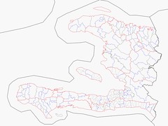
I’m trying to get the whole of the Tendring district address complete, fortunately not alone as percivjr has done much of the north and west of the district, and we continue to make progress as spare time allows, and we have had the occasional new mapper pop up and do their street in villages we’ve not yet got to ourselves, or web site developers wanting to put their clients on the map in places we’ve still to reach.

I’ve discussed what I’m doing with relatives and my inlaws wished that the whole area had been complete the year they offered to deliver electoral roll forms to a rural part of the district; most places only had housenames and road names and were difficult to find and if they had all been available on a map in advance it would have saved driving up and down the same lane numerous times, perhaps using more in fuel than they got paid for the deliveries.

Also, I hope, but don’t know, that with suitably complete address data that I can at some point download a map for my Garmin which will allow navigation to an exact house. If this isn’t possible now, then maybe at some future time as storage card capacities increase. But for it to be possible the data has to be there. If it is possible now I should read my Garmin manual…

I’ll try and get to the other SotM-US videos as time permits, at the risk of making more of these long diary entries after watching them.

Location: Tendring, Essex, England, United Kingdom

House numbers

Posted by EdLoach on 11 June 2013 in English.

This morning I saw a tweet from pascal_n which read:

#OpenStreetMap "Address Counts per Country", Stats: http://t.co/1wL0KjbF7e Map: http://t.co/igaHD5ixl2 by OSM Chairman Simon Poole @sp8962

Visiting the address counts per country page, I spotted the note at the top that read:

“2013-03-27 Added A/P column. The values are total address count divided by population, Denmark with a complete address import for the country at 0.42 can serve as a rough guideline to where this value should be for similarly developed countries. We are missing population values for some countries they will added asap.”

Having done quite a bit of local address mapping (aside: not alone, another local mapper has done much of the northwest section of the Tendring district) was inspired to calculate the local figure. I have an OSM extract updated regularly using Osmosis and Wikipedia gives the population figure for Tendring, 2011 estimate as 138,100. So I loaded up the extract into JOSM, waited while it rendered, clicked on a random node then pressed 3 to zoom in and speed things up again, searched for everything with an addr:postcode tag, got figures of 1 relation, 67 nodes, and a lot of ways totalling 50,199, did the sums and reached a figure of 0.36.

This probably helps support that 0.42 is a fair target for at least this area. I know there is still Brightlingsea that needs a lot of address surveying, but after that it is mainly small villages, the biggest of those probably being half of Thorpe-le-Soken, which won’t affect the figure much. Wikipedia suggests a population of 8,500 for Brightlingsea and while some of the town has been mapped, the figure I get doing (50,199)/(138,100-8,500) is just under 0.39.

I’ll try and remember to do this calculation again when we have finished mapping all the addresses in the district to see how it comes out.

Location: Tendring, Essex, England, United Kingdom

A mysterious new house

Posted by EdLoach on 10 June 2013 in English.

I was out surveying at the weekend, starting at Thorpe-le-Soken railway station and aiming to finish at Little Clacton’s village carnival collecting many of the remaining missing house numbers to complete Little Clacton parishes addressing. As part of this I walked down Batemans Lane with the intention of taking Lotts Road, heading back up Talbot Road to do Homing Road and Thorrington Road before heading along Brookfield Road to Elm Road. Note the named tracks get their names from OS OpenData; there are no on the ground signs.

However, Lotts Road turned out to be a small path through nettles initially. I could tell from OS OpenData StreetView that it should be one side or the other of the house shown, but I missed it and ended up walking into Ideal Nurseries, which seems to be some greenhouses that have seen better days surrounded by old vehicles in a similar state to the greenhouses. And a brand new house which looks like it is about to be completed. If you look on Bing it is under construction, or if you zoom in it is just a cleared bit of orchard.

When I got home I did a bit of investigation. I couldn’t find any planning application for it on the council website which concerned me a bit. Should I report it, or not? So before deciding I took another look this morning and happily tracked down the application - why I missed it on Saturday was because I was looking for something recent. The permission had originally been granted in 1990, and the linked application for resiting (due to powerlines) was made and granted in 1991 - the “other” document on the above link contains correspondence checking that marking out the corners of the property and digging a trench for the front foundation counted as commencement work under the terms of the original permission and it seems that was all that was done until probably a year or so ago (depending how new Bing’s imagery is…)

Having said all that I do think I’ve found a building on Bing which should have been removed by 1997. I figure I’ve probably missed something there too. Or the council did.

Edit: It was me. In the refusal of the 1996 application there is correspondence which says it is “being used wholly and solely as incidental to the enjoyment of the dwelling house” - so not as a separate property and can remain (see “Other” pages 2 and 3).

Edit 2: Rereading the above, “aiming to finish” in the first sentence was meant to be followed by the bit about how I got sidetracked by a pub

Location: Little Clacton, Tendring, Essex, England, United Kingdom

Schroedinger's Ways

Posted by EdLoach on 8 November 2012 in English.

I’ve recently started learning Git(hub) with a view to helping with Potlatch2 tags. My first commit (which is now live) was to add access=destination to roads.

Due to conversations on the #osm irc channel I thought I’d look into trac ticket 4378 regarding creating ways with only one node.

I trawled through the code and worked out what was happening when you deleted the last but one node in a way, which seemed to be the easiest way to create such ways, and came up with what seemed a simple change but after some more testing I reverted this change as although I think it improves things it isn’t a cure and I want to do some more work on it (aside: the problem from the above is that after deleting the second last node it deletes the way, but you need to undo twice to restore that second last node - after the first undo there is a single node way in existence that can be saved).

So I started considering when a way is a way. The easy answer is that it has to have 2 nodes, so if you select one node of a two node way and delete it then the way should be deleted before the node (which would fix the undo issue I mention above). But if you are deleting the nodes while drawing a way you can get to the stage where the second last node is deleted but you are still in draw mode, so whether the way should be deleted or not depends on whether you delete the last node or add another. So in draw mode you don’t want to delete the way unless the last node is deleted (you’d lose the id, so the history of any changes, and all the tags/relation memberships).

It is this indeterminate state of whether the way exists depending whether you add a node, exit draw mode, or remove the last node that I decided to call a Schroedinger’s Way.

And I think the exiting draw mode when you have a 1 node Schroedinger’s Way is going to be the hardest bit to address, as you want to delete the way but not have the undo issue I mention above, but the second last node is already deleted.

Perhaps someone who has developed Potlatch 2 longer than I (as in most of the people who have ever developed Potlatch 2) will have some ideas about how to address this.

GT-31 vs Garmin eTrex 30

Posted by EdLoach on 21 October 2012 in English.

My new eTrex arrived in the last week or so, and as the ordered rechargable batteries haven’t yet arrived I stuck a couple of Duracell batteries in and took that and my old GT-31 out with me for a ramble yesterday (or pub crawl - we were marking CAMRA’s Cider month by walking between 5 cider pubs over a 7.2 mile route). I wanted to compare the traces from the two.

So, this morning I loaded all the traces into JOSM, coloured the one set red, the other set blue and added the Bing imagery background. (Aside: at some point I’ll probably upload these traces, though I tend to only upload in date order and often only catch up at Christmas; I’ve captured a few images and put them on Flickr.)

Both GPSes were in the same pocket of my fleece jacket, except when I brought out the Garmin to show how OSM maps were displayed and included the POIs we were passing. Thanks to Talkytoaster for the easily added OSM map. I’ve yet to try other OSM maps, though I believe others are available.

Based on yesterday’s single test, in summary the GT-31 seems more accurate when I’m travelling on a bus or in a car (especially in the car). When walking across fields, the Garmin looks to generally be a little more accurate, though there was very little in it. The GT-31 creates a larger point cloud when in pubs (the Garmin was more likely to report a signal lost). The GT-31 was only set up to capture when moving above 1km/h (iirc) so the Garmin showed a dense point cloud when I was waiting for the bus home for 5 minutes that the GT-31 didn’t.

Location: Harwich, Tendring, Essex, England, United Kingdom

Had a quick play with Bing tracing

Posted by EdLoach on 1 December 2010 in English.

http://osm.org/go/0EHnB9k9

I decided to concentrate on the landuse for the area bounded by Holland Road, Thorpe Road, Centenary Road and London Road initially. I'm quite pleased with how it has come out.

I've used a mixture of methods though. Sometimes I have shared nodes with multiple ways (some closed), and sometimes I've drawn ways and used a multipolygon to create an area. Both work, but I'm not sure which I prefer. I think shared nodes for landuse areas makes sense, but if I've defined all the boundaries of an area as a combination of fences and hedges it seems more sensible to add these to a multipolygon than put a landuse area on the top.

I see the addition of field boundaries when looked at with the almost complete footpath coverage in the district (thanks in part to user Steeplejack's magnificent efforts) as making the map useful for ramblers at last. It will be time consuming though - it's taken some hours to trace this area which I'm guessing is just over 1 km² and the total area of the (Tendring) district is about 300km². Having said that, I've traced the buildings on the south side of Holland Road and moved the house numbers (previously mapped on nodes) onto the buildings, and moved the nodes on the north side to the corner of the relevant property ready to convert to areas, and I don't plan on tracing buildings anywhere until I've collected the house numbers to tag them with.

For reference, Bing imagery is available up to z21 in this area. I have resisted the temptation to map trampolines in people's gardens...

Location: Great Clacton, Clacton-on-Sea, Tendring, Essex, England, CO15 4RF, United Kingdom

A rare diary entry - Brook Country Park

Posted by EdLoach on 11 September 2010 in English.

Free time seems rare at present. Mapping has been restricted to about 10 minutes of house number surveying a (week)day recently. So finally getting some time to visit Brook Country Park between Brook Retail Park bottle bank and collecting my son from his nan's in Little Clacton was a small joy.

It is one of those little local niggles that has begun to be scratched. I found a whole half an hour to wander around the recently opened Brook Country Park for almost 30 minutes today. I almost mapped it before it opened earlier this year (dog walkers were already fairly evidently using it), but waited, and since it opened this is the first time I got beyond the car park.

I've used footway for the footpaths and path for the mown paths. This will probably invite comments on tagging, but I don't care. This makes sense to me and I'll continue to do it locally. I'll add surface tags to those ways I've overlooked when I get a moment. And hopefully get back before too long to add the other paths (all footways are done).

As an aside the latest JOSM is almost becoming a parody of a tagging tool. Amenity=bench is something I've tagged lots of, but the tagging presets in the new tested version are really over the top for something that doesn't even render in any of the renders I usually view. And when you look at highway=path which many UK mappers still use as the path equivalent of highway=road as in something which needs more details adding at a later time, the number of options is silly. Sac scale? Is that French? The paths I mapped today are near Tesco and one or two plastic bags have blown into the far side of the hedges - how do I tag that?

It's great to find such a large area so close to home where I can wield a GPS for more than waypoints. I was doing footpaths, but decided to leave that to Steeplejack as he is doing them so much quicker than I manage (it was good to see him when I was working at the Clacton Beer Festival a couple of weeks ago; pity I was so busy that I forgot to buy him the drink I'd promised. I owe you, if you're reading...). So house numbers it is locally. Tendring is road complete when compared via ITO to OS Locator, and we have a number of "roads", usually called Mews, which are usually named shared driveways that don't make it to OS Locator, but are an essential part of postal addresses.

Other validation tools I've looked at recently - there are a few bicycle shops still to map in the Tendring District; and this Routing tool that has expanded to cover all Europe rather than just .de has some other things I need to check. There were others but I can't find the link at present.

And as a matter of full disclosure, I'm approaching the end of a very nice half price Tesco Shiraz and have deliberately tried to be both humourous and provocative in the above diary entry. I suspect based on previous experience that it is the humour that won't come across as well as I'd hoped.

Location: Great Clacton, Clacton-on-Sea, Tendring, Essex, England, CO15 4RF, United Kingdom

Haiti Administrative Boundaries

Posted by EdLoach on 29 January 2010 in English.

I've recently been helping tidy up the Haiti administrative boundaries that had been imported into OSM. Relations were created, overlaid ways were split at appopriate places, tags were moved from ways to relations and most recently I've been updating admin_levels to be the lowest number as per the wiki documentation.

A quick look at OSM shows the Departments at this zoom level 8. At zoom level 11 admin levels 4 (department) and 5 (arondissiment) are visible, and zooming in to zoom level 12 shows the admin level 8 (commune) boundaries. The admin level 10 boundaries (the pcode:3 level districts) become visible at zoom level 13. Only a subset of these last boundaries have to date been imported.

I wanted a quick way to visually see which of the pcode:3 districts had been imported, so learnt how to use a Xapi request to retrieve all boundary=administrative tagged relations in a certain bounding box (I found the numbers from that by using the Export tab and drawing the area I wanted manually, then copying them from there). With the 14.5MB data.osm file I got back from that I loaded it into Kosmos and made a set of rules to cover different administrative levels in different colours (this always takes me trial and error, but the set I'm currently using is here).

The resulting picture is on Flickr - a small version of it is included here:
Haiti Administrative boundaries from OSM as at 29/01/2010

If more of the admin_level 10 boundaries are imported I suspect there will be more work to do merging the new ways with the existing ones that they will probably overlay. If this happens then I will produce an updated diagram.

I had hoped to produce different maps showing pcode:1, pcode:2 and pcode:3 labels at appropriate zooms, but AreaCenter in Kosmos doesn't seem to work with relations and it doesn't seem to like colons in tags, as I could get the name value in the wrong place but got no errors or text when trying to use the pcode:3 value instead. Perhaps I should try and learn how to play with Mapnik...

Duplicate nodes

Posted by EdLoach on 29 November 2009 in English.

I've spent the last couple of weeks, more-or-less, trying to clear all the duplicate nodes in the UK. It's taken that long, and about 800 changesets, partly because I lose track of which I've done and the excellent tool here:
http://matt.sandbox.cloudmade.com/dupe_nodes.html
shows changes made before midnight GMT after about 7pm GMT, so it takes some time to see what remains to be done. I used what I think is a variation of that tool here: http://matt.sandbox.cloudmade.com/foo.html?lat=53.14677&lng=-5.053711&zoom=5&layer=5 as I was able to tackle a square at a time to try and keep track of what I'd done a little more easily.

As I type, the second link above is showing one green square for the UK which includes 8 new duplicates introduced yesterday that I fixed last night. There also seem to be a load of red dots which I think may be some sort of cache issue, as the lack of coloured squares suggests no errors (and there shouldn't be really, as those red dots are the duplicates I dealt with on Friday evening).

What causes the duplicates, though? Well, there seem to be various reasons. Some areas have had issues for a while, and also include lots of unjoined ways. I suspect these are usually down to new users, probably using older versions of Potlatch when it wasn't clear that the way you were drawing was going to join the other way. In other cases there were duplicate ways on top of each other. I'm hoping these were all pre-API 0.6 upgrade and were attempts by users to reupload changes after timeouts, causing the way to be uploaded multiple times. In some small number of cases there were roundabouts which were very circular but had an excessive number of nodes and the way went around the roundabout a number of times; I suspect some sort of neating of circles tool with a bug. To my surprise though, the duplicates that I've seen new in the last two or three days have been added by long standing mappers using JOSM (tested), so wonder if there is some bug with joining ways, or whether it is just harder to tell with certain preference combinations than it is in Potlatch these days. I'll keep my eye on other new duplicates and see if there is any pattern.

During one evening when I was waiting for the refresh to appear, I did briefly look at the USA. Some people will know about the TIGER import of US data means everything at the county boundaries involves (or involved at the time) disconnected ways and duplicate nodes, but sorting them out is a nightmare. Where county boundaries run along a way, the way is duplicated, but not usually the same way. One county might have it running along their boundary and then left at a junction, whereas the other may have it running along the shared boundary and then right at that same junction (perhaps where three counties meet). Splitting the ways and removing the duplicates, then rejoining all the side ways to the way that remains is very time consuming and requires much more care than the UK tidying up I've been doing. Respect is due to the mappers who continue with this task.

Map completeness

Posted by EdLoach on 22 June 2009 in English.

I've been mapping for this project now for just over 10 months and sometimes I am surprised at how complete the map now seems compared to when I first looked at it. I know I've done a lot of work near where I live, but I tend to look at that in isolation and know how much there is that can still be added (as I drive around there are lots of public footpath signs that seem to jump out to say "You haven't walked me yet"). But I sometimes forget that there are many other mappers out there also working hard to improve their localities. Colchester is so very much better as well for example, and I've only been there a couple of times to map (usually to walk cycle routes).

What made me consider this was that I did a two hour round trip on Saturday to add three nodes to the map. Admittedly they were very specific nodes (NCN mileposts - see http://wiki.openstreetmap.org/wiki/WikiProject_United_Kingdom_Sustrans_Mileposts) and were south of Colchester (near Birch), in the centre of Colchester, and north of Colchester (Langham), so weren't particularly close together either.

Then on Sunday I was pushing a pushchair randomly around the Beehive pub in Beehive Lane off the A12 making traces. I thought perhaps if the area had largely been traced from Yahoo (I don't know whether it had been or not) then the service ways behind houses to garages not only made for more peaceful walking, but also were less likely to be on. I think I added one small driveway, one footway, plus fleshed out the Beehive's car park details a bit.

On the way home we made a slight detour to Little Totham to visit the end of the beer festival at The Swan (CAMRA national pub of the year in 2002 and 2005). I could easily find an excuse to spend a day mapping that village, with pub lunch, as compared to the other areas I'd been in recently, my few brief notes from where I parked added the pub itself, the start of two footpaths (well one that crossed the road and ran down the side of the pub), the start of one side road with a note about another being visible off that but unsurveyed, a post box and a telephone box. I was also able to fine tune the lane to the village (NPE sourced) to the GPS trace and remove the source=NPE tag.

Location: Little Totham, Maldon, Essex, England, United Kingdom

Tracking tonight

Posted by EdLoach on 18 June 2009 in English.

It's our local CAMRA branch (Tendring) branch meeting tonight, and it's at the Village Maid in Bradfield (a pub I've not been in before). I remember marking that on when I was hunting postboxes; one of the ones I was hunting was on a road down the side of the pub that is no entry at one end. I can't remember now whether I marked the whole road as oneway=yes, or just added a short section at the end - I've a feeling the pub car park is on that street and will check tonight whether perhaps they might be able to turn the "wrong way" out of it.

I've guessed roughly where the pub was in the associated entry location - Mapnik was showing "More coming soon" when I zoomed in to find it.

Location: Bradfield, Tendring, Essex, England, United Kingdom

Customer Service

Posted by EdLoach on 17 June 2009 in English.

I have to say I've never had anything but excellent customer service from the two companies I have dealt with regarding my GT31 unit.

I originally placed an order on StorageDepot's website for a GT31 last August, when it showed the stock was moving quickly (or words like that), but suggested at least that there was stock. Unfortunately I wasn't quick enough, but I received an email from them apologising and giving me URLs linking to two other suppliers who did currently have stock, so I was still able to get a unit within a couple of days. Thanks to their kindness I used them later when I needed a replacement bicycle mount bracket (the screws disappeared on a bumpy cycle path in Milton Keynes - tip: paint over them with a female relative's nail varnish to help hold them in. Also works on pet collar name cylinders that screw together - I bought a few of those before the girl at the pet shop gave me the tip...). I added one of the things that hold it on your upper arm at the same time, which I've found useful mapping footpaths while pushing pushchairs.

Anyway, I ended up buying from gps-speed.co.uk and all was great until yesterday when I took out the SD card to copy tracks off (as usual), and afterwards it wouldn't lock back into the unit. I tested with a second card in case it was the card but had no luck there, so followed the returns procedure on their website and posted it yesterday lunchtime.

Just after noon today I got a call from them asking if I'd accept a staff member owned unit which was newer than the one I'd returned; because I'd owned mine for more than 28 days they had to send it back (to Taiwan) and wondered if I'd accept a newer (but used) one rather than wait for the repaired one. I jumped at the chance and suspect I'll see the unit possibly as early as tomorrow.

I should still be able to map something this weekend, after all.

That was close

Posted by EdLoach on 15 June 2009 in English.

For a while now I've known I was due to attend a meeting this evening at The Blacksmiths Arms, Little Clacton. I'd already planned to use this as an excuse to walk there and check out a couple of source=NPE footpaths to find whether they were there or not.

But sometimes nature has different plans. By the end of Look East (local news bulletin on BBC) just before 7pm, I'd seen news about cows being killed by lightning, hail so heavy it looked like snow had fallen, flash flooding, and various other weather related stories. Oh, and the forecast at the end with the weather radar suggested as we hadn't had it we would be getting it shortly.

So I left the house early. Little Clacton is only a couple of miles from home, and even with the footpath diversion I hadn't expected the walk to take much more than half an hour or so tops. But at 7pm I grabbed the waterproofs, the small umbrella (already in my mapping bag) and the large umbrella out of the car boot, and set off to walk.

The first part of the route was on lanes with no footpath. I was surprised by how many people on this short length I met walking the opposite way (2). By the time I reached the public footpath I was walking towards dark clouds that seemed to mix sheet and fork lightning equally. In the distance I could see the road where the pub was situated beyond the fields; made easier by the darkness triggering the street lamps a couple of hours earlier than normal. While on the footpath I
a) walked quicker
b) took fewer photos
c) had to switch to night mode for those photos
d) found a bridleway I was unaware of
e) worried that the photo of the bridleway signpost will be all black
f) experienced the darkest stretch of footpath I've yet mapped; trees either side and the storm seemed to blot out all light and I could only make out a short distance in front of me, enough to know to keep left to avoid the drainage ditch, and to keep my arm up if I wanted to avoid a brambled face.

I got to the pub about 20 to 8, and the heavens opened as I ordered my first pint of beer. The satellite TV signal went before my phone network failed, so the text I was sending home to say I had beaten the storm never made it (still in my Outbox waiting for a resend, but seems pointless now). Anyway, as the power stayed on I was dry, comfortable, refreshed and rather impressed by the storm which flooded a pub courtyard to a level where it overflowed to create a stream across the smokers' patio.

I'll get to the mapping tomorrow. I suspect that the NPE footpath is pretty accurate, and the unexpected bridleway is on as another NPE path. The footpath and bridleway actually take different fields though, and a more accurate survey of the bridlepath is required at some point.

Location: Little Clacton, Tendring, Essex, England, United Kingdom

pushchair=no

Posted by EdLoach on 15 June 2009 in English.

Sometimes I think I ought to add an extra tag on some of the footpaths that I try mapping while pushing a pushchair.

This weekend for example, we (my 11 month old son and I) were making good progress adding footpaths in Mistley (including Green Lane, Church Lane, Shrublands Road),
http://www.openstreetmap.org/?lat=51.94322&lon=1.07451&zoom=15&layers=B000FTF
but followed one side path and got to a point where the driveway went through a gateway but the public footpath continued between a fence and a hedge. Looking down the path I could probably have got the pushchair as far as the first tree at which point I would have had to reverse out again (or take sleeping son out of chair, collapse pram, manipulate everything past tree, restore chair, restore no-longer-sleeping son to seat).

On Sunday I'd hoped to walk what looks like an old lane on most maps from Parkeston to Ramsey. We were going quite well until what looked like the old lane disappeared through a gate into the oil refinery's grounds and the path went off to the left, very narrow and overgrown. Again my son was asleep, and with no shade I couldn't just peak around the corner, although adding my GPS track to OSM when I got back it looks like we were a short distance from the dismantled railway line, so might have got through if we'd tried. Instead we went to Frinton and did some paths around the edge and through a housing estate - the worse bit there was moving the brambles and nettles out of his reach on one short stretch.
http://www.openstreetmap.org/?lat=51.84529&lon=1.24245&zoom=17&layers=0B00FTF

Location: Ramsey and Parkeston, Tendring, Essex, England, United Kingdom

This weekend

Posted by EdLoach on 7 September 2008 in English.

Not many traces this weekend, compared with the last couple of weeks. We pushed the pram from Clacton to Jaywick to track the footpath and cyclepath (well, mostly pushed - there was some carrying where drifts of sand had crossed the wall and made it impossible to push the pram).

On the plus side I worked out how to use the Waymarks in the Genie. A great addition. While I can import photos in JOSM against the track gpx, using the waypoints seems a much neater solution.

And I spent some time getting Tiles at Home running more reliably on mine and my wife's Windows machines (XP and Vista). Problems since all seem to be server related rather than client.

I considered cycling Lodge Road today but waited in for visitors who didn't make it in the end. Lodge Road seems to be marked on many maps as a road. I cycled it years ago and it starts as a poorly surfaced road and finishes at the other end as a track (at a gate that I pass regularly by car). I want to mark where it changes from road to track, having marked it on as a track with a gate at one end based on NPE maps in Potlatch and the knowledge it can't really be called a road.

Jaywick and Little Clacton are targets for tracing by car in the coming week, as I think I've got almost all the more central Clacton roads marked now. If fine I might get out on the bike and add PsOI (or should that be POIs?) instead. Or at least check it is still roadworthy.

Clacton Beer Festival

Posted by EdLoach on 20 August 2008 in English.

The beer festival start tonight. Too late I thought it might have been a better idea to map the streets between the station and the festival in time for it to get on the OSMARENDER layer (rather than say the B road to Harwich).
I'm hoping to get a lift to the festival this evening (I'm helping behind the bar), and expect to be walking home. I'll take the Genie each way and capture some of the town centre (and if on foot I might take the opportunity of catching the bus lane I can't get by car...)

New to OpenStreetMap

Posted by EdLoach on 18 August 2008 in English.

And working out how to use User Diaries. As a start this is the information from my wiki profile which I think should have been diary entries instead.

As at 15th August 2008 I became the owner of a Locosys Genie NaviGPS GT-31 - and am now working out how to drive it. Trial and error at the post office car park might have captured the route home, but we'll see.

18/08/2008 As it turns out it hadn't captured the route home - I hadn't set an interval for tracking my route. Since then I've done a few 1 second intervals of roads in and around Clacton, as well as a 5 second interval route pushing a pram around an industrial estate! Someone said this was addictive. Anyway, I think I've now mastered mini-roundabouts, roundabouts, level-crossings and bridges in JOSM and I'm getting the hang of the different street types. As an aside I went to Wivenhoe at the weekend (as chauffeur to daughters) and that looks beautifully mapped already. At some point I'll work out the OSM user diaries as I suspect I should move these sort of notes there.