Last week I went twice to visit (and map!) the ruins of an old sawmill, called Älsebo såg in swedish. There were two POIs on openstreetmap, but I wanted to check it out to see if I could map some areas also, and perhaps roads as well.
The first time I was out biking and mapping in the forest. I knew from studying an old map that there was supposed to be an old disused road in the forest. These are among my favourite things to map and so I was very happy to find the road in the forest. Unfortunately there was a stream crossing the trail, and the bridge was more or less nonexistent:
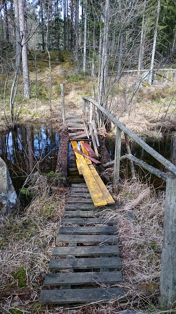
It was possible to cross but very difficult to also get my bike across at the same time. I considered throwing the bike, but since it is only two months old I’d rather get wet instead. But I managed to get across.
Anyhow eventuelly I arrived where the old sawmill was supposed to have been, and I immediately discovered both ruins and another old road in the forest.
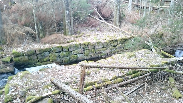
The ruins were pretty easy to find, though one side of the stream had many trees lying over the actual ruins.
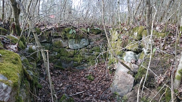
Close to the sawmill I also saw the ruins of what probably was an old residential building, probably related to the sawmill.
Since I was out biking and still hade a long way back home, I decided not to stay very long. Instead I went back two days later, bringing my kids along. They played in the stream while I went around and took pictures and GPS traces. The kids love this kind of places; they can play as much as they like and they can stay for a long time. I really enjoy combining hanging out with my kids in the forest and mapping.
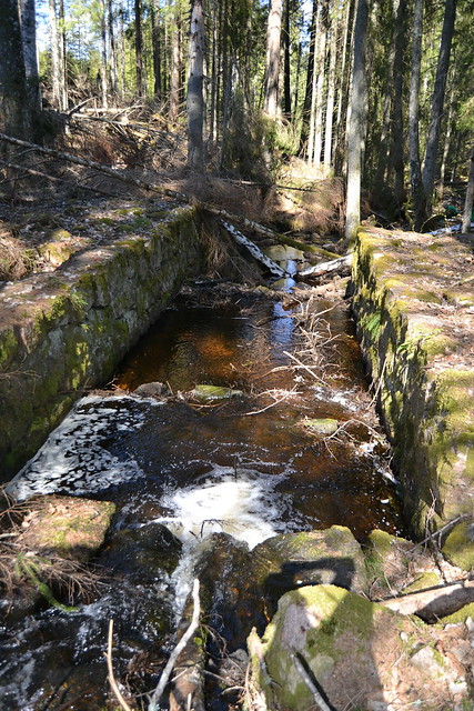
Since the main sawmill buildings were inside the river canyon and had high buildings around them, the GPS traces were not very reliable, so it was quite difficult to trace the outline of the ruins, but I tried anyway.
I also followed another old road close to the sawmill; this had probably been used at the same time as the sawmill. It connected to both lake Ämten and the other old road I found earlier. All in all I am quite happy with the results, though there may still be more interesting things in the area to map.
Discussion
Comment from Jimiiee on 10 May 2017 at 13:00
Hope you didn’t get your feet wet :)
Comment from ChristianA on 10 May 2017 at 13:28
No worries, it usually happens when I am mountiainbiking.