monxton's Comments
| Changeset | When | Comment |
|---|---|---|
| 180808135 | Hi @sprutton. Thanks for editing OSM. Could you please give me some background about the named viewpoints you have added on St Giles Hill Park? I walked round them all today. The main viewpoint is signposted, but the other three you have given names to - St Catherine's, Beech and St Giles Hill Lower - there was nothing on the ground to indicate that they had these names. Is there any source for them that you can point me to? |
|
| 42553414 | OK, I have removed the defunct web link. As to no longer being a hotel, tripadvisor says it is closed until 19 May 2022. In common with many temporary closures, I'd prefer to leave it on the map until their stated re-opening, unless you can point to some evidence that the closure is now permanent. I can't address the unspecified difficulties you are having with your OSM editor of choice. |
|
| 105304234 | Also removed an imaginary local cycle route from Handlebar Café to private council car park. Possibly the editor was confused with the cycleway to the public St Catherine's P&R car park a bit further along the road. |
|
| 89516347 | Thank you. The error was very obvious, but perhaps only with an English keyboard layout. |
|
| 89516347 | Phrase identify the node you are discussing. |
|
| 89516347 | Narrows it to a node, of which there are 636 in this changeset. |
|
| 89516347 | Can you tell me what object that attribute is on please? |
|
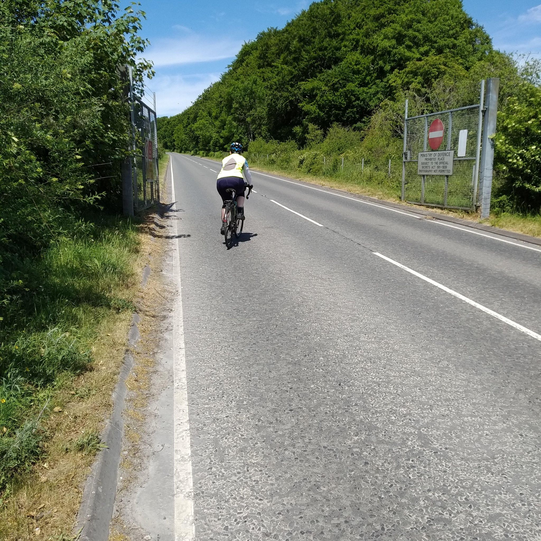
| 72758126 | Thanks I have done so, and added a note to the road itself, though I don't think any router will flag it up. It was actually the SE gate where the photo was taken. Not sure I understand your routing question. The access sign says "public must keep to the road at all times", so no, access is strictly on the road only. |
|
| 72758126 | I'm surprised your experience is so different to mine. I've never found the gates closed. I was there on Tuesday (reason I was trying to route that way), so I took a photo: https://dgtzuqphqg23d.cloudfront.net/SdOczq6dh94DYpThFIaR1MIyfCBIHBDKsJzDY2laRfA-2048x2048.jpg
|
|
| 72758126 | Ticker Berkin, would you please explain why you think permissive is the wrong access value for this gate? The sign before the gate says "Permission to proceed may be assumed when the gate is open". Currently the road is not routable because of the access values on the gates, even though the road itself is marked access=permissive. |
|
| 79715753 | I have not changed the extent of the cycle route, it stops in the middle of nowhere as it did before. The route should eventually extend to Mora, according to http://www.ciclovia.pt/ciclovias/4alentejo/2evora/rmora/rmora.php, but I don't know if it has got any closer. |
|
| 79076190 | COuldn't add a comment because something was wrong in potlatch and I couldn't type in the box. I may have created problems around Furadoura, where there are multiple objects overlaid all over the area. Will try to sort this out with a different editor. |
|
| 58530230 | Significant names that were missing from the map. Some of them correspond to actial villages, others to areas representing current or former parishes. If current, ideally they would be represented by boundaries, but I don't have those. |
|
| 24148983 | I don't recall that with 100% certainty, but I think it is not. The school children use the field to the west of the school building, while the playground is a public facility. |