OpenStreetMap
larryv's Comments
| Changeset | When | Comment |
|---|---|---|
| 123667929 | Aren't multipolygons inherently relations? I remapped it as a multipolygon so the fencing and gates formally delineate the cemetery boundary instead of merely overlapping the edges of the area. '[Multipolygons] can also be useful to make the distinction between linear objects (e.g. a fence surrounding a property, tagged on the way) and the area inside (tagged on the multipolygon relation) without having to draw overlapping ways. [...] For example, a forest could be delineated by four fences, in which case the four ways would be tagged with the barrier tag, but could still be used as "outer" members of the forest relation.' |
|
| 123628793 | Oh neat, I didn't know this was a thing. I think I *will* map the sections, then. |
|
| 123628544 | Thanks! The roads were already tagged this way when I began working on them, but I decided to fix them later to keep the changeset focused. "Permissive" makes sense. |
|
| 122823742 | Fair points. I was concerned about pedestrians coming off the overpass being given roundabout paths to reach points west (due to the lack of explicit crosswalks that you noticed), but I'm not familiar with the liberties that routing software can take, so I can accept that it's not necessary or appropriate to try accommodating them like this. |
|
| 122823742 | I was thinking along these lines, as the sidewalk ends at that point (the only continuing route is over the pedestrian bridge): |
|
| 122559974 | Awesome, thanks! |
|
| 113622176 | Having layer=0 correspond to grade does make a lot of sense, and I've made the update (<changeset/113637552>). If that convention is very prevalent, then it would be helpful if the wiki mentioned it explicitly. It only seems to be obliquely implied. |
|
| 113622176 | I meant the latter; the protruding section of building is a porte-cochère. My understanding from that page is that "layer" only has meaning with respect to any intersected objects. It explicitly states that "[n]egative values do not imply that object is underground". Is that assertion false? Am I missing a guideline from elsewhere on the wiki? In any case, I'm not attached to the current state. I can certainly set "layer=1" for the roof instead. |
|
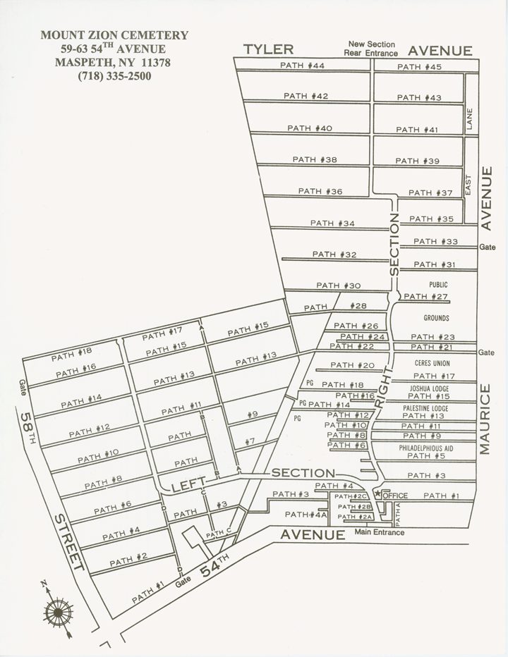
| 113589382 | The way already had that name when I started working on it. This map published on the cemetery's website seems to corroborate it: http://www.mountzioncemetery.com/images/grounds_large.gif (linked from http://www.mountzioncemetery.com/page.asp?id=aboutus) |