ke9tv's Comments
| Post | When | Comment |
|---|---|---|
| New York minor civil subdivisions - status and progress | I think you and I are mostly in agreement. TL:DR: Population is a terrible surrogate for the nebulous ‘local importance’ that Form of government (County/Borough, City, Town, Village, Hamlet)You want to be able to access the form of government and precise municipal boundary for hamlets, villages, towns, cities, and boroughs/counties in New York. You have that information in the boundary relation, including having the form of government in Census Burea conceptsOSM supports the tagging Arbitrariness
Historical AccidencyI will continue argue that ‘form of government’ is not as informative as you make it out. It is not in any way indicative statewide of the character of the community. ‘Town’ is the least indicative: it ranges from Town of Red House (mostly forest, population less than 100) to Town of Hempstead (suburban to urban, population about 800,000 in a comparable land area), so we’re talking nearly four orders of magnitude in population density, and comparable differences in just about any feature of the human geography that you could name, apart from the form of government. About all that can be said is that a Town is the government you get if you don’t vote to incorporate. (In fact, some of our Towns don’t have central business districts or anywhere to hang a ‘place=*’ node that made sense. They get nodes with ‘place=municpality not:place=town’ on the centroids of their land area, because every admin boundary is expected to have a ‘place’ node but because we don’t want them rendered inappropriately. An example is Town of Tusten; the Tusten settlement was burnt to the ground in the French and Indian War and never rebuilt. The town offices are in the Village of Narrowsburg. (My brother’s farm is in the rural hinterland of the township, nearer to Yulan than to Narrowsburg.) There needs to be a Cultural difference between Towns and VillagesYou argue that Towns are more rural than Villages. That does tend to be true away from the major cities, where villages incorporated so as to be able to provide government services for a settlement that would not be feasible for the entire township. In the suburban counties surrounding New York City, the cultural relation between Town and Village is often inverted. Often, Villages incorporated to preserve their ‘small-town’ character while urbanization proceeded apace around them. Near where I grew up (in the hamlet of Inwood, Town of Hempstead), a number of villages (Woodsburgh, Hewlett Neck, Hewlett Harbor, Hewlett Bay Park, …) are considerably less densely populated than nearby hamlets (Inwood, Woodmere, …) and have correspondingly fewer amenities, are zoned for much larger lots, lack multi-family dwellings (and often have no business districts at all!) and so on. Village of Cedarhurst is much more urban than the other Villages in that area, partly because of history: it was once a hub joining multiple rail lines, and partly because it is landlocked; most of the neighbouring communities have waterfront. Village of Lawrence is something of a mixed bag; it has a business district near the train station, but its southern part is almost indistinguishable from neighbouring Woodsburgh. Many of the smaller Cities (ranging from Sherrill, which has largely abandoned its city charter in favour of being administered as if it were a Village, to ones like Glen Cove or Cohoes) are hard to distinguish culturally from nearby Villages or Hamlets. Often, the significant difference is largely in the fact that they incorporated before the uniform Village Law was passed in 1911, and therefore there was no way for them to cede any part of their governmental authority to the Towns that they were carved out from. (Villages have some latitude in what services their governments may provide. All depend on the Towns for certain functions.) The Village that started the whole thingI have ho objection to the reclassification of Woodbridge. I have no personal experience with that particular village. If it has a summer population of outsized importance compared with its size as determined by the count of permanent residents, by all means upgrade it, and thanks for the additional information. I object only to the flat assertion that “it’s legally a village, and that’s that.” Conclusion: more similarities than differences?You and I are 100% in agreement that I suspect that our differences might stem from the possibility that I’ve experienced more diverse places in the state. I was born in Queens; spent most of my childhood in Town of Hempstead, and now live in Town of Niskayuna. My daughter and son-in-law live in Town of Glenville - but self-identify as living in Scotia despite being a block or two outside the Village. (They’re in the neighbourhood south of Mohawk Avenue that is outside the Village boundary, but is the result of Scotia growing beyond its assigned limits. Many of their services are provided by the Village by agreement with the Town.) My brother lives in the quite rural Town of Tusten - which has no live settlement of the same name (its offices are in the Village of Narrowsburg) and intentionally has a |
|
| New York minor civil subdivisions - status and progress | As promised, I’m still working through the details of how to do a mechanically-aided edit to push |
|
| New York minor civil subdivisions - status and progress | @gdt: Arbitrary population cutoffs were removed from the Wiki for As far as fitting the OSM terms into a Christaller model, I don’t have any source of data for ‘number of people who say they live in a place’. What I have - what all of us have - is census figures, tied to arbitrary polygons. Generally, of course, these polygons follow the political boundaries. In all these cases of administrative regions/CDP’s, the population - and the source for it - is tagged on the boundary, so that’s unambiguous information about what population was counted, who counted it, and when it was tabulated. (And in all cases in New York at As for the population on It’s not ideal, it’s a starting point. It’s surely better than the mess we have, in which Geneva (pop. <4000) is a city because it has a city charter, while Brentwood (pop. >60000) is a hamlet because its only local government is the Town of Islip. I don’t think we’re going to do significantly better than a somewhat arbitrary framework without a lot more effort than I’ve put into this, and I’ve been working on this project for over half a year at this point. |
|
| New York minor civil subdivisions - status and progress | @Minh Nguyen: I’m ok with a rounder arbitrary threshold with an exception for Saranac Lake. It turns out that “about 5000” seemed like the right level anyway, but I’m equally good with saying “5000, but make sure Saranac Lake is included because of its very high regional importance.” Your suggestion of I retained I did NOT put In general, it’s hard to deal with If there were It’s an easy enough operation to push |
|
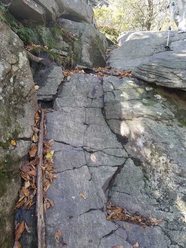
| The Harmony of Difficulty Rating Systems | In your second paragraph you mention “exertion level based on length/elevation”. That’s highly dependent on the specific trip, of course, which is why those scales are usually for an outing rather than for a trail. Of course, there are extremes: if you want to visit the Ouluska shelter it’s a 30-km walk from anywhere, but in many cases you can choose your adventure to be as long/short as you have time and stamina to handle. Length and elevation gain are also, of course, measurable if you have a DEM and can drape a trail segment over it. So the idea of focusing on specific hazards and specific technical demands is a good one. SK53’s list is a good starting point. Locally to me, I might add a few things (beaver activity), and if asked to come up with an overall rating, I think I’d need to separate summer from winter. A relatively straightforward YDS class-3 scramble in summer is an entirely different proposition when it’s glazed with black ice or covered by a metre-and-a-half of snowpack. A lot of entry-level guidebooks to the country around here will say of a trail, “hikeable mid-May to mid-October, best left to the experts outside those times,” while more advanced ones will be more frank about “do you need ice axe and crampons (and likely a rope and helmet) or will ski poles and Hillsound or Kahtoola spikes do?” SK53’s point that the scales don’t work outside their intended range is also a good one. I don’t understand SAC’s T5 and T6 at all, really. They seem to stumble into the class four is a myth problem - once you’re skilled enough to grade a route like that, you no longer see the difference among the lower grades. Perhaps a mountain guide with extensive experience in assessing the abilities of clients could do a better job? Everything also falls into the realm of subjectivity - what’s difficult for me might be easy for you, or vice versa. Personality also comes into it. I’ve had some other mappers criticize my trail grading - of trails they haven’t hiked, yet! - and my personal opinion is that they’re serious contenders for the all-European sandbagging title. My concern is mostly motivated by hiker safety and impact on the land. A lot of my travel is into an area within a couple hours’ drive of New York City, and there are times when it gets invaded by legions of the clueless, too many of whom find themselves totally out of their depth. Some of that is probably unavoidable - they arrive having no idea what a ‘strenuous’ or ‘difficult’ trail is! (Moreover, you can’t fix stupid!) Still, we should do whatever we can to reduce the likelihood of having a party of novices arrive at a spot like |
|
| Meandering streams | Locally to me, many of the small streams in the lowlands change every spring when the snow melts. Some of the third- or fourth-order rivers have changed course significantly in major storm events; in particular, Hurricane Irene in 2011 caused several small rivers in the Catskills to cut new channels. An interesting side point is that cadastral boundaries often follow the former alignment of watercourses. American law is complicated there; what happens with property lines and political boundaries depends on the process by which the water moved - was it a gradual event or a sudden catastrophe, and did it move from a force of nature, or from human intervention? The field abounds in obscure legal terms: accretion, erosion, avulsion, reliction, and so on. Don’t even get me started on what happens in beaver habitat! It took me half an hour to walk around this mess, where the beavers flooded the trail (and several hundred metres upstream). |
|
| Organizer experience and learnings from State of the Map (SotM) 2021 | I know that I and several others were surprised that an online-only event can sell out. Advance publicity ought to have indicated more clearly that seats were limited.The seccondary, read-only video sharing worked well, though. |
|
| Why are the Adirondack and Catskill Parks labeled 'national_park' ? | Circeus - It gets even more complicated than that. We have some fairly significant natural areas that are designated by counties or municipalities. In New York, these include many thousands of hectares that New York City has purchased outside its boundaries to protect its water supply. (This is an unusual case. From the point of view of governing law, New York City is a private landowner. It doesn’t export its law to these parcels, which continue to be governed by the county in which they’re situated.) Moreover, we have a fair number of protected areas that are administered by NGO’s (the Nature Conservancy, the Open Space Institute, the National Audubon Society, the Appalachian Mountan Club and Ducks Unlimited are some of the more significant ones in my area). If State-level protection engenders controversy, imagine what NGO protection dredges up! |
|
| Why are the Adirondack and Catskill Parks labeled 'national_park' ? | Richard - Thanks for the vote of confidence! It means a lot, particularly because the tagging of State-level recreational and conservation facilities in the US is embroiled in a rather heated controversy at the moment. Hearing from a European with boots on the ground in both continents is tremendously encouraging, and may go far to deflate the argument that the decision is inconsistent with international practice. |
|
| Why are the Adirondack and Catskill Parks labeled 'national_park' ? | Thanks! I don’t write diary entries often, but sometimes I have repeatedly to deal with the same issue. (The previous entry, about Camp Smith, was to avoid firing the first shot in an edit war.) Demonstrating that you’ve done your homework is important when the you-know-what starts flying. :) |
|
| Planned rendering changes of protected areas | When considering the Adirondack Park, also note that it is quite large - larger in land area than, say, Slovenia or Massachusetts. It’s also a private-publc partnership, with only about half the land owned by the state. While IMHO boundary=national_park is entirely appropriate to it, protect_class=2 for the whole thing is not. It contains villages, highways, logging and mining operations, farms, dairies, all of which are very, very tightly regulated by the Adirondack Park Authority. Protect_class=7 is closer, but you tell us that won’t be rendered. The state lands within and adjoining the park have complex boundaries. They have complex protection status, from Wilderness (no motors allowed, no roadbuilding, facilities only for protection, not for visitors’ convenience, roughly class 1b) through Primitive Area, Canoe Area, Wild Forest (where snowmobiles are allowed), State Forest (logging by contract), Wildlife Management Area, and various types of recreation area. The crazy quilt of boundaries are there, are signed, and are significant to residents and visitors. It’s always going to look untidy. It is untidy on the ground, the result of a great many political compromises. Even High Peaks Wilderness, taken alone, is bigger than a good many national parks. It’s a walk of about 66 km across it, from Lake Placid to Long Lake. (I know. I’ve had my personal boots literally on that ground.) Suppressing High Peaks Wilderness because it is contained in the Adirondack Park, or suppressing the Adirondack Park because taken as a whole it has too ‘weak’ a protection status, would astonish the locals. It’s laudable to want to beautify the rendering. Please don’t try to alter what’s on the ground to make the rendering prettier. I’m at a loss for how to make a complex object osm.org/relation/6362702 look good on the map. But it is what it is, and it’s quite lovely indeed in the field! |
|
| Trunk in a funk | Question about ‘parkways’ in New York. Many of these (e.g. Grand Central Parkway, Southern State Parkway, Northern State Parkway, Meadowbrook Parkway, Wantagh Parkway, Sagtikos Parkway) are full-up motorways (dual carriageway, access fully controlled) - except that they have low clearances (so HGV can’t make it through a lot of the underpasses) and are signed ‘no commercial traffic’ or ‘cars only’. Still motorways? Or should they downgrade to trunks? (I’m thinking ‘motorways’ myself.) Note that this is NOT all state parkways. Examples: Taconic Parkway is a trunk for most of its length (there’s a section north of Hawthorne to where the grade crossings start that I’m ok with ‘motorway’); Long Mountain Parkway is a primary, and Seven Lakes Parkway is (or should be) unclassified. Also, do you agree with me that the current tagging in osm.org/#map=18/41.70324/-73.78317 is simply nonsensical, whatever we decide? Either it’s a motorway with occasional at-grade crossings (I don’t like but am willing to defer to the community) or it’s a trunk. It isn’t a motorway with 30 m of trunk spliced into it for a grade crossing - that’s a statement, “Just kidding, it wasn’t really a motorway after all!” |
|
| Mapping with Strava | There’s one spot that I’ve hiked a few times where my tracing of the trails has been reduced to out-and-out guesswork. The rock is broken and tumbled, with many right-angled fractures, all of which are wonderful corner reflectors for microwaves. There was a repeatable anomaly in multiple passes of the SRTM data, which causes the spot to appear as a bottomless pit on the elevation data sets: http://caltopo.com/map.html#ll=42.20587,-74.03053&z=17&b=mbt And my GPS tracks from a half-dozen traverses of that cliff top are all wonky. Strava shows an amorphous fog surrounding what might be the trails, plus, I strongly suspect, a lot of systematic error. The trail to the west of the false “bottomless pit” goes for about 100 m under an overhanging cliff face, which doesn’t help. One of these years, I’m going to have to recruit a few friends and get in there with alidade, plane table, sighting rod and measuring tape, because the only way we’re going to get even half-way decent data for that spot is to do it the old-fashioned way, starting from somewhere that the signals are stable. I keep putting it off, there continue to be places where I’ll get more data for less work. |
|
| New York Long Path | http://labs.strava.com/heatmap/#14/-74.16411/42.53240/blue/both is the sort of coverage I see for trails that I have mapped. There were a few runners doing a few pieces of that preserve, but most of the trails were unvisited. A hiker would consider them ‘active.’ |
|
| New York Long Path | Ah! That’ll help for a section or two. Some of the sections have no points on Strava, or a thin enough covering that I’m not sure I trust it. But there’s at least one missing section that I can trace from there, so thanks! |
|
| New York Long Path | I don’t have the Strava app (or an account for same), and recall being rather put off it when it asked permission to download my private contact list. Alltrails and Everytrail have nothing on the missing bits. |
|
| What am I missing? | I see that you have done data import from NYSGIS. I have an OSM project in mind that also involves NYSGIS data, and I’d like to get in touch with you to hear how you handled licensing issues and the like. (I’m also curious about how you handled the import of “NYS DEC Lands,” since the result doesn’t appear to match very closely with what I now see from NYSGIS.) Could I trouble you to shoot me an email at kennykb@acm.org so that I’ll have your contact information? Thanks. |
 or even
 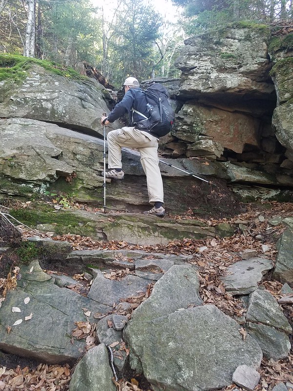 with ice starting to form and too little daylight left to go back the way they came.