OpenStreetMap logo OpenStreetMap

jwheare's Diary

Recent diary entries

The Hub, Edinburgh building tagging

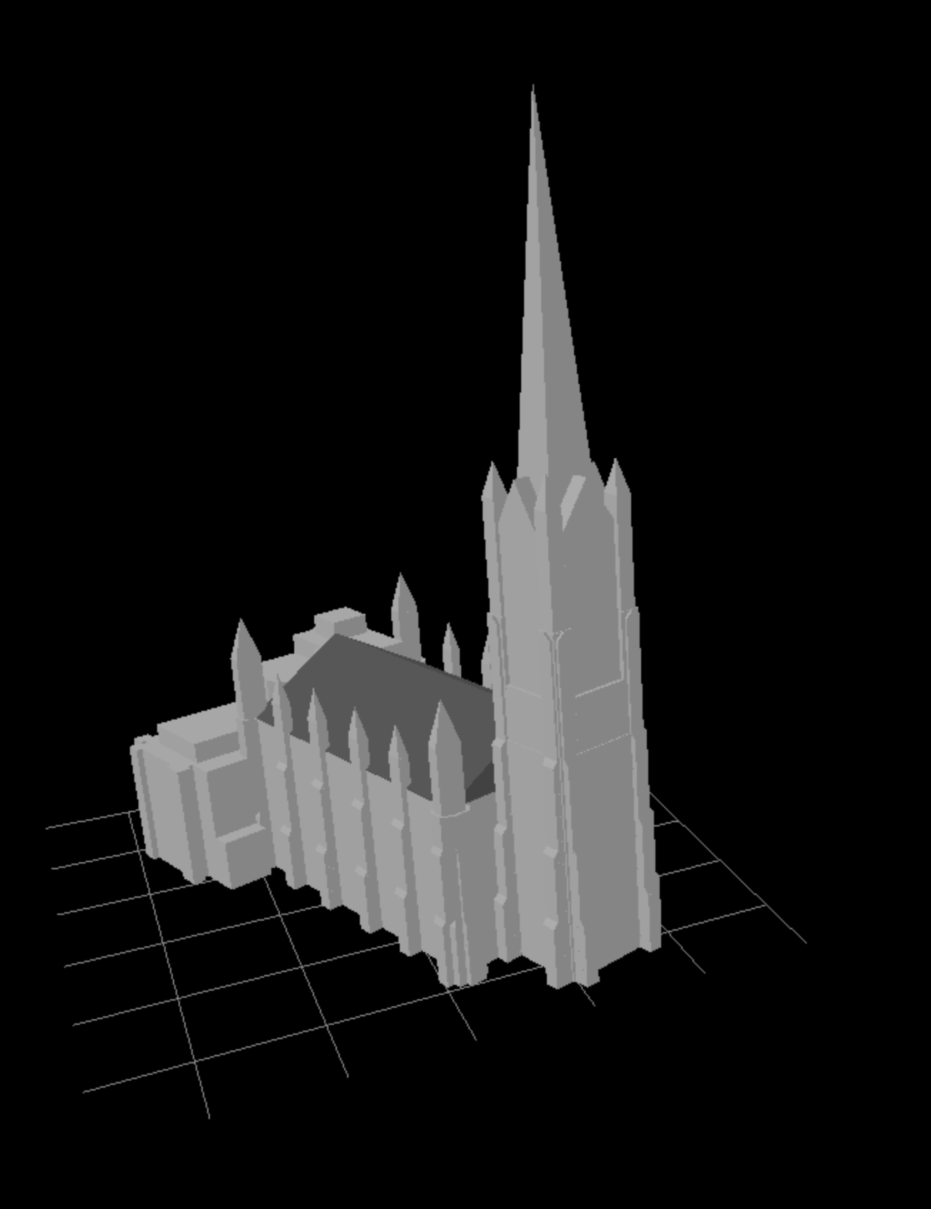
Posted by jwheare on 31 March 2026 in English. Last updated on 1 April 2026.

The Hub, Edinburgh rendered with Beakerboy’s OSM Building Viewer https://beakerboy.github.io/OSMBuilding/index.html?id=42997989

I’m working on a project using OSM building data so I thought I’d familiarise myself with the building:part and roof tags and see what the editing process is like.

The Hub only had height data and a basic outline tagged for the spire, so as the highest man made point in Edinburgh, it made for a good candidate to get stuck in.

I used height data from the OGL licensed Scottish LiDAR Phase 5 DSM that covers Edinburgh, and photos of the building from Wikimedia Commons

The elevation profile tool in QGIS proved useful for exploring the LiDAR data (after I worked out how to right-click to confirm the path). I normalised the elevation to zero with the raster calculator and set a custom colour ramp to aid visualisation:

See full entry

Location: Old Town, City of Edinburgh, Scotland, United Kingdom

wetland=tidalflat controversy

Posted by jwheare on 3 March 2026 in English.

I started a new wiki talk page discussion on the conflicting/controversial usage of the wetland=tidalflat tag regarding implied and explicit surface types:

Also posted a comment on positive related changes being worked on by the carto team:

Slipways

Posted by jwheare on 13 December 2025 in English. Last updated on 9 January 2026.

Current wiki guidance for tagging slipways (osm.wiki/Tag:leisure=slipway) is as follows:

A typical mapping might be to make a short highway=service way to the water’s edge and make the final node a leisure=slipway.

The highway=service that is part of the physical slipway is often further refined with a service=slipway. Keep in mind though that this does not replace leisure=slipway, mapped as a node on the end of that way.

Some mappers instead tag the whole way as leisure=slipway without using a highway=* tag, or sometimes in combination with highway=service (here service=slipway can be applied as well as above).

In other words there are two options (the first being implicitly preferred)

Option 1 - tag the node

  • way: highway=service + service=slipway
  • final node: leisure=slipway

Option 2 - tag the way

  • way: leisure=slipway + optional highway=service + service=slipway
  • final node: not tagged

The map marks an icon for both nodes and ways tagged with leisure=slipway. It’s therefore likely not advisable to do both. But which one is preferable?

There is some discussion about this on the wiki but no apparent resolution and it appears to refer to previous versions of the guidance: osm.wiki/Talk:Tag:leisure%3Dslipway

Though there is a question raised about wether leisure=slipway should be replaced by highway=service + service=slipway outright, especially given not all slips are for leisure use. But the map only marks an icon for leisure=slipway so this is likely not recommended.

Status quo

I wrote a script to analyse the data from of an area on the south east coast of Scotland.

https://overpass-turbo.eu/s/2hdk

The results:

  • 45: option 1 (includes 16 orphaned nodes with no way)
  • 62: option 2

So option 2 appears to be preferred, however it results in the map icon being placed at the mid point of the slip.

For ways that are correctly scoped to just the sloped slipway, this is probably ok. Longer ways should be split anyway.

See full entry