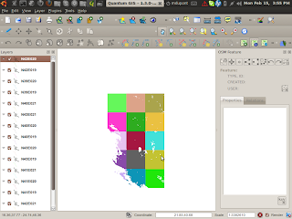
OpenStreetMap logo OpenStreetMap

h4ck3rm1k3's Diary

Recent diary entries

We have the first data from the Brod Survey online.

They have hired a GIS/QGis expert who is leading the mapping there. If this goes well, there might be more jobs and work for OSM and OSGEO people in the future.

This project is using F/LOSS GIS Software and OSM for doing urban planning in Kosovo. The team went there for the first survey last weekend.

We have alot of data now online, and want to create maps for them.

Here is a nice shot of the wonderful nature in the mountains of Kosovo:


Here is how I made the exif tags for the photos:
http://osmopenlayers.blogspot.com/2010/04/how-to-create-osm-file-with-gpx-and-jps.html

Here is how I merged the tracks :
http://osmopenlayers.blogspot.com/2010/04/convert-like-this-produce-list-of-files.html
Tracks:
http://www.openstreetmap.org/user/h4ck3rm1k3/traces/659428

I have created osm files and kml files from the photos,
http://xhema.flossk.org:8080/mapdata/03/brod/total.osm
http://xhema.flossk.org:8080/mapdata/03/brod/total.kml

they load into gearth etc, but are not loading into the sahana, even if I made a KML layer with them.
http://xhema.flossk.org:8000/sahana2/gis/map_viewing_client

I am uploading them to openstreetview at the moment.

I have been able to load and place the photos with josm, but that is not ideal for collaboration.

Question :
is there a way to use this photo for tracing, a way to rectify it on the map somehow :


Here are some resources I found

Mapping with cameras on Kites :
http://www.hprinzler.de/kap_e3.htm

Mapping with aerial photos :
http://rscc.umn.edu/rscc/v1m6.html

here there is some research into it :
http://www.springerlink.com/content/w8g0v000p6265151/

All help from the osm community is welcome,
any mentorship and help is welcome.

We have alot of work ahead to get this map of dragash going, this is the first town of many.

thanks,
mike

Location: 41.990, 20.709

I stumbled on this map today, from a guy called The Amirr who has made tons of maps. He claims they are his work , but then says he sourced them from an atlas.

http://commons.wikimedia.org/wiki/File:Highways_of_Albania.svg

What is the deal on all the map material in wikipedia, why do they have so many maps and points that we cannot use?
Why are the licensing rules so lax there and so stringent here?

mike

Hi all,
you might have seen my previous work on blender export.
http://openarena.ws/board/index.php?topic=3352.0

Recently I have discovered the new game qwet quake world enemy
territory, it has huge landscapes and is very fast.
Ideally we would be able to use that engine to drive around in a city,
I can imagine long term a 3d world for interactive markup of osm data.

so, after people were asking about my work on irc,
I have updated the code for the openstreetmap to blender export ,
after there was more interest on the mailing list:

http://bazaar.launchpad.net/~kosova/%2Bjunk/openstreetmapkosova/annotate/head%3A/kmz_ImportWithMesh.py

The new version uses bevled curves for the streets, so you can extrude
them. It overcomes the previous blocky shape.

You can use the script like this :

0. start blender at least once and end it, it creates your ~/.blender dir
1. copy the py to ~/.blender/scripts/kmz_ImportWithMesh.py
2. export your osm to kml (sorry)
gpsbabel -i osm -f shkoderstreetsbig.osm -o kml -F shkoderstreetsbig.kml

I extracted only the highways for export.

3. then you can just select import/openstreetmap(kml) from the menu.

The bevel and taper objects could be tuned per street type:
http://www.blender.org/development/release-logs/blender-235a/taper-curves/

Here is where I got some of the new code from :
http://en.wikipedia.org/wiki/File:BMonSphere.jpg

I have not looked into textures and scaling, the resulting data is too big.

But at least the results look better now.

All this needs work, but it is a better starting point, and much
better than my previous work.

This should be the final output, something like this, for race car driving!
http://www.tutorialsforblender3d.com/Models/Tracks/Mountain_Valley.html

See my video example here, you can fly through the city. You can see
that the bevel is not perfect, needs to be flat.
http://www.youtube.com/watch?v=Hw9aW3iI5fs
sorry about the audio synch.....

mike

t@h running on server

Posted by h4ck3rm1k3 on 18 March 2010 in English.

you can see the progress
http://server.tah.openstreetmap.org/User/show/byid/1597/

here is how I setup it:
tilesathome running on xhema.flossk.org
tilesathome is a great project to help openstreetmap.
you should run it on all computers you can instead of downloading torrents all day.

you can see the people running it here:
http://server.tah.openstreetmap.org/User/show/?order=last

Here my My id:
http://server.tah.openstreetmap.org/User/show/byid/1597/

How to install :
sudo apt-get install xmlstarlet subversion libgd-gd2-perl libmath-vec-perl inkscape pngcrush perlmagick zip libwww-perl ttf-dejavu xfonts-thai libxml-writer-perl libset-object-perl libappconfig-perl libxml-xpath-perl libxml-perl libxml-parser-perl libxml-sax-perl pngnq optipng liberror-perl libipc-run-perl libclass-accessor-perl libmodule-pluggable-perl
466 sudo mkdir /var/openstreetmap
467 cd /var/openstreetmap
469 sudo chmod a+rw .
470 svn co http://svn.openstreetmap.org/applications/rendering/tilesAtHome-dev/tags/Ulm tilesAtHome
472 cd tilesAtHome/
487 cat tilesAtHome.conf.linux
488 cp tilesAtHome.conf.linux tilesAtHome.conf
489 vi tilesAtHome.conf
490 cp authentication.conf.example authentication.conf
491 vi authentication.conf

here you put your email that is listed here:
https://www.openstreetmap.org/user/h4ck3rm1k3/account
where you put your username and not h4ck3rm1k3
and your password.

510 nohup perl tilesGen.pl loop
517 cat nohup.out

http://osmopenlayers.blogspot.com/2010/03/tilesathome-running-on-xhemaflosskorg.html

Start of port of mapzen to haxe

Posted by h4ck3rm1k3 on 12 March 2010 in English.

http://osmopenlayers.blogspot.com/2010/03/start-of-port-of-mapzen-to-haxe.html

I am starting to port mapzen to haxe
http://gitorious.org/mapzen-port/mapzen-port

That will allow for compilation to c++, javascript, flash etc. All without any adobe licenses.

http://haxe.org/ more…
http://haxe.org/ref/syntax

Here are some of the changes between actionscript and haxe
http://haxe.org/doc/flash/as2_compare

All help is welcome, I think this would be a great google summer of code 10 gsoc10 project.

we have gotten public domain shapefiles from albania,
and have a new import project in progress.
this time we have our new server to host the files, instead of archive.org org.

Join our social network here:
http://xhema.flossk.org:8081/blog/groups/albanianfloodingcrisiscamp/

and we have some wikis workpackages here
http://wiki.openstreetmap.org/wiki/Albania_TPGInc_River_Import
http://wiki.openstreetmap.org/wiki/Albania_TPGInc_Import
http://wiki.openstreetmap.org/wiki/Albania_TPGInc_Communes_Import
http://wiki.openstreetmap.org/wiki/Albania_TPGInc_MajorWater_Import

Now have the villages in one file, needs to be split :
http://xhema.flossk.org:8080/mapdata/03/MapAction/tpginc/LL_Villages.osm

and the historical sites:
http://xhema.flossk.org:8080/mapdata/03/MapAction/tpginc/LL_Sites.osm

Hello,
I have an agreement with the nice people from http://travel2macedonia.com.mk/ to license us their POI data for macedonia.

I have created an xslt script to transform the marker data to osm format,
it is just the start , needs someone to look at all the data and compare it to the existing map.

Anyone interested?

Here is the data so far, the tags will have to be reworked...

http://gitorious.org/macedonian_pois/macedonian_pois/trees/master

There are three files:
macedonianpois.osm
my output so far (not perfect, but loads)
macedonianpois.xml
the source data from
transform.xlst
the xslt

Process like :
xsltproc transform.xlst macedonianpois.xml > macedonianpois.osm

I have checked the files into archive.org :
http://www.archive.org/details/MacedonianPoisFromHttptravel2macedonia.com.mk

mike

Location: Madzhir Maalo, Centar, Skopje, Municipality of Centar, City of Skopje, Skopje Region, 1001, North Macedonia

Logistics Plus Workpackages are online

Posted by h4ck3rm1k3 on 16 February 2010 in English.

I have finished the upload, it is online now.
http://www.archive.org/details/GpsDataFromKosovoDatapointsWorkPackages

Each work package contains 10000 Points, sorted by Lat/Lon (in stripes)
Each person can work on a couple of packages, probably 2-3 of them.

The work is :
0. get a wiki account
http://wiki.openstreetmap.org/index.php?title=Special:UserLogin&type=signup

1. Pick a file to work on,
edit the Person column, put your name in there.
For example for me :
[[User:H4ck3rmik3|James Michael DuPont]]

2. You can leave the Finished column to NO until you have finished it.
then put in :yes

3. DO NOT UPLOAD THE POINTS, trace them.

4. Load the point osm layer into JOSM
5. Create a new layer and download the OSM data for that area into it.
6. Trace over the major streets in the point data, for trails that have only one tiny amount of points, look if you can see some streets in the landsat and yahoo wms layers.
7. Upload the new streets layer into OSM. Delete the point layer.
8. Write the changeset ID into the Table like this :
| [http://www.openstreetmap.org/browse/changeset/3751578 changeset]
9. Mark the finished column as yes, or put notes about problem in there.

The table is now online:
http://wiki.openstreetmap.org/wiki/Kosovo_LogisticsPlus_Tracing

Mike

Malenki has finished up the last import of the iMMAP data,
http://wiki.openstreetmap.org/wiki/Kosovo_iMMAP_Import

Now I will have to finish up the missing files and close that off.
Thank you all your your great job.

The next step will be the tracing of the 10million+ Logistics Plus gps points,
given the street data we have, we can now use these gps trails to determine if those roads are used. This will give us a chance to review the data.

I have started a wikipage here:
http://wiki.openstreetmap.org/wiki/Kosovo_LogisticsPlus_Tracing
and there is a video here:
http://www.youtube.com/watch?v=5Riwff1KxcY

My current work is to split the points into chunks for processing. I am using basic perl stuff, any help is appreciated, you can try it yourself and do it better/faster than me. Or you can wait till it is ready.

I will be posting the chunks to archive.org asap.

mike

Location: 42.520, 20.837

New toplogical data from ILLYRICUM

Posted by h4ck3rm1k3 on 15 February 2010 in English.

Here you can see that we have new data for the topology of Kosovo, Albania and surrounding area.
http://osmopenlayers.blogspot.com/2010/02/new-topological-data-from-bekim.html

It is AsterDEM derived data :
http://asterweb.jpl.nasa.gov/content/03_data/01_Data_Products/release_DEM_relative.htm And should not be a problem for OSM usage.

Here are some screenshots of qgis :
ILLYRICUM

details of dragash


Namefinder and OSM now starting to working in the OAD

Posted by h4ck3rm1k3 on 14 February 2010 in English. Last updated on 15 February 2010.

Have made progress on the openaddress database.
now I can display an OSM openlayer and use the namefinder.

Next will be to do that for each line in the address database when you click on it.

This uses the geonames database,
the url looks like :

The Uril looks like this :
HOSTNAME/geo/geonames/search/gjilan

Blog Post here:
http://osmopenlayers.blogspot.com/2010/02/namefinder-with-osm-map.html

This takes lat lon and display :

The url looks like this:
HOSTNAME/openlayers/basic/42.2138889/20.7397222/

here is the blogpost:
http://osmopenlayers.blogspot.com/2010/02/simple-openlayers-controller-for.html

The source for all parts is here :
http://github.com/h4ck3rm1k3/OAD-Open-Address-Database

you can start the start like this :
cd OAD/OAD-Open-Address-Database/OAD
perl ./script/oad_server.pl