Rawaz's Diary

Recent diary entries

Detailed 3D buildings on OSM, without drawing a single part

Most buildings in OSM never get past a flat grey extrusion, and the reason is tedium rather than difficulty. Simple 3D Buildings is an easy scheme to read, but a decent tower needs dozens of building:part polygons, each with its own min_height and height. Nobody wants to draw 44 near-identical facade piers by hand.

So don’t draw them. Here is the whole recipe in one picture, from the Vesta Tower complex in Slemani: a 12-floor office tower, a 14-floor residential tower and the shopping podium between them.
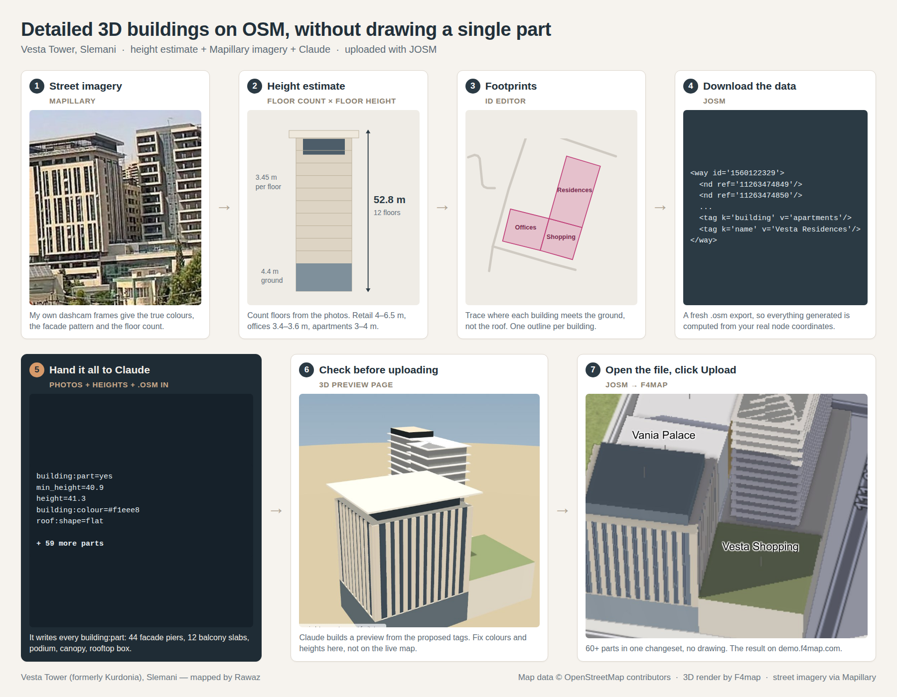
From street imagery and a height estimate to a 3D model on OSM, in seven steps

The seven steps

… See full entry

Location: ڕزگاری تازە, Sulaymaniyah, Bakrajo subdistrict, Sulaymaniyah District, Sulaymaniyah Governorate, Iraqi Kurdistan Region, 46001, Iraq

How this started

A researcher from Puerto Rico reached out to me with a question about sub-national population figures in Iraq. While trying to help, I realised something surprising: although Iraq had conducted its first full population and housing census in decades — the 2024 Iraq Census — those population figures had not been mapped onto the administrative boundaries in OpenStreetMap. The data existed and was public; it simply had never been connected to the polygons.

This diary documents the work of closing that gap, from the national level down to district (qada) level, and — just as importantly — it records why some of the numbers on the official Arabic source do not line up one-to-one with the population now tagged on OSM polygons. If you are comparing the source document against OSM and something looks off, this entry is meant to explain it.

Primary source

The governorate and district figures come from the published 2024 census results:

https://alssaa.com/post/show/43032-iraq-2024-population-census-results-for-the-governorates

The page is in Arabic and lists each governorate’s total and a breakdown by qada (district). I worked from this document throughout. Where I refer to a name by translating it from the Arabic source, I put the translation in quotation marks — the official/authoritative spelling is the Arabic one, and I don’t want to imply my English rendering is canonical.

The guiding principle: population follows the polygon

The single most important decision in this whole exercise: each population figure was tagged onto the OSM polygon that geographically contains that place — not necessarily onto the governorate or district the census table lists it under.

… See full entry

Location: محلة 215, Al-Kindi, Al-Karkh Central Subdistrict, Al-Karkh District, Baghdad, Green Zone Municipality, Zawra District, Baghdad Governorate, Iraq