MadCat3D's Comments
| Changeset | When | Comment |
|---|---|---|
| 183686149 | I Reverted because this section of I-15 is recently opened and does note reflect on satellite map but is in fact the current physical routing of I-15. source - https://udotinput.utah.gov/1800north#tab-36202 |
|
| 177786559 | Thank you for the information, I'm still a bit new to mapping and always learning something new. And I agree a missed opportunity to make the building height the same as its address, it would have been great! |
|
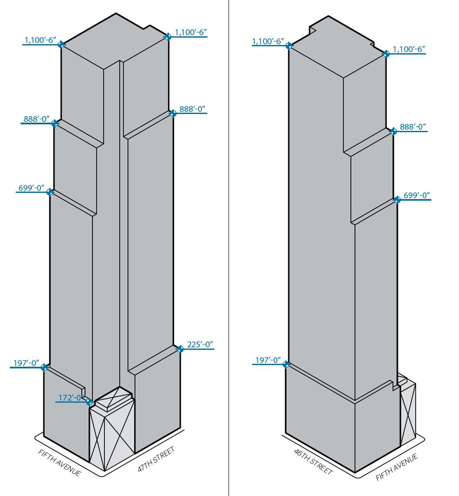
| 177786559 | As excavation for the foundation is underway I put the building as under construction, if this is incorrect policy I apologize. I got the height data from Ney York YIMBY (https://newyorkyimby.com/2025/12/excavation-continues-for-kpf-designed-skyscraper-at-570-fifth-avenue-in-midtown-manhattan-2.html) placing current planed height at 567ft, which I then converted to meters rounding to try and keep it as accurate between feet and meters. This height is also reported by ABS partners in their article discussing a law firm seeking to be the anchor tenant for the building (https://absre.com/law-firm-nears-deal-to-anchor-570-fifth-ave-development/). Admittedly the footprint is based on renderings from KPF’s site (https://www.kpf.com/project/570-fifth-avenue-2) as well as older renderings of the buildings massing which can be found here (https://newyorkyimby.com/wp-content/uploads/2021/12/172224159.PHnNVTNx.d13.jpg). Granted these are likely not perfectly accurate and the intentions were/are to update as more information continues to become available. If I have done anything incorrectly for the new York mapping community again I apologize. |
|
| 175643004 | nope, that was a mistake, not sure how I did that but I will fix that, thanks for pointing that out. |
|
| 174811656 | According to a note on the lake area, it says that it "should follow 4200 ft mean level (butlerm)". I am not sure who made that note or why, but I think this change does not reflect that. |