OpenStreetMap logo OpenStreetMap

Enock4seth's Diary

Recent diary entries

TL;DR

Bing imagery in Greater Accra Region is very very old but it continues to be used as the primary reference for adding new data into OpenStreetMap. Esri World Imagery however seems more recent in and better aligned thank Bing.

This diary is a comparison of seleted locations in Accra with new developments that can be clearly seen in Esri World Imagery but not in Bing; one of the reasons not to use Bing as primary reference for adding new data into OpenStreetMap in Accra.

Bing imagery also have some interesting imagery offsets and mosaic problems such as the photo below and around this node. Bing vs Esri in Accra, Ghana south of Kotoka Internation Airport

Location on OSM

©Bing aerial imagery (left) and ©Esri World Imagery (right).

I have been mapping landuse areas in Greater Accra Region recently (deleting, adding and replacing multiple overlapping ways by remote mappers, same as that of Kumasi) which revealed these changes. Most of my observations in relation to the recentness of publicly available imagery in OSM concludes Esri World Imagery is the most recent and seems to have a good alignment with existing known data and GPS traces.

Here are two locations in the region that have seen rapid developments recently of which little or no traces can be seen in Bing imagery.

The Bank Square

The Bank Square, Accra, Ghana

Location on OSM

©Bing aerial imagery (left) and ©Esri World Imagery (right). Screenshot taken in JOSM

Jamestown Fishing Harbour

Jamestown Fishing Harbour

Loation on OSM

©Bing aerial imagery (above) and ©Esri World Imagery (below). Screenshot taken in JOSM

Conclusion

  • Tracing and aligning features in OpenStreetMap to Bing in Accra at present will be completely useless.
  • Compare imagery sources to see which is most recent and use a combination of both instead, in the case of Accra, Esri World Imagery at the moment is most recent and better aligned to existing data.
  • Watch out for offsets and imagery mosaic issues

Some other locations that can be compared:

Location: West Ridge, Accra, Korle-Klottey Municipal District, Greater Accra Region, GA-222-2148, Ghana

Hello OSM World,

This is the first post in the Worst of OSM in Ghana series. I start with improving landuse=residential in Kumasi.

About 3 years ago someone mapping for an institution decided to randomly map a ton of residential landuse areas across Ghana. Some local contributors had lengthy message exchanges with them before they stopped to map. Why? Because these landuse areas are either connected to some building or highway, etc… 
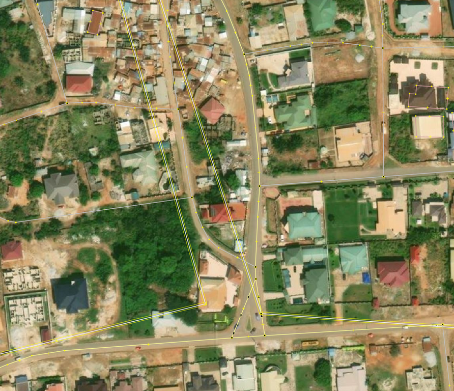
© OpenStreetMap Contributors. Screenshot from JOSM with Bing

Fast forward 2024, many of these ways still exist in OSM and interferes with new contributions. Kumasi was selected as the start of trying to reuse/delete/improve these landuse=residential because Sammyhawkrad have really put a lot of time into improving data coverage in Kumasi but these landuse=residential definitely throws him away.

In summary this is how I improved the data:

  1. First, I reached to active editors in this area about my planned mass modifications
  2. Using JOSM, I drew a large area around Kumasi in a local layer © OpenStreetMap Contributors. Screenshot from JOSM with OSM Carto
  3. Started splitting with More tools → Split Object [ALT+X ]
  4. I then downloaded data from OSM separately and merged into local layer
  5. I tried to reuse existing ways as possible using More tools → Replace Geometry [CTRL+SHIFT+G] (requires UtilsPlugin2) which sometimes resulted in issues and conflicts when I update data [CTRL+U]. Because a node was shared with a building or highway.
  6. It took more hours than expected to complete this. At some points I could only delete than re-use.
  7. Finally, I uploaded the data when it’s assumed less mappers will be contributing in this area (somehow helps me to avoid some unexpected conflicts)

Notes

Massive remote mapping of features is much helpful when they don’t take all of local mappers time undoing your contributions, it is also demotivating.

There are many of these occurrences across the Ghana and likely somewhere else that needs clean up and more hands, I hope this summary inspires and is helpful for other local mappers to improve and contribute quality data.

If you are mapping in Ghana, Beware of imagery offsets and rapidly growing settlements not to add useless data.

Happy mapping!

Location: Alabar, Asokore-Mampong Municipal District, Ashanti Region, Ghana

Worst of OSM in Ghana #0000

Posted by Enock4seth on 6 May 2024 in English.

Hello OSM World,

Welcome to #WOSMinGhana 000

I am starting a series of OSM Diary posts title Worst of OSM in Ghana, inspired by best and worst of OSM posts I have seen. The idea is to share one photo per week (I hope I can keep up, feel free to share any you might have seen in Ghana too :D). i.e. Before and After (if I am able to improve or fix it)

Sometimes you come across very interesting mapping activities and data and you are out of words. Myself and other volunteer mappers have taken screenshots of worst contributions on OSM in Ghana over the years and then proceeded to improve them / notify mappers or organizations.

Why talk about the worst not the best? Highlighting these worst mappings might help create more awareness about what we put out there as part of individual or organized mapping activities.

This is purposely to help improve OSM data in Ghana in these areas by myself or other mappers and for us all to beware of when mapping.

Looking forward to the coming weeks.

Location: Kwameteng, Sekyere Central District, Ashanti Region, Ghana

This is not new, a lot have been said too - https://lists.openstreetmap.org/pipermail/talk/2021-April/086458.html

Yes, several ##hashtags for Changest comments is very bad and not helping human.

Looking around Ghana and seeing especially new mappers whose first point of contact to OpenStreetMap is via some kind HOTOSM Tasking Manager instance activity / project, carry on this hashtag way of changeset comments to their individual contributions IMHO is not a good sign of building a good project, community and future.

It could be that some of them are not aware of it or think it’s cool to use ONLY hashtags as a changeset comment. Please, if you don’t know, It doesn’t tell anything useful.

This is why I now leave comments on such changesets in Ghana to draw mappers attention, I hope this little efforts convinces someone.

I recommend you read: https://wiki.openstreetmap.org/wiki/Good_changeset_comments and always use a descriptive text that can help yourself and everyone tell what actually happened in a changeset in the future.

If you are a trainer, catch them young!

Happy mapping!

Bye!

Location: Wa East District, Upper West Region, Ghana

Bookmaker Ghana

Above is the coverage of 3 months of contributions by one mapper using MAPS.ME :/ and have added ONLY shop=bookmaker beneath power=pole.

Close look

Looking closely at this contributions, I concluded the mapper is either an employee of Ghana Grid Company or a contractor. He/She is probably collecting some internal data on each pylon power=pole, might be useful to OSM? not sure about this.

What have I done?

  • I have commented here, here and also send an OSM message.
  • I have also transformed some of these bookmakers where there are no power=pole and power=line in OSM already AND changed name=* to note=*, see #103352102 in case the user responds (IMHO I don’t think these translate into a meaningful OSM tag though)

Next steps…

  • Delete nodes where there exist power=pole and move name=* to note=* (reason stated above) ELSE repeat #103352102
  • Ask on talk-gh [at] openstreetmap [dot] org for anyone who could connect with the mapper
  • Delete all note=* after 3 months? Kindly advice…

Enock

Location: Odumase, Obuasi Municipal District, Ashanti Region, Ghana