Charles de Foucauld’s Dictionnaire abrégé touareg-français de noms propres “Abridged Tuareg–French dictionary of proper names” is not only a valuable gazetteer of the Tuareg-inhabited central Sahara, but also a historical source capturing a time when European understanding of Tuareg toponymy had not yet taken on a life of its own.
One example of this divergence between traditional usage of local native speakers, and European reception, is the name and possibly the extent and nature of the Ăhaggar.
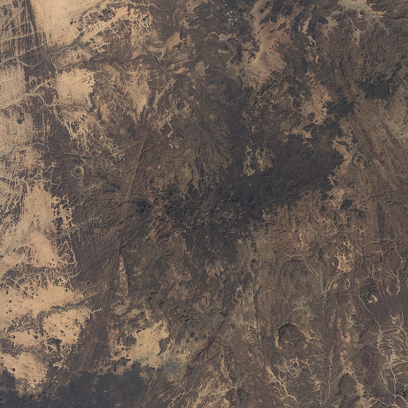
The Ăhaggar, clearly and unanimously, is a mountain range or mountain massif. In the early 1900s, Ăhaggar is also attested as the name of a country containing the Ăhaggar mountains. To my knowledge, the usage continues today (in the sense of a land, perceived as culturally or socially distinct, though not politically independent).
In Europe, it’s also known by the name Hoggar, a form which came about through contact with Arabic. Besides, the central part of the mountain massif is often introduced to tourists as the Atakor, apparently also giving rise to the geologically defined area of the Atakor volcanic field. Some overlapping area is now also protected as the Ahaggar Cultural Park.
I’d like to first and mainly look at the historical explanations given in Foucauld’s Dictionnaire, which are interesting as approximations to the local usage prior to major European (or other foreign) influence. After that, I’ll also go over some representations of the Ăhaggar in online databases.
The historical usages
The mountains
According to a first entry in Foucauld’s gazetteer, the Ăhaggar is …
la région appelée proprement Ăhaggar est le massif montagneux central du pays des Kel-Ăhaggar, massif de forme ovale, […] qui est compris entre 23° et 23° 30′ lat. N. et 2° 50′ et 3° 40′ long. E.
“The region properly called Ăhaggar is the massif of mountains central to the land of the Kel-Ăhaggar, a massif of oval shape, located between 23° and 23° 30′ lat. N. and 2° 50′ and 3° 40′ long. E.”
Let’s draw an ellipsis from the given coordinates:
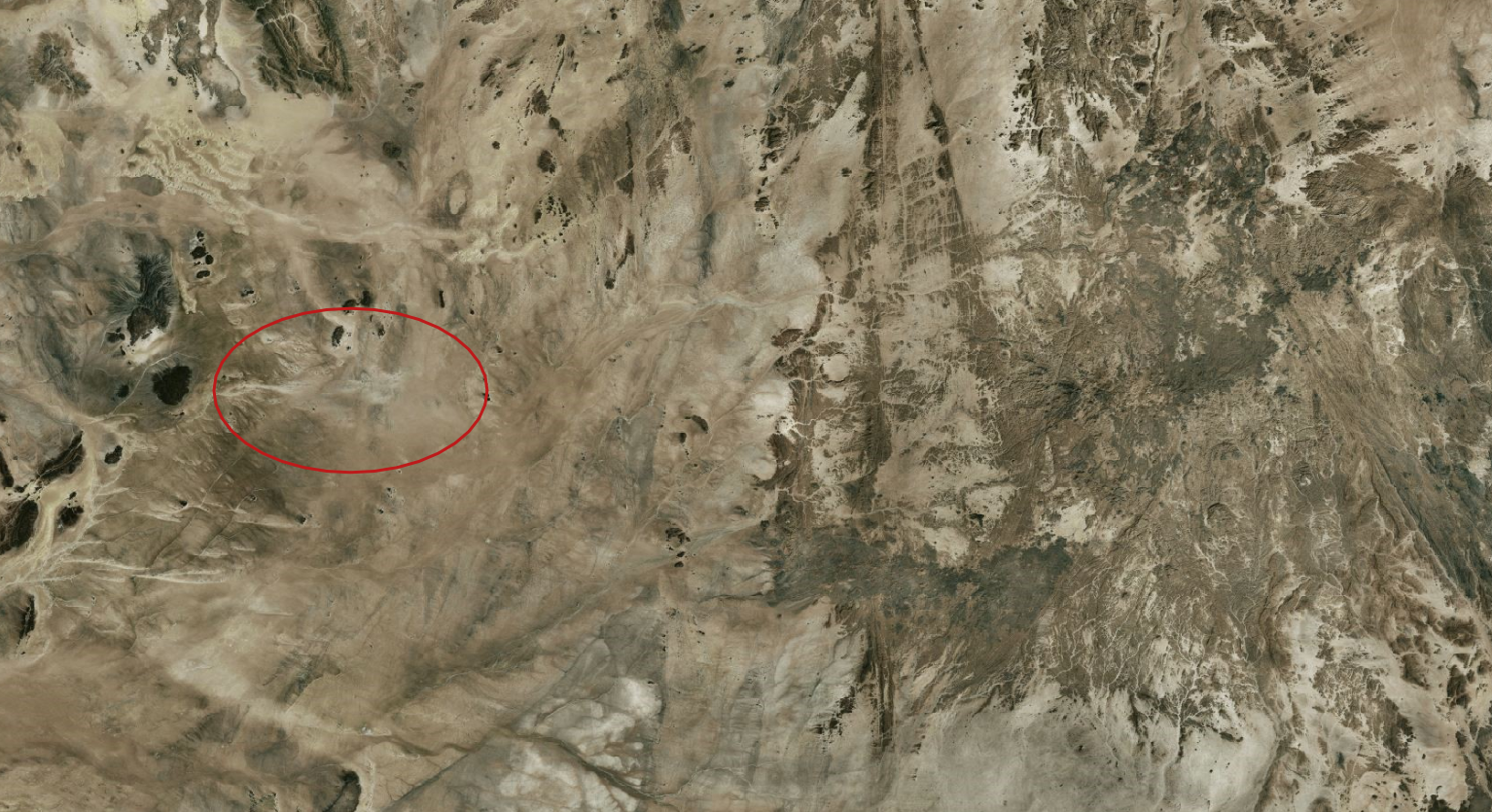
That doesn’st look like a mountain range. Turns out, as a French aristocrat Foucauld still used the Paris meridian in about 1910. Hence, shifting the location by about 2.33° results in a much more sensible perimeter:
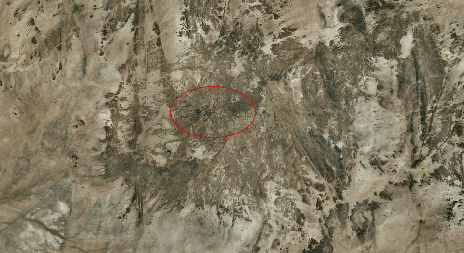
This defines a moderate extent of what is locally called the Ăhaggar (meaning the mountain range). Foucauld also records a separate name for the foothills of the mountains, which reinforces the understanding that Ăhaggar refers only to this highest mountainous area. The rocky or mountainous areas immediately adjacent, which may be geologically completely continuous, have separate Tuareg names. They are, then, not part of the Ăhaggar mountains according to local, traditional usage (as transmitted by Foucauld). At any rate, the peaks are much lower outside the Ăhaggar.
Regarding the name of the mountains, Foucauld states that …
Ăhaggar est le nom propre de cette région et le terme le plus employé de beaucoup pour la désigner
“Ăhaggar is the proper name of this region and the term most used by many [? most used by far?] to refer to it.”
He also lists a bunch of alternative names, and, as stated above and clearly on Foucauld’s mind when writing the gazetteer, Ăhaggar is at the same time the name of the country. Therefore he decides that …
pour éviter les confusions, nous la désignons habituellement dans ce dictionnaire non pas par le nom Ăhaggar, mais par le nom Ătakôr-n-Ăhaggar
”to avoid confusion, we [i.e. the author, Foucauld] usually refer to it [the massif of mountains] in this dictionary not by the name Ăhaggar, but by the name Ătakôr-n-Ăhaggar” – in effect, in almost all instances shortened to Ătakôr.
I think it is probable that by this decision, Foucauld started the European tradition of distinguishing a central part of the Ăhaggar as the Atakor – when, in fact, Foucauld makes it clear that in local usage these names are interchangeable and refer to the same mountain area.
The country
In a second entry, Foucauld states that Ăhaggar is also the name of the …
pays tout entier des Kel-Ăhaggar (territoire soumis à la domination des Kel-Ăhaggar, compris entre le Tidikelt, l’Ăhnet, l’Ădṛaṛ, l’Ăir et l’Ăjjer)
“The entire country of the Kel-Ăhaggar (territory under the rule of the Kel-Ăhaggar, surrounded by the Tidikelt, the Ăhnet, the Ădṛaṛ, the Ăir and the Ăjjer)”
With Kel-Ăhaggar being the …
[nom propre] des Touaregs qui habitent le territoire de l’Ăhaggar, en un seul corps de nation, sous le commandement d’un chef unique
“proper name of the Tuareg who live in the territory of the Ăhaggar, as a single body of a nation, under the government of a sole ruler”
I wouldn’t make claims about undivided nationhood – Foucauld’s statement stems from a specific political era and perspective, of course. The complex structure of Tuareg society is much better described in European scientific literature by now. Nevertheless, it seems appropriate to characterize the Ăhaggar as an independent, self-governed country prior to military defeat by the French in 1902.
As described by Foucauld, the Ăhaggar mountains are the center (not geometrically) of the Ăhaggar country, and the latter is named after the former. But the country stretches far beyond the mountains, about 500 km to the North, 330 km to the East, though only some 200 km West and 150 km South. It covers various landforms – mountains and sand seas and flat rocky areas, another major mountain range (the Tefedest), and even claims some of the surrounding sandstone plateaus.
As said above, I think the Ăhaggar is nowadays still perceived by inhabitants as a distinct region or land, after decades of being subsumed in Algeria. (Perhaps the term “cultural region” might be fitting?) The distinction seems clearest in relation to the largest neighbour, the Ăjjer. Ăhaggar people have clear opinions that things are done differently in the Ăjjer, and where necessary carefully delineate spheres of influence.
Foucauld sketched the borders of the country. This sketch can be seen on page 8 and page 9 of the scan of one of his dictionaries. As a work of Charles de Foucauld, this sketch is in the public domain, and I might get around to releasing my digitization of it.
The Ăhaggar in current databases
I’ve already introduced some of the understandings of names by Europeans; I’m going to quickly cover how and where they are present in online databases:
GeoNames
GeoNames has two entries for the mountains, Ahaggar and Atakor, showing the European distinction described above. The placement of both entries is in the correct area; however, as said before, both names refer to the same massif for local native speakers.
There is no entry in GeoNames to reflect the historical country, current region or land.
Wikidata
Wikidata also distinguishes between the Hoggar and the Atakor-n-Ahaggar. On the latter item, I have already added some of the information found in Foucauld’s gazetteer. The English and German Wikipedia articles linked to Atakor-n-Ahaggar imply, to my understanding, that the Atakor volcanic field is an area established as distinct in geology – and therefore could be treated as distinct from local naming and delineation. The Dutch Wikipedia article covers both the mountain massif (i.e. the indigenous concept) as well as the volcanic field (i.e. the scientific concept).
The French Wikipedia article describes the Ăhaggar mountains as covering 50000 km²; the English article states that the mountains cover 550000 km². The ellipsis based on Foucauld’s (approximative) description has an area of about 3600 km². Therefore, the Dutch Wikipedia article comes closest with 3800 km².
I don’t know of a Wikidata item for the country Ăhaggar – maybe I’ll create one when the existing ones are improved.
OpenStreetMap
OpenStreetMap has a node and a way to represent the Ăhaggar mountains. They are redundant to each other – they both describe the mountain range, without an obvious sign of the European Ăhaggar–Atakor distinction. (However, they link to the separate Wikidata entries.)
I have created the way, not too long ago. The node is much older. The way shows my best understanding of how the Ăhaggar mountains are delimited, starting from Foucauld’s (public domain) sketch map and refined according to a number of entries scattered throughout the gazetteer.
In my opinion, the two OSM objects could be merged to a single object representing the local conception that there is one mountain massif distinct from the surrounding areas interchangeably called Ăhaggar/Ătakôr (plus some other alternative names).
I’m not too keen on creating a boundary of the historically independent country, current region of Ăhaggar on OSM.