
OpenStreetMap and Humanitarian OpenStreetMap Team Together
Posted by Harry Wood on 30 November 2015 in English.Amazing what some professional video editing can achieve. I had a fairly long waffling chat with Jonathan Cronin, and he’s sliced out the good bits, overlaid some photos, etc, to turn it into this video:
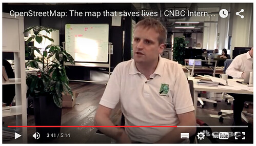
In the background behind me is the Future Cities Catapult offices where I work some of the time. Some of the cutaways are to itoworld’s animated edits globe videos
Of course, he’s also interviewed Ivan Gayton from MSF. (Incidentally I recently posted my own video of Ivan as he described the Kunduz hospital bombing at a missing maps meet-up. Zero attempt at editing that one)
The video title “OpenStreetMap: The map that saves lives” suggests that this is all about humanitarian stuff, but if you watch the video, you’ll see we’re describing OpenStreetMap in general. OpenStreetMap and Humanitarian OpenStreetMap Team Together. Jonathan asked lots good general questions and seemed to understand some of the deeper issues and motivations of OpenStreetMap, and included this in the final cut. This makes a nice change. Over the years I’ve seen spikes of media interest (TV appearances and everything!) always about humanitarian OpenStreetMap, never so much about the bigger idea of making a free and open map of the world.
I’m also pleased that the video clearly shows how these stories flow into each-other nicely. It even ends with Ivan, a senior aid organisation figure, talking about the business impact of OpenStreetMap! And why not? It’s all the same story. It’s a brilliant story which we should all share in and be proud of together. OpenStreetMap old-timers should enjoy their part in the story of how we built a community and mapping platform which was capable of responding the way we did for Haiti, almost by accident. A spontaneous thing which later gave rise to HOT. We should also celebrate the fact that we are creating the very first maps of the developing world, and we are doing it as open data, starting these people’s maps off with a strong free & open footing, where otherwise the big G would probably conquer the territory first.
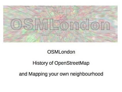
So this video popped up last week. And around about the same time recently, I published my talk, given at the Missing Maps meet-ups, about mapping your own neighbourhood.
That’s a coincidence, but very much part of the same idea of stitching together the humanitarian mapping story with the overall OpenStreetMap story. Humanitarian mappers should look back at the history of OpenStreetMap and consider themselves part of this great endeavour to create a free map of the world (and make efforts to be a part of it more, by mapping your own neighbourhood)
But the timing of these is a fortunate too, because I see various folks recently creating/highlighting divisions between OpenStreetMap and the Humanitarian OpenStreetMap Team. Discussions around the orientation of OSMGeoWeek event listings, and the use of changeset comments coming from the OSM Tasking Manager, seemed to quickly illustrate that these communities have divided far more than necessary, and we really just need to talk to each-other more. Speaking as somebody who has always had a firm foot in both places, I find it frustrating that it’s not just a simple friendly collaboration. (This is before I even mention my despair at recent OSMF mailing list discussions)
But its OK because…
“Since giving this talk, everyone in the OpenStreetMap community is following my advice, and a new spirit of harmonious cooperation has settled over the project…” (echo from a 2009 blog post. Pigs might still fly). But seriously though. I know there’s real issues in these discussions. Issues we should work through. But they can get blown out of proportion. I hope this video and my talk are useful illustrations that OpenStreetMap and the Humanitarian OpenStreetMap Team are a friendly cooperative parts of the same whole. Let’s not be imagining otherwise. They are all part of the same brilliant story. I, for one, will continue to enjoy telling this story, every chance I get!
Discussion
Comment from imagico on 30 November 2015 at 19:07
That is a very nice video, especially in the beginning where it explains the core of what OpenStreetMap is about, i.e. people mapping their environment and sharing their knowledge of the world with others.
I want to point out however that the narrative that both OSM and HOT are about creating “a free map of the world”, which also was mentioned several times in recent discussions in some form, is not really correct. For me as someone who has mapped primarily in those areas in OSM that are probably most distant from this potential goal this seems pretty clear. For OSM the map of the whole world would be the ultimate conclusion when everyone on earth has become a mapper and is contributing his/her knowledge to the OSM database. But this does not make it a goal of the project, OSM is about the process of collecting data and sharing knowledge.
And for HOT the map of the whole world seems to be no goal either, HOT is about generating free map data where map data is needed, either actutely in case of a desaster/crisis or prophylactically where it might be needed in the future. In any case HOT mapping is generally based on data needs by specific interested parties (that is mostly the aid organizations HOT cooperates with). And these parties generally do not have a need for a “map of the world”, there are huge parts of the world, both geographically and thematically, they have no interest in at all.
Comment from Harry Wood on 1 December 2015 at 18:14
It’s long been observed that different people get different things out of OpenStreetMap, and have different ways of expressing their motivations. Of course some of us are intent on using OpenStreetMap just for a for a sat-nav application in Los Angeles, while others are using OpenStreetMap just for an immunisation programme in Lubumbashi. You say “OSM is about the process of collecting data and sharing knowledge”. But knowledge of what? In what form? Perhaps a good way of describing it would be… it’s knowledge in the form a “free and open licensed map of the world” :-)
I agree though, that it would be wrong to say we are only succeeding in our goals if we are managing to map the whole world. Wide coverage, reaching into every corner of the globe isn’t necessarily the primary focus of the project. On an individual level we encourage people to focus on mapping their neighbourhood. On a project level, achieving wide coverage… I would say it is an important success metric (and one we are succeeding at!) but yeah… not the only success metric.
Certainly we are building a “free and open map of the world” if we only take it to mean the OpenStreetMap system of edibility, data representation, and community building can work the same worldwide.