
Camden Mapping Party
Posted by Harry Wood on 2 July 2013 in English. Last updated on 9 October 2013.A couple of weeks ago we had a London mapping evening around Camden. Derick was off mapping a different slice of cake and Andrew and I were mapping with a new person, and having a good chat about OpenStreetMap as we went.
Camden’s an area I know pretty well, and it’s quite well mapped already I thought, but maybe in need a refresh, and it’s starting to be on the border of London’s building outline overage, so we can start to take it that next level of detail. Down the backstreets there’s always new surprises to uncover too. I haven’t added the data yet but one of the buildings we encountered was made out of a bus.
In the pub we had an unusual gathering. Mainly unusual because there was no TomH and no Firefishy. But we did have Shaun journeying in from Ipswich to join us, and we had two new faces. One who had joined in with mapping, and one who we had met at #geomob previously.
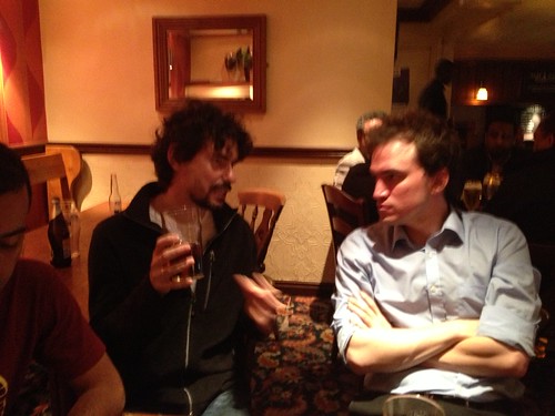
The Cobden is a pub I have been curious about. Turns out it’s not ideal. We all crammed around a table and shouted at eachother because this it was a bit loud, and then ate Thai food, which is always amusing in a pub. While doing that we talked about…
Public transport tagging schemes. Apparently there’s a new one. Personally I’ve not really tried to get my head around any of the existing ones much.
We talked about imports, and good ways of doing them as “community imports” e.g. using a snapshot server or basic checklist approach. I need to try out the TODO list plugin some time. It’s on my todo list :-) The UK food hygiene rating system dataset could be of interest as a checklist dataset. It doesn’t have precise coordinates, but it does have a lot of POI data. Hopefully people will coordinate any such efforts on that wiki page.
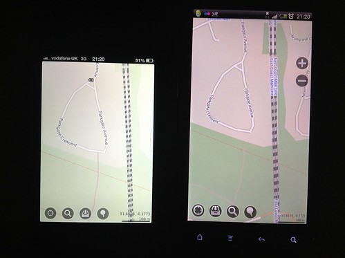
Shaun was using an app called “outside”, but I can’t seem to find it now. We also generally arsing around with phones. We came up with a way to do a pub visualisation of recent data changes. Two phones side-by-side running MapsWithMe with different data up-dated-ness. Tada!
We had Willie with us, at the end of his visit, just before he had to head back to Brazil. So we were looking at the Brazil map, including his home town of Feira de Santana (well mapped) including a very circular ring road.

Derick and I have both visited Foz do Iguaçu which somehow looks unimpressive on the map. Maybe we need a surface tag to make a massive patch of white there. surface=tumultous_roaring_whitewater :-)
We talked about the challenge of routing in a circle. It has been done by the cyclestreets guys
And finally the idea of “OSM dating” came up because OSM singletons are intelligent sociable and have a keen sense of… where they are in the world. More desirable than your average online dating pot-luck apparently (It was a woman suggesting this)
So there you have it. I’m not sure if any follow on action has been taken to bring about the “OSM dating” idea, but maybe at tonight’s pub meet-up they’ll be lots of new people looking to hook up with a map enthusiast, and all sorts of flirting going on. Just imagine what you could be missing out on if you don’t come along!
Join us tonight in the Queen’s Head pub from 7pm. Later on I’m hoping we may see some OKFN people, if they come to the same pub after their OpenData event.
Discussion
Comment from wille on 2 July 2013 at 22:02
Thank you very much for the warm welcome! The pub meetings were great! :D