Loading...
Way: 81832452
Version #5
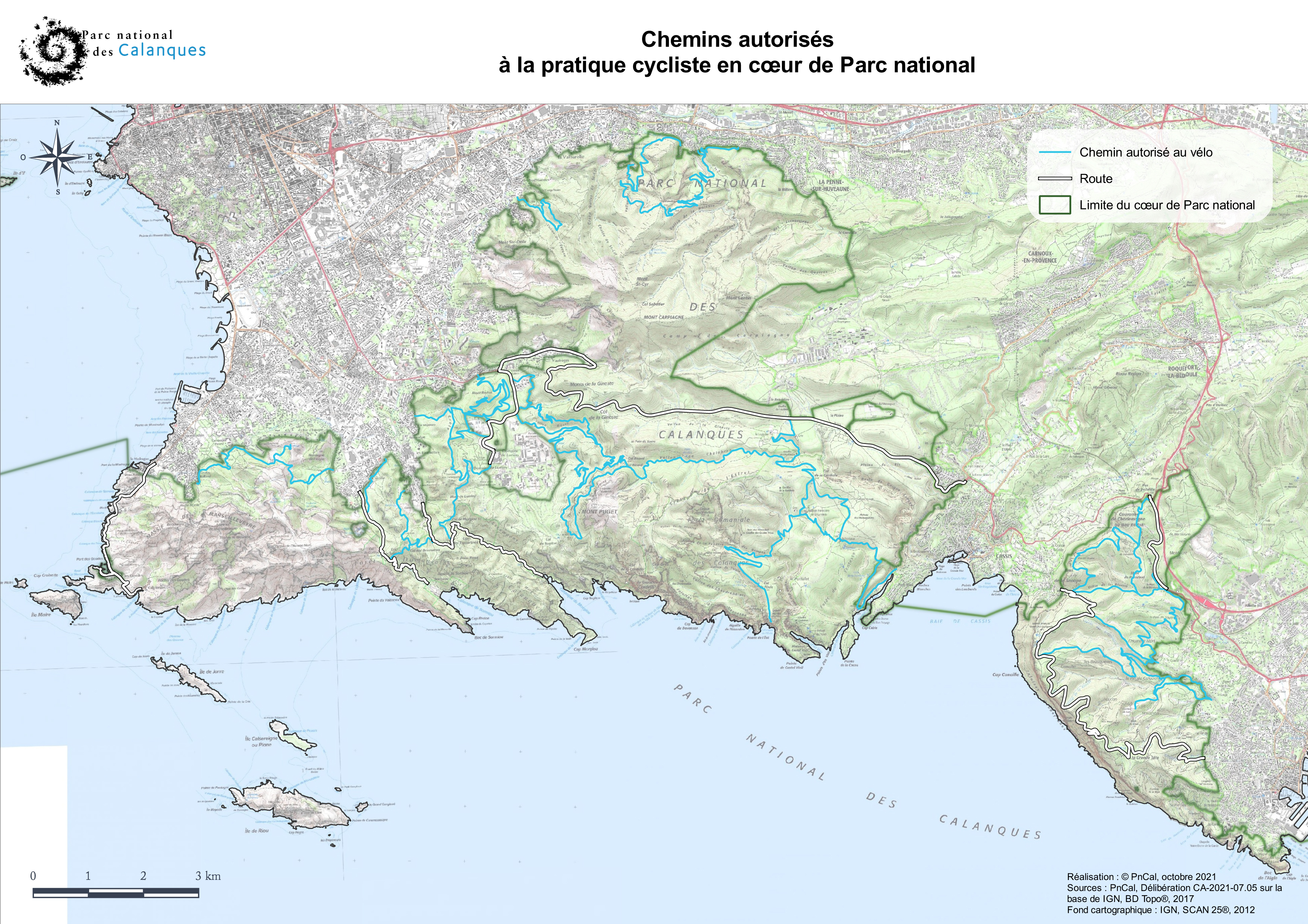
DWG issue - Updating trail access: http://www.calanques-parcnational.fr/sites/calanques-parcnational.fr/files/thumbnails/image/carte_velo.jpg
Tags
| bicycle | no |
|---|---|
| highway | path |
| hiking | yes |
| note | Balisage en barre jaune (6). |
| sac_scale | mountain_hiking |
| trail_visibility | good |
| trailblazed | yes |
Part of
3 relations
- Relation 11862673
- Relation Sentier de Grande Randonnée 98 (2681053)
- Relation Jaune 6 (2431804)
Nodes
29 nodes
- 954295776 (part of ways 187523195 and 187523194)
- 10050025444
- 954295813
- 954295871
- 10050025443
- 954295721
- 954295759
- 954295790
- 1981923419
- 1981923431
- 954295733
- 1981923438
- 1981923445
- 1981923448
- 1981923451
- 954295773
- 1981923498
- 1981923501
- 1981923508
- 1981923527
- 1981923533
- 954295811
- 1981923555
- 954295860
- 10050025442
- 1981923570
- 1981923578
- 1981923589
- 954295729 (part of ways 187523195 and 187523196)
Welcome to OpenStreetMap!
OpenStreetMap is a map of the world, created by people like you and free to use under an open license.
Hosting is supported by Fastly, OSMF corporate members, and other partners.
| https://openstreetmap.org/copyright | https://openstreetmap.org |
| Copyright OpenStreetMap and contributors, under an open license | |