Way History: D48 (28928903)
Version #20
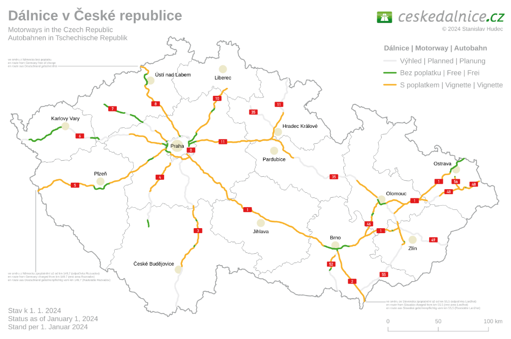
D48
- Edited by vojtechzaboril
- Changeset #118520517
Tags
| agricultural | no |
|---|---|
| bicycle | no |
| bridge | yes |
| carriage | no |
| foot | no |
| highway | motorway |
| horse | no |
| int_ref | E 462 |
| lanes | 3 |
| layer | 1 |
| maxspeed | 100 |
| oneway | yes |
| parking:lane:both | no_stopping |
| placement | right_of:1 |
| priority_road | designated |
| ref | D48 |
| smoothness | excellent |
| source | km |
| source:maxspeed | sign |
| source:ref | rsd_cr |
| surface | asphalt |
| toll | yes |
| toll:hgv | yes |
| turn:lanes | ||merge_to_left |
Nodes
2 nodes
- 316529458 (part of ways D48 (918848556) and 438885378)
- 316529493 (part of ways D48 (918848555) and 438885378)
Version #19
D48
- Edited by vojtechzaboril
- Changeset #101280136
Tags
| agricultural | no |
|---|---|
| bicycle | no |
| bridge | yes |
| carriage | no |
| foot | no |
| highway | motorway |
| horse | no |
| int_ref | E 462 |
| lanes | 2 |
| layer | 1 |
| maxspeed | 100 |
| oneway | yes |
| parking:lane:both | no_stopping |
| priority_road | designated |
| ref | D48 |
| smoothness | excellent |
| source | km |
| source:maxspeed | sign |
| source:ref | rsd_cr |
| surface | asphalt |
| toll | yes |
| toll:hgv | yes |
Nodes
2 nodes
- 316529458 (part of ways D48 (918848556) and 438885378)
- 316529493 (part of ways D48 (918848555) and 438885378)
Version #18
Zpoplatnění D48
Tags
| FIXME | only rough shape from katastrální mapa, needs survey |
|---|---|
| agricultural | no |
| bicycle | no |
| bridge | yes |
| carriage | no |
| foot | no |
| highway | motorway |
| horse | no |
| int_ref | E 462 |
| lanes | 2 |
| layer | 1 |
| maxspeed | 100 |
| oneway | yes |
| parking:lane:both | no_stopping |
| priority_road | designated |
| ref | D48 |
| smoothness | excellent |
| source | km |
| source:maxspeed | sign |
| source:ref | rsd_cr |
| surface | asphalt |
| toll | yes |
| toll:hgv | yes |
Nodes
2 nodes
- 316529458 (part of ways D48 (918848556) and 438885378)
- 316529493 (part of ways D48 (918848555) and 438885378)
Version #17
toll & toll:hgv set according to https://mytocz.eu/cs/vymezene-useky-silnic/mapy and http://www.ceskedalnice.cz/image/zpoplatnene-velka.png
Tags
| FIXME | only rough shape from katastrální mapa, needs survey |
|---|---|
| agricultural | no |
| bicycle | no |
| bridge | yes |
| carriage | no |
| foot | no |
| highway | motorway |
| horse | no |
| lanes | 2 |
| layer | 1 |
| maxspeed | 100 |
| oneway | yes |
| parking:lane:both | no_stopping |
| priority_road | designated |
| ref | D48 |
| source | km |
| source:maxspeed | sign |
| toll | yes |
Nodes
2 nodes
- 316529458 (part of ways D48 (918848556) and 438885378)
- 316529493 (part of ways D48 (918848555) and 438885378)
Version #16
Eroad
Tags
| FIXME | only rough shape from katastrální mapa, needs survey |
|---|---|
| agricultural | no |
| bicycle | no |
| bridge | yes |
| carriage | no |
| foot | no |
| highway | motorway |
| horse | no |
| lanes | 2 |
| layer | 1 |
| maxspeed | 100 |
| oneway | yes |
| parking:lane:both | no_stopping |
| priority_road | designated |
| ref | D48 |
| source | km |
| source:maxspeed | sign |
| toll | yes |
| toll:hgv | yes |
Nodes
2 nodes
- 316529458 (part of ways D48 (918848556) and 438885378)
- 316529493 (part of ways D48 (918848555) and 438885378)
Version #15
Drobné úpravy
Tags
| FIXME | only rough shape from katastrální mapa, needs survey |
|---|---|
| agricultural | no |
| bicycle | no |
| bridge | yes |
| carriage | no |
| foot | no |
| highway | motorway |
| horse | no |
| int_ref | E 462 |
| lanes | 2 |
| layer | 1 |
| maxspeed | 100 |
| oneway | yes |
| parking:lane:both | no_stopping |
| priority_road | designated |
| ref | D48 |
| source | km |
| source:maxspeed | sign |
| toll | yes |
| toll:hgv | yes |
Nodes
2 nodes
- 316529458 (part of ways D48 (918848556) and 438885378)
- 316529493 (part of ways D48 (918848555) and 438885378)
Version #14
Přidány zákazy zastavení a stání na mostech
Tags
| FIXME | only rough shape from katastrální mapa, needs survey |
|---|---|
| agricultural | no |
| bicycle | no |
| bridge | yes |
| carriage | no |
| foot | no |
| highway | motorway |
| horse | no |
| int_ref | E 462 |
| lanes | 2 |
| layer | 1 |
| maxspeed | 100 |
| oneway | yes |
| parking:lane:both | no_stopping |
| priority_road | designated |
| ref | D48 |
| source | km |
| source:maxspeed | sign |
| toll | yes |
| toll:hgv | yes |
Nodes
2 nodes
- 316529458 (part of ways D48 (918848556) and 438885378)
- 316529493 (part of ways D48 (918848555) and 438885378)
Version #13
Přidán tag "priority_road=designated"
Tags
| FIXME | only rough shape from katastrální mapa, needs survey |
|---|---|
| agricultural | no |
| bicycle | no |
| bridge | yes |
| carriage | no |
| foot | no |
| highway | motorway |
| horse | no |
| int_ref | E 462 |
| lanes | 2 |
| layer | 1 |
| maxspeed | 100 |
| oneway | yes |
| priority_road | designated |
| ref | D48 |
| source | km |
| source:maxspeed | sign |
| toll | yes |
| toll:hgv | yes |
Nodes
2 nodes
- 316529458 (part of ways D48 (918848556) and 438885378)
- 316529493 (part of ways D48 (918848555) and 438885378)
Version #12
Přidány zákazy
Tags
| FIXME | only rough shape from katastrální mapa, needs survey |
|---|---|
| agricultural | no |
| bicycle | no |
| bridge | yes |
| carriage | no |
| foot | no |
| highway | motorway |
| horse | no |
| int_ref | E 462 |
| lanes | 2 |
| layer | 1 |
| maxspeed | 100 |
| oneway | yes |
| ref | D48 |
| source | km |
| source:maxspeed | sign |
| toll | yes |
| toll:hgv | yes |
Nodes
2 nodes
- 316529458 (part of ways D48 (918848556) and 438885378)
- 316529493 (part of ways D48 (918848555) and 438885378)
Version #11
Dalnice - konzistence
Tags
| FIXME | only rough shape from katastrální mapa, needs survey |
|---|---|
| bridge | yes |
| highway | motorway |
| int_ref | E 462 |
| lanes | 2 |
| layer | 1 |
| maxspeed | 100 |
| oneway | yes |
| ref | D48 |
| source | km |
| source:maxspeed | sign |
| toll | yes |
| toll:hgv | yes |
Nodes
2 nodes
- 316529458 (part of ways D48 (918848556) and 438885378)
- 316529493 (part of ways D48 (918848555) and 438885378)
Version #10
(no comment)
Tags
| FIXME | only rough shape from katastrální mapa, needs survey |
|---|---|
| agricultural | no |
| bicycle | no |
| bridge | yes |
| carriage | no |
| foot | no |
| highway | motorway |
| horse | no |
| int_ref | E 462 |
| lanes | 2 |
| layer | 1 |
| maxspeed | 100 |
| motorroad | yes |
| oneway | yes |
| ref | D48 |
| source | km |
| source:maxspeed | sign |
| toll | yes |
| toll:hgv | yes |
Nodes
2 nodes
- 316529458 (part of ways D48 (918848556) and 438885378)
- 316529493 (part of ways D48 (918848555) and 438885378)
Version #9
(no comment)
Tags
| FIXME | only rough shape from katastrální mapa, needs survey |
|---|---|
| agricultural | no |
| bicycle | no |
| bridge | yes |
| carriage | no |
| foot | no |
| highway | motorway |
| horse | no |
| int_ref | E 462 |
| lanes | 2 |
| layer | 1 |
| maxspeed | 100 |
| motorroad | yes |
| oneway | yes |
| source | km |
| source:maxspeed | sign |
| toll | yes |
| toll:hgv | yes |
Nodes
2 nodes
- 316529458 (part of ways D48 (918848556) and 438885378)
- 316529493 (part of ways D48 (918848555) and 438885378)
Version #8
Úprava silnice R48 a relace její trasy
Tags
| FIXME | only rough shape from katastrální mapa, needs survey |
|---|---|
| agricultural | no |
| bicycle | no |
| bridge | yes |
| carriage | no |
| foot | no |
| highway | trunk |
| horse | no |
| int_ref | E 462 |
| lanes | 2 |
| layer | 1 |
| maxspeed | 100 |
| motorroad | yes |
| oneway | yes |
| ref | R48 |
| source | km |
| source:maxspeed | sign |
| toll | yes |
| toll:hgv | yes |
Nodes
2 nodes
- 316529458 (part of ways D48 (918848556) and 438885378)
- 316529493 (part of ways D48 (918848555) and 438885378)
Version #7
Edited link roads
Tags
| FIXME | only rough shape from katastrální mapa, needs survey |
|---|---|
| bridge | yes |
| highway | trunk |
| int_ref | E 462 |
| lanes | 2 |
| layer | 1 |
| maxspeed | 100 |
| motorroad | yes |
| oneway | yes |
| ref | R48 |
| source | km |
| source:maxspeed | sign |
| toll | yes |
| toll:hgv | yes |
Nodes
2 nodes
- 316529458 (part of ways D48 (918848556) and 438885378)
- 316529493 (part of ways D48 (918848555) and 438885378)
Version #6
road refs
Tags
| FIXME | only rough shape from katastrální mapa, needs survey |
|---|---|
| bridge | yes |
| highway | trunk |
| int_ref | E 462 |
| lanes | 2 |
| layer | 1 |
| maxspeed | 100 |
| motorroad | yes |
| oneway | yes |
| ref | R48 |
| source | km |
| source:maxspeed | sign |
| toll | yes |
| toll:hgv | yes |
Nodes
2 nodes
-
316529494 - 316529493 (part of ways D48 (918848555) and 438885378)
Version #5
Brno-Východ D1 - R46 - R35 - R48 - I/48 - I/58 - Kopřivnice - added lanes and maxspeed where missing, Obchvat Příbora - better position, partly tagged recently opened R48
Tags
| FIXME | only rough shape from katastrální mapa, needs survey |
|---|---|
| bridge | yes |
| highway | trunk |
| lanes | 2 |
| layer | 1 |
| maxspeed | 100 |
| motorroad | yes |
| oneway | yes |
| ref | R48 |
| source | km |
| source:maxspeed | sign |
| toll | yes |
| toll:hgv | yes |
Nodes
2 nodes
-
316529494 - 316529493 (part of ways D48 (918848555) and 438885378)
Version #4
toll:hgv tagimg
- Edited by Bohdan Kotouček
- Changeset #9592020
Tags
| FIXME | only rough shape from katastrální mapa, needs survey |
|---|---|
| bridge | yes |
| highway | trunk |
| lanes | 2 |
| layer | 1 |
| motorroad | yes |
| oneway | yes |
| ref | R48 |
| source | km |
| toll | yes |
| toll:hgv | yes |
Nodes
2 nodes
-
316529494 - 316529493 (part of ways D48 (918848555) and 438885378)
Version #3
oprava dle ortofotomapy
Tags
| FIXME | only rough shape from katastrální mapa, needs survey |
|---|---|
| bridge | yes |
| highway | trunk |
| lanes | 2 |
| layer | 1 |
| motorroad | yes |
| oneway | yes |
| ref | R48 |
| source | km |
| toll | yes |
Nodes
2 nodes
-
316529494 - 316529493 (part of ways D48 (918848555) and 438885378)
Version #2
zpoplatněné úseky R48
Tags
| FIXME | only rough shape from katastrální mapa, needs survey |
|---|---|
| bridge | yes |
| highway | trunk |
| layer | 1 |
| oneway | yes |
| ref | 48 |
| source | km |
| toll | yes |
Nodes
2 nodes
-
316529494 - 316529493 (part of ways D48 (918848555) and 438885378)
Welcome to OpenStreetMap!
OpenStreetMap is a map of the world, created by people like you and free to use under an open license.
Hosting is supported by Fastly, OSMF corporate members, and other partners.
| https://openstreetmap.org/copyright | https://openstreetmap.org |
| Copyright OpenStreetMap and contributors, under an open license | |