Loading...
Way: De Gevangentoren (276967874)
Version #8
Migrate URL scheme to HTTPS for URLs within the ISO8166-2 region of NL-ZE that supports secure connection
Tags
| alt_name | Bomvrije |
|---|---|
| amenity | restaurant |
| building | house |
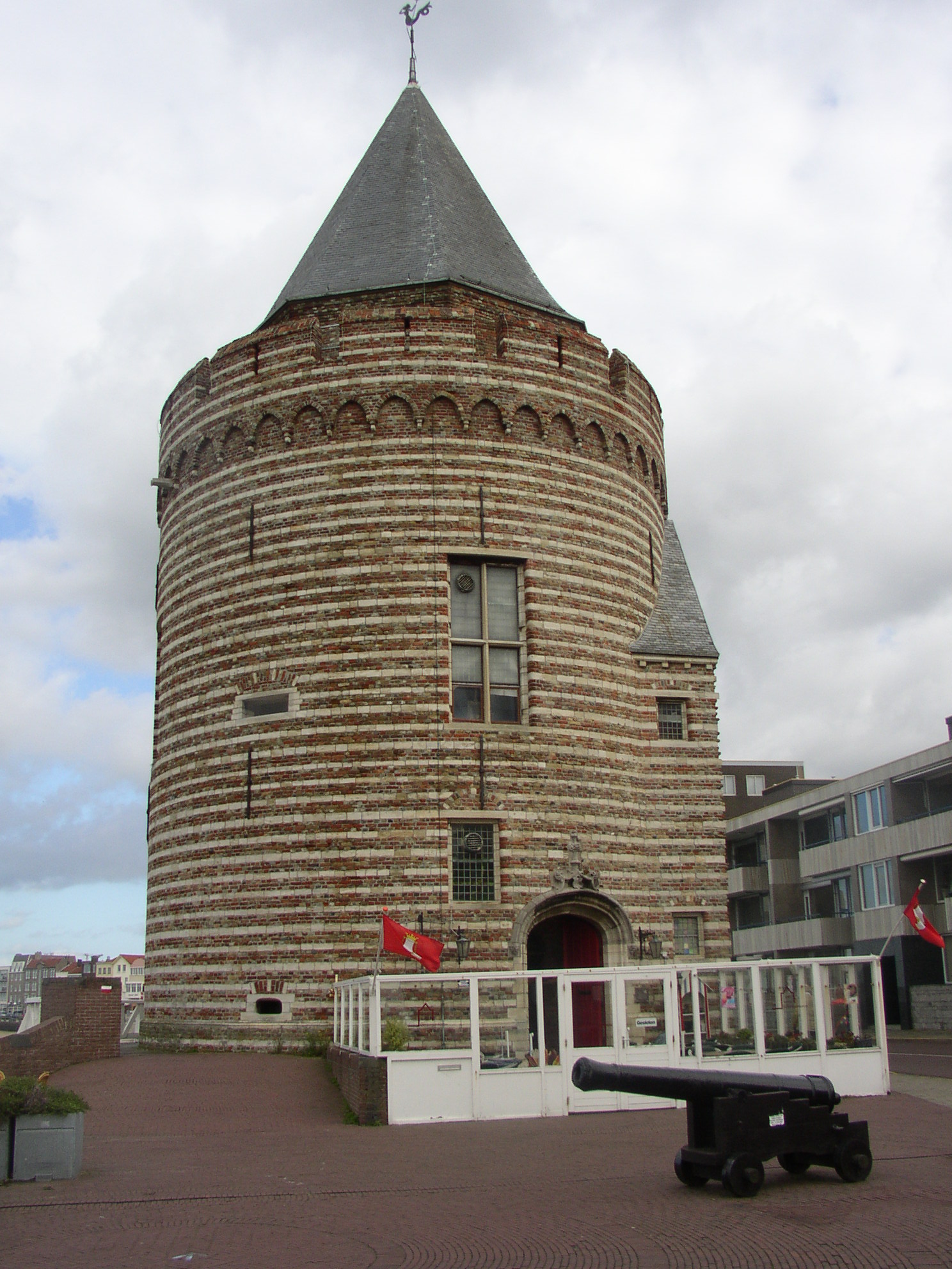
| description | Ronde, aan de zeekant opgetrokken poorttoren, daterend uit omstreeks 1491 en oorspronkelijk één van de torens van de in 1811 door de Fransen gesloopte Westpoort. |
| heritage | 2 |
| heritage:operator | rce |
| historic | city_gate |
| image | https://upload.wikimedia.org/wikipedia/commons/0/02/Vlissingen04.JPG |
| name | De Gevangentoren |
| ref:bag | 718100000000540 |
| ref:rce | 37637 |
| source | BAG |
| source:date | 2014-03-24 |
| start_date | 1491 |
| url | https://photos.app.goo.gl/e12aWk1gykMRLqbX8 |
| website | https://www.restaurantdegevangentoren.nl |
| wikidata | Q2202092 |
| wikipedia | nl:Gevangentoren (Vlissingen) |
Nodes
35 nodes
- 2815184419
- 2815184275
- 2815184257
- 2815184207
- 2815184204
- 7942072424
- 2815184186
- 2815184142
- 2815184127
- 2815184123
- 2815184134
- 2815184148
- 2815184167
- 2815184195
- 2815184220
- 2815184248
- 2815184280
- 2815184308
- 2815184342
- 2815184387
- 5916996654 (part of ways 310806580 and 626760359)
- 2815184424
- 2815184461
- 5642446088 (part of ways 626760362 and Boulevard De Ruyter (851504420))
- 2815184366
- 2815184408
- 2815184452
- 2815184482
- 2815184500
- 2815184506
- 2815184505
- 2815184490
- 2815184464
- 2815184421
- 2815184419
Welcome to OpenStreetMap!
OpenStreetMap is a map of the world, created by people like you and free to use under an open license.
Hosting is supported by Fastly, OSMF corporate members, and other partners.
| https://openstreetmap.org/copyright | https://openstreetmap.org |
| Copyright OpenStreetMap and contributors, under an open license | |