Loading...
Way: Villa gallo-romaine du Grosswald (251383432)
Version #7
removed site_type= as transitional simultaneous tagging with archaeological_site=, as discussed in https://community.openstreetmap.org/t/implementation-of-new-tagging-scheme-of-archaeological-site/7850
Tags
| access | yes |
|---|---|
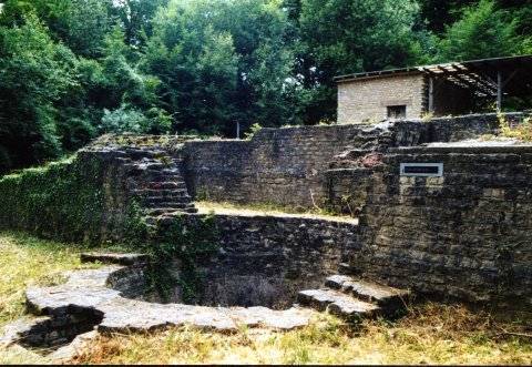
| archaeological_site | roman_villa |
| heritage | yes |
| historic | archaeological_site |
| historic:civilization | western_roman |
| image | http://archeographe.net/sites/default/files/img/spip/sar-14.jpg |
| landuse | grass |
| name | Villa gallo-romaine du Grosswald |
| source | Bing Sat |
| start_date | C2 |
| website | https://archeographe.net/Sarreinsming-la-villa-du |
Part of
1 relation
- Relation Grosswald (13799739) (as inner)
Nodes
Welcome to OpenStreetMap!
OpenStreetMap is a map of the world, created by people like you and free to use under an open license.
Hosting is supported by Fastly, OSMF corporate members, and other partners.
| https://openstreetmap.org/copyright | https://openstreetmap.org |
| Copyright OpenStreetMap and contributors, under an open license | |