Loading...
Way History: West Brown Deer Road (1255966529)
Version #2
add etymology wikidata, wikipedia
- Edited by 1998alexkane
- Changeset #151873300
Tags
| highway | primary |
|---|---|
| lit | no |
| maxspeed | 35 mph |
| name | West Brown Deer Road |
| name:etymology:wikidata | Q2346859 |
| name:etymology:wikipedia | en:Brown Deer, Wisconsin |
| oneway | yes |
| ref | WI 100 |
| sidewalk | no |
| surface | concrete |
Nodes
4 nodes
- 6860183029 (part of ways 732596152, 1255966530, and West Brown Deer Road (387043009))
- 8076998903 (part of way 866557497)
- 9600728726
- 196640373 (part of ways North Spruce Road (1082717677), North Spruce Road (40531807), and West Brown Deer Road (1043079489))
Version #1
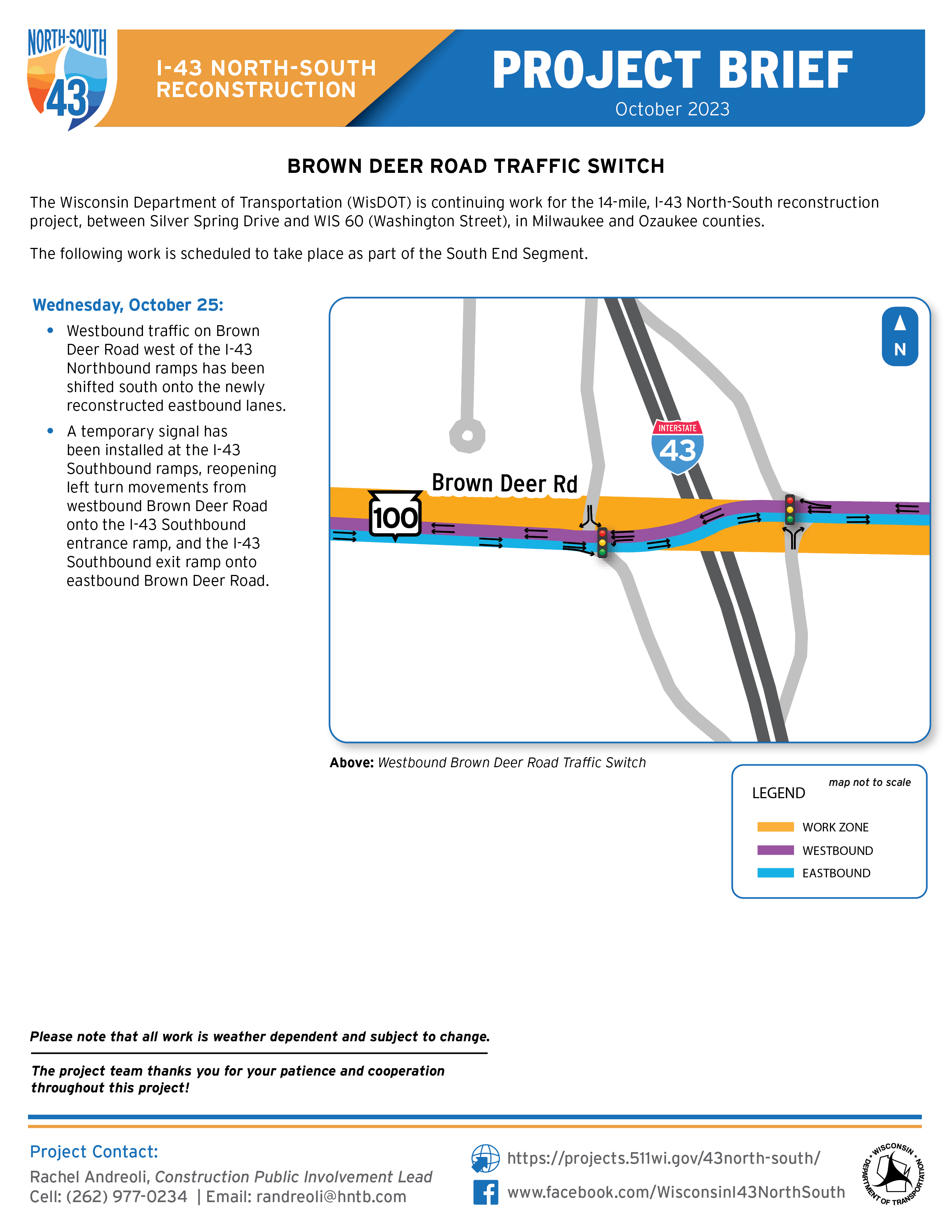
Geometry of roads was changed according to Lyft telemetry data and https://projects.511wi.gov/43north-south/wp-content/uploads/sites/705/231025_BDR_Switch-EB-WB.png
- Edited by pmarkina_lyft
- Changeset #148044261
Tags
| highway | primary |
|---|---|
| lit | no |
| maxspeed | 35 mph |
| name | West Brown Deer Road |
| oneway | yes |
| ref | WI 100 |
| sidewalk | no |
| surface | concrete |
Nodes
4 nodes
- 6860183029 (part of ways 732596152, 1255966530, and West Brown Deer Road (387043009))
- 8076998903 (part of way 866557497)
- 9600728726
- 196640373 (part of ways North Spruce Road (1082717677), North Spruce Road (40531807), and West Brown Deer Road (1043079489))
Welcome to OpenStreetMap!
OpenStreetMap is a map of the world, created by people like you and free to use under an open license.
Hosting is supported by Fastly, OSMF corporate members, and other partners.
| https://openstreetmap.org/copyright | https://openstreetmap.org |
| Copyright OpenStreetMap and contributors, under an open license | |