Bemærkninger indsendt eller kommenteret på af Pyknite
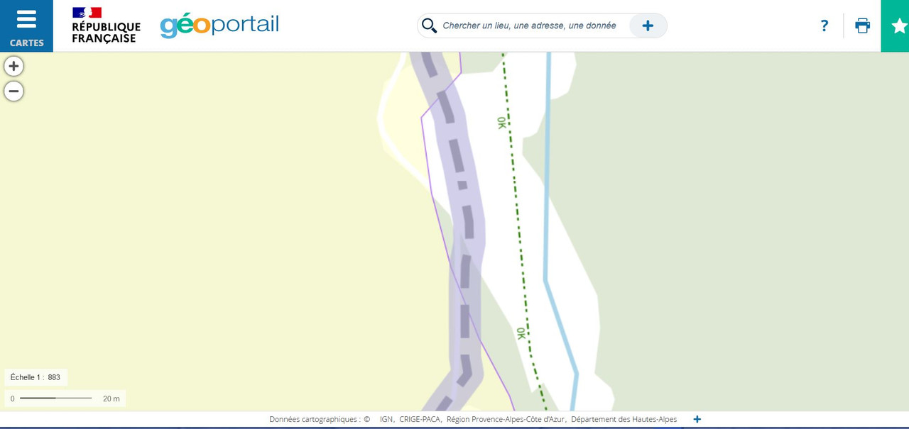
According to many italiand and french official sources, the international border is not by the river, instead is by the unsurfaced road.
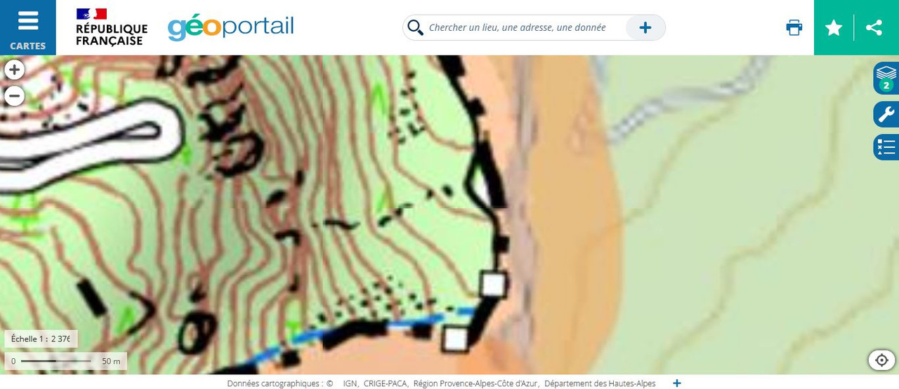
This is a screenshot with the wrong part inside a red rectangle: https://postlmg.cc/SjDJxrK7
Official source of french national geoportal (IGN), vectorial: https://www.geoportail.gouv.fr/carte?c=6.670146509608229,45.04352149959723&z=17&l0=ORTHOIMAGERY.ORTHOPHOTOS::GEOPORTAIL:OGC:WMTS(https://wiki.openstreetmap.org/wiki/Tag:1)&l1=GEOGRAPHICALGRIDSYSTEMS.PLANIGNV2::GEOPORTAIL:OGC:WMTS(1)&permalink=yes
related screenshot 1: https://i.postimg.cc/fTq0Q9zN/Rio-Gorgia.jpg related screenshot 2: https://i.postimg.cc/m2dv890v/Bardonecchia-Rio-della-Gorgia.jpg related screenshot 3: https://i.postimg.cc/3r1VxpJk/Bardonecchia-Rio-della-Gorgia2.jpg
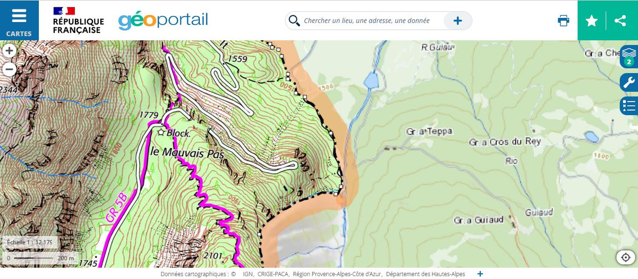
Official source of Italy geoportal (IGM), image of low detail: https://www.igmi.org/it/geoprodotti/raster/1/ED50_ritagliato_ultima_prodotta/foglio-1515568453.61
Extract of Italy geoportal (IGM), image of high detail: https://www.geamap.com/it/italia#zoom=15&lat=45.04326&lon=6.66876&layer=17&overlays=FFFFFFFFFFFFFFFFFFFFFFF
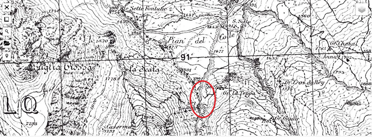
related screenshot: https://i.postimg.cc/yY9NydMk/Carta-IGM-Rio-Gorgia.jpg
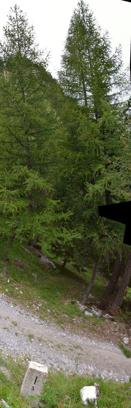
Pic of boundary stone, taken directly in place: https://i.postimg.cc/057Yb8V0/Cippo-alla-base-del-greto-del-Rio-Gorgia.jpg
Who can fix this? Thanks you
There is a new roundabout already open and working. GPS trace updated is already available.
Who can add the new roundabout and edit the involved relationships?