Pyknite's Notes
Notes submitted or commented on by Pyknite
| Id | Creator | Description | Created at | Last changed | |
|---|---|---|---|---|---|
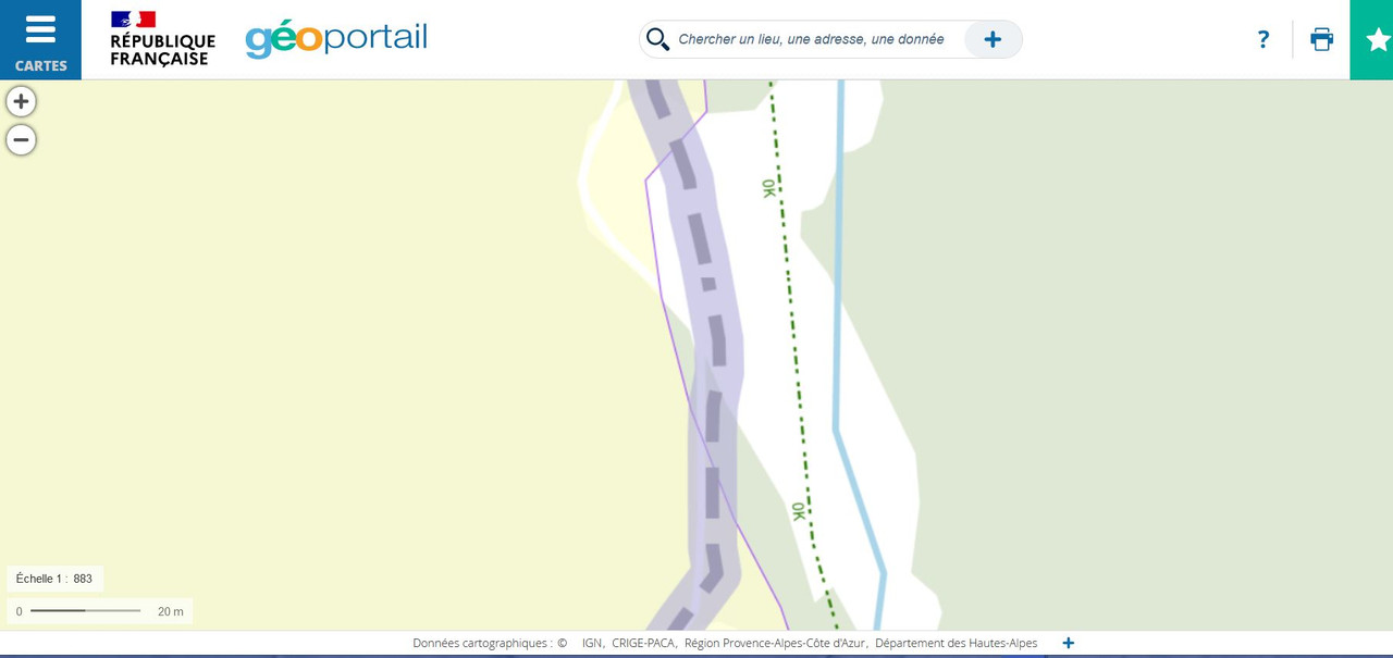
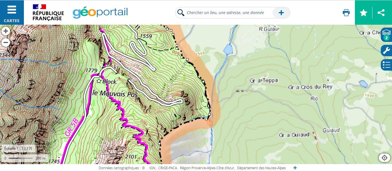
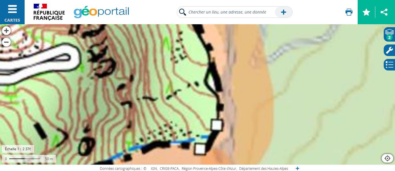
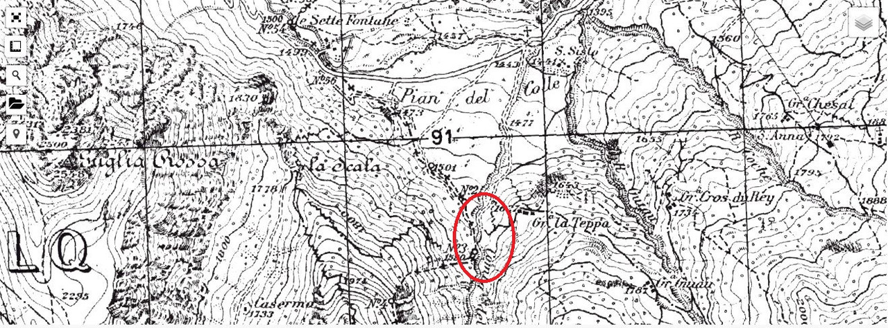
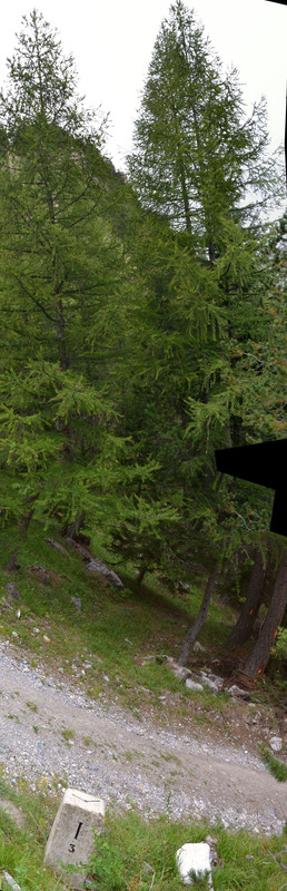
| 3222042 | Pyknite | According to many italiand and french official sources, the international border is not by the river, instead is by the unsurfaced road. This is a screenshot with the wrong part inside a red rectangle: https://postlmg.cc/SjDJxrK7 Official source of french national geoportal (IGN), vectorial: https://www.geoportail.gouv.fr/carte?c=6.670146509608229,45.04352149959723&z=17&l0=ORTHOIMAGERY.ORTHOPHOTOS::GEOPORTAIL:OGC:WMTS(1)&l1=GEOGRAPHICALGRIDSYSTEMS.PLANIGNV2::GEOPORTAIL:OGC:WMTS(1)&permalink=yes related screenshot 1: https://i.postimg.cc/fTq0Q9zN/Rio-Gorgia.jpg related screenshot 2: https://i.postimg.cc/m2dv890v/Bardonecchia-Rio-della-Gorgia.jpg related screenshot 3: https://i.postimg.cc/3r1VxpJk/Bardonecchia-Rio-della-Gorgia2.jpg Official source of Italy geoportal (IGM), image of low detail: https://www.igmi.org/it/geoprodotti/raster/1/ED50_ritagliato_ultima_prodotta/foglio-1515568453.61 Extract of Italy geoportal (IGM), image of high detail: https://www.geamap.com/it/italia#zoom=15&lat=45.04326&lon=6.66876&layer=17&overlays=FFFFFFFFFFFFFFFFFFFFFFF related screenshot: https://i.postimg.cc/yY9NydMk/Carta-IGM-Rio-Gorgia.jpg Pic of boundary stone, taken directly in place: https://i.postimg.cc/057Yb8V0/Cippo-alla-base-del-greto-del-Rio-Gorgia.jpg Who can fix this?
|
|||
| 3222048 | Pyknite | There is a new roundabout already open and working. GPS trace updated is already available. Who can add the new roundabout and edit the involved relationships? |