Loading...
Relation: Potter Hill Meadows (64651)
Version #3
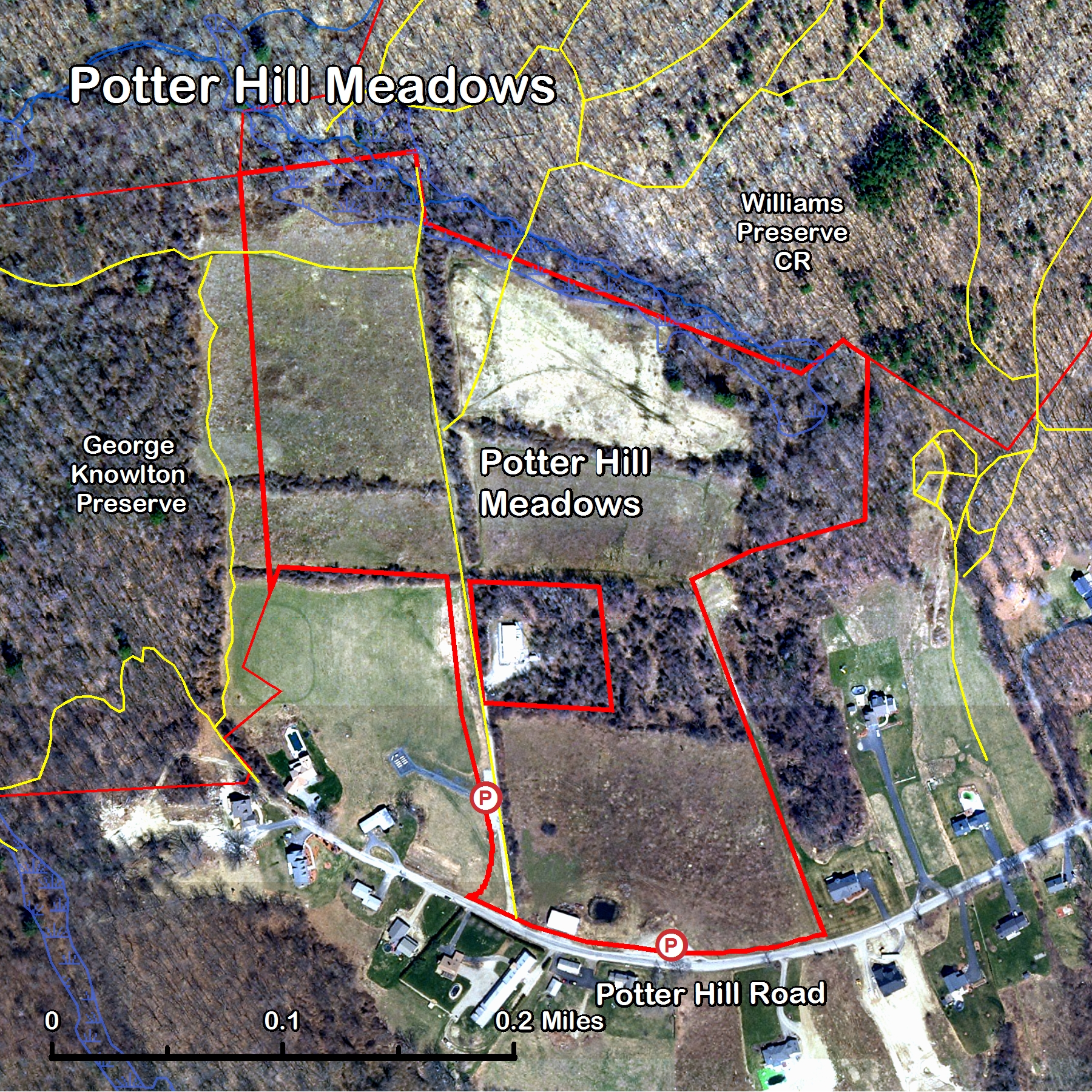
Both of these parcels were incorrectly labelled as Martha Deering Wildlife Management Area. They have been changed to reflect the correct names. Referencehttp://www.graftonland.org/properties/maps/aerial/Photo%20Map%20PotterHillM.jpg
Tags
| access | yes |
|---|---|
| landuse | conservation |
| leisure | nature_reserve |
| massgis:ARTICLE97 | 1 |
| massgis:ASSESS_ACR | 0.00000000 |
| massgis:ATT_DATE | 2008/02/15 |
| massgis:CAL_DATE_R | 4/12/2007 |
| massgis:DCAM_ID | 0 |
| massgis:DEED_ACRES | 32.60000000 |
| massgis:EOEAINVOLV | 1 |
| massgis:FEESYM | DFG |
| massgis:FEE_OWNER | Department of Fish and Game |
| massgis:FY_FUNDING | 2007 |
| massgis:INTSYM | CR |
| massgis:LEV_PROT | P |
| massgis:OLI_1_ABRV | DFG |
| massgis:OLI_1_INT | CR |
| massgis:OLI_1_ORG | Department of Fish and Game |
| massgis:OLI_1_TYPE | S |
| massgis:OS_DEED_BO | 41413 |
| massgis:OS_DEED_PA | 284 |
| massgis:OS_ID | 110-5496 |
| massgis:OWNER_ABRV | DFG |
| massgis:OWNER_TYPE | S |
| massgis:POLY_ID | 5496 |
| massgis:PRIM_PURP | B |
| massgis:PROJ_ID1 | DFW0918 |
| massgis:PUB_ACCESS | Y |
| massgis:SITE_NAME | MARTHA DEERING WMA |
| massgis:SOURCE_MAP | DFW918 |
| massgis:SOURCE_TYP | SV |
| massgis:TOWN_ID | 110 |
| name | Potter Hill Meadows |
| owner | Department Of Fish And Game |
| ownership | state |
| protected | perpetuity |
| start_date | 2007-04-12 |
| type | multipolygon |
Members
Welcome to OpenStreetMap!
OpenStreetMap is a map of the world, created by people like you and free to use under an open license.
Hosting is supported by Fastly, OSMF corporate members, and other partners.
| https://openstreetmap.org/copyright | https://openstreetmap.org |
| Copyright OpenStreetMap and contributors, under an open license | |