Loading...
Node: Hochkreuz (1665254205)
Version #7
schema is an important part of website adresses!
- Edited by 0815jh007
- Changeset #61509810
- Location: 50.9190434, 6.1228820
Tags
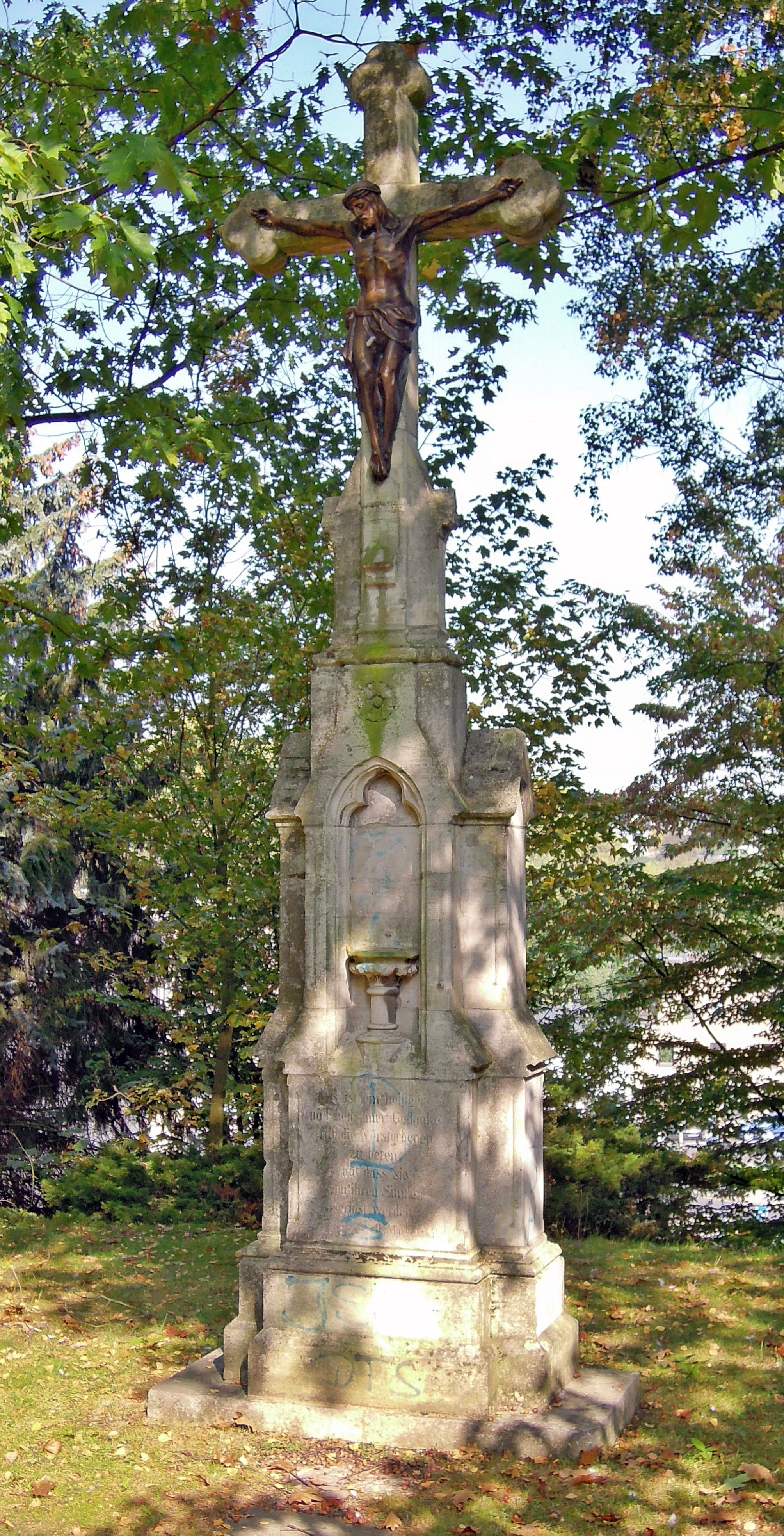
| description | Das Kreuz hat eine neu romanische Form auf einem kreuzförmigen Sockel mit Inschrift. Errichtet 1885; stand bis Januar 1976 |
|---|---|
| fixme:wikipedia | The wikipedia tag links to a list article, not an article about this specific feature. Needs a better link, or maybe rename "wikipedia" to "related:wikipedia"? See osm wiki - key:wikipedia : "only provide links to articles which are 'about the feature'" |
| heritage | yes |
| historic | wayside_cross |
| image | https://upload.wikimedia.org/wikipedia/commons/d/d6/%C3%9Cbach_Hochkreuz_%281%29.jpg |
| name | Hochkreuz |
| note | 50° 55' 08,3" N 06° 07' 21,7" O |
| start_date | 1885 |
| website | http://www.limburg-bernd.de |
| wikipedia | de:Liste der Baudenkmäler in Übach-Palenberg |
Welcome to OpenStreetMap!
OpenStreetMap is a map of the world, created by people like you and free to use under an open license.
Hosting is supported by Fastly, OSMF corporate members, and other partners.
| https://openstreetmap.org/copyright | https://openstreetmap.org |
| Copyright OpenStreetMap and contributors, under an open license | |