Loading...
Way: 1125079706
Version #36
Added/updated/modified a number of ways and points from a bike ride. Updated and corrected PROW numbers on and off route.
Tags
| check_date | 2024-02-28 |
|---|---|
| highway | proposed |
| proposed | footway |
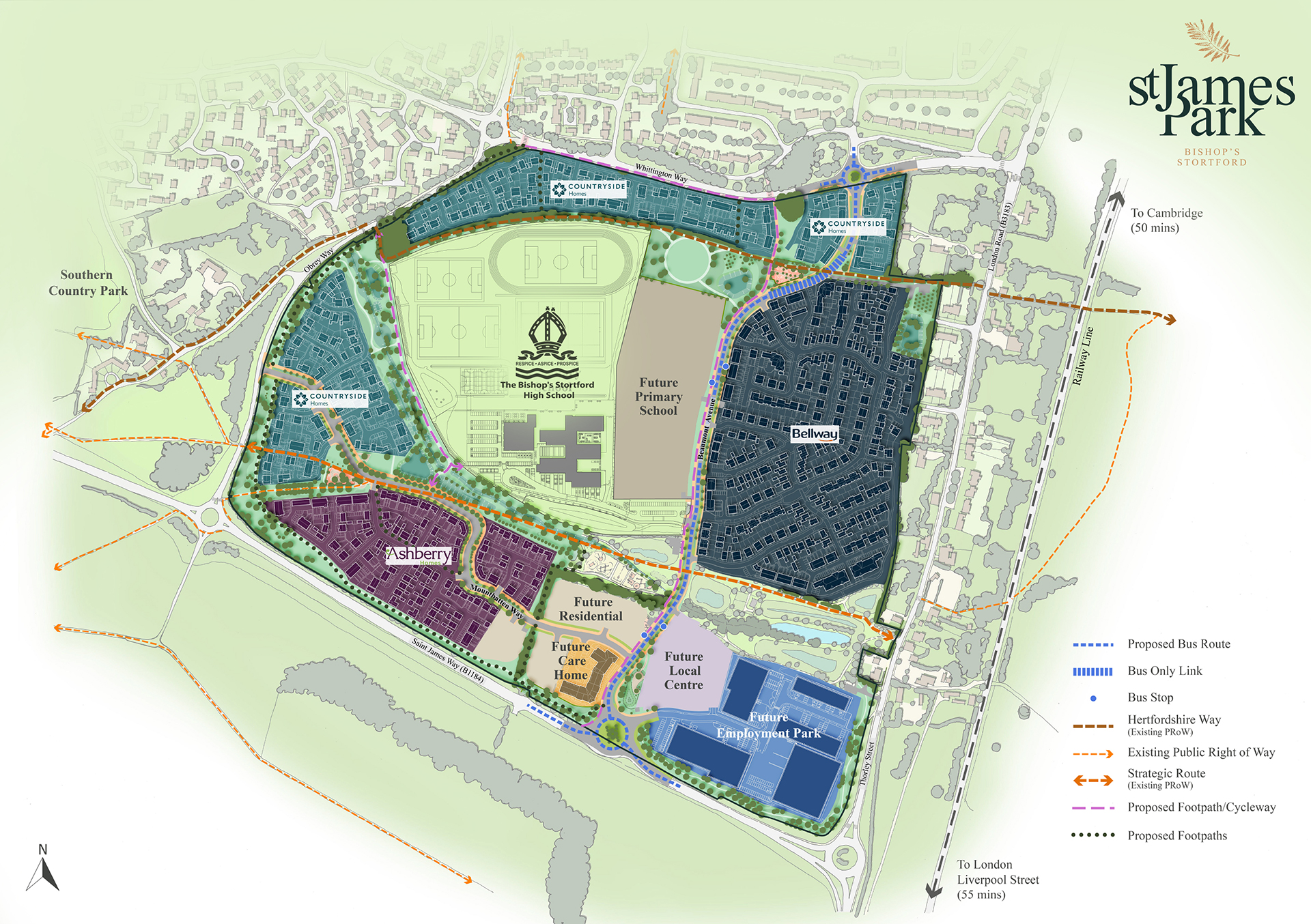
| source | https://www.st-jamespark.com/app/uploads/2023/03/St-James-Masterplan-3-2023.jpg |
Nodes
3 nodes
- 11242332463 (part of way 1125079704)
- 11242332462 (part of way 1213444499)
- 10288560483 (part of way Thorley Footpath 1 (1219384002))
Welcome to OpenStreetMap!
OpenStreetMap is a map of the world, created by people like you and free to use under an open license.
Hosting is supported by Fastly, OSMF corporate members, and other partners.
| https://openstreetmap.org/copyright | https://openstreetmap.org |
| Copyright OpenStreetMap and contributors, under an open license | |