Loading...
Way: 1060161156
Version #52
Added/updated/modified a number of ways and points from updated aerial imagery.
Tags
| access | no |
|---|---|
| construction | highway |
| highway | construction |
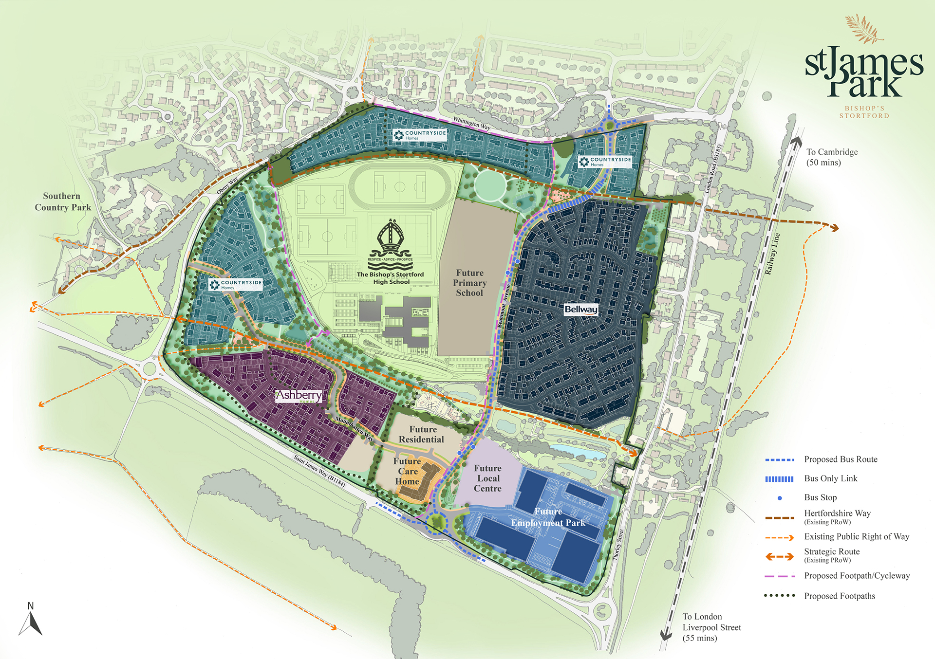
| source | https://www.st-jamespark.com/app/uploads/2023/03/St-James-Masterplan-3-2023.jpg |
Nodes
6 nodes
- 8813031411 (part of way 1125079694)
- 9821234600 (part of way 1070094353)
- 10208348586 (part of way 1116114955)
- 11736681932
- 11736681931
- 9821234599 (part of way 1070094351)
Welcome to OpenStreetMap!
OpenStreetMap is a map of the world, created by people like you and free to use under an open license.
Hosting is supported by Fastly, OSMF corporate members, and other partners.
| https://openstreetmap.org/copyright | https://openstreetmap.org |
| Copyright OpenStreetMap and contributors, under an open license | |