Reinhart Previano's Diary Comments
Diary Comments added by Reinhart Previano
| Post | When | Comment |
|---|---|---|
| Mari Petakan Pembayaran Nontunai Indonesia di OpenStreetMap! (Revisi) | Iya |
|
| Mari Petakan Pembayaran Nontunai Indonesia di OpenStreetMap! (Revisi) | Saya biasanya cuman pakai iD dan Vespucci (Android). Aplikasi serupa seperti JOSM, Potlatch, dan Go Map (iOS) juga bisa, asal bisa edit |
|
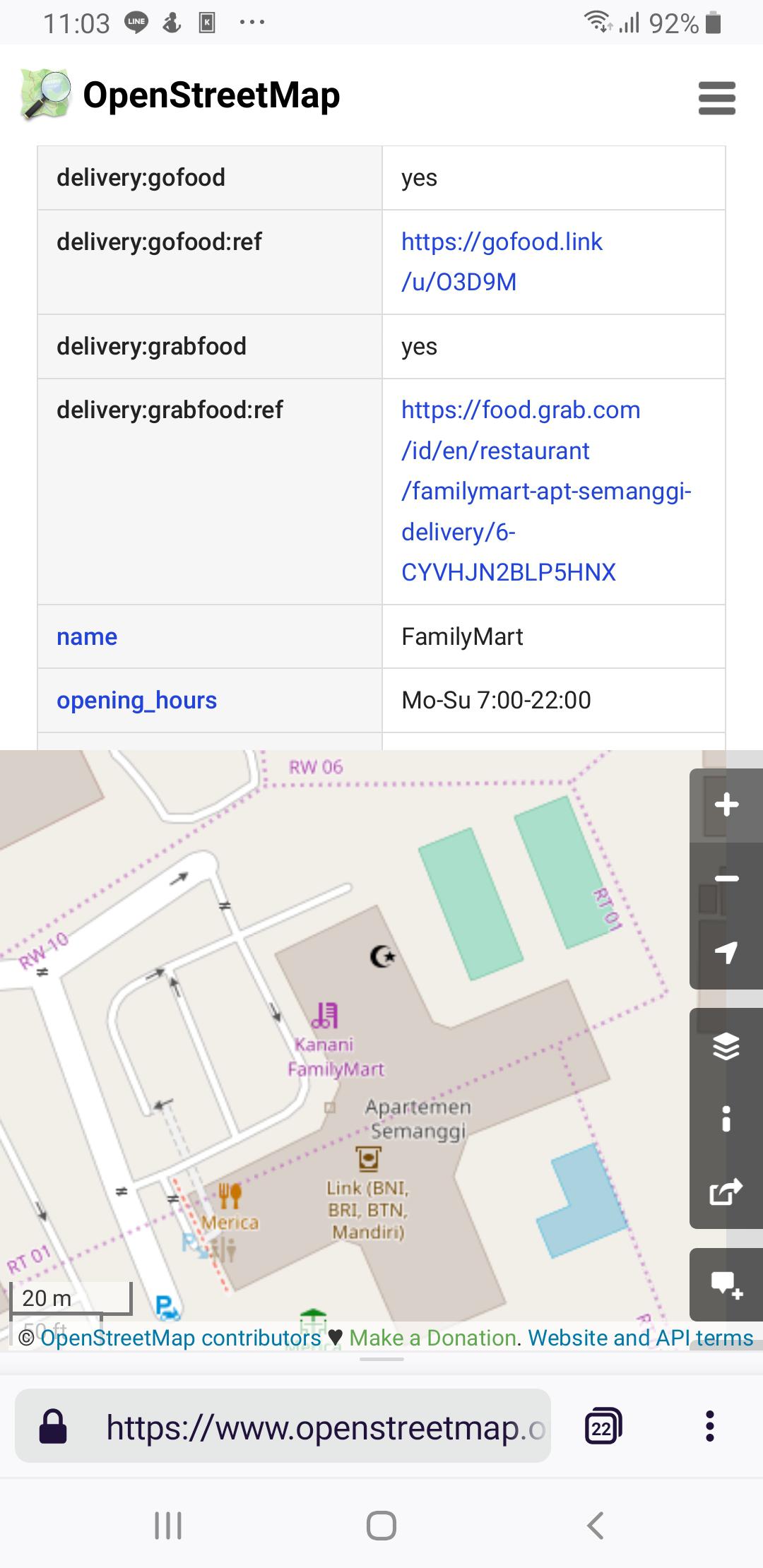
| Testing Delivery Subkeys for Food-Ordering Apps | Here’s an example on how https://www.openstreetmap.org/node/4621907250 How this information is displayed on: OpenStreetMap:
GoFood (after clicking on the
GrabFood (after clicking on the
|
|
| Testing Delivery Subkeys for Food-Ordering Apps | Sure, I’ll mum commenting soon. I think I need to give clear examples of the
|
|
| Upgrading Transjakarta Networks to Public Transport V2 Schema | As an update here are some changes I’ve made, starting from Corridor 9: + https://www.openstreetmap.org/changeset/71257265 + https://www.openstreetmap.org/changeset/71262712 + https://www.openstreetmap.org/changeset/71262812 + https://www.openstreetmap.org/changeset/71453713 + https://www.openstreetmap.org/changeset/71454405 + https://www.openstreetmap.org/changeset/71454422 + https://www.openstreetmap.org/changeset/71454773 + https://www.openstreetmap.org/changeset/71455101 Final touches will be made around Pluit and Penjaringan stations, before I continue to the next steps. |
|
| Mapping the New Genting Highlands | I recently added a hotfix to the FWP exit paths: they actually follow the way shown in the old change sets. |
|
| Mapping the New Genting Highlands | Hmm… I think I need to reword those. I initially compared against other maps only to see whether some features (such as tunnels) are exists. The rest of the mapping, which is tracing the start and end of the tunnel, is based on satellite imagery. |
|
| Mapping the New Genting Highlands | Here is another evidence that proves the current correct FWP exit path, based on two different satellite imageries. The differences of the satellite imagery sources (Bing then DigitalGlobe), at least, proved that the old exit from First World Plaza is removed for construction.
The problem with reversion is, the former version of the map data is too outdated. Genting’s SkyAvenue shopping mall has been opened about 2-3 years ago, yet I believe that the initial construction has been started about 5 years ago. I actually feel surprised with few changes to OpenStreetMap since then. The point of mentioning Google Maps and HERE WeGo here is, simply to compare on which maps has the most updated content, at least from the basic road and features, not for using them to trace new roads or buildings into OSM (through tools such as PicLayer JOSM plugin; while this changeset is actually made using iD). |
|
| Mapping the New Genting Highlands | I recently rechecked and modified the FWP exit paths, which might seem the most infringing one. Now, it is based on older satellite imagery.
The First World Plaza lobby is supposed to be a straight long corridor which sits along the rightmost tower (or simply the Tower 1). I decided to straighten this path along this tower then allow the path to bend at the end of the lobby. The old Genting Outdoor Theme Park was built straight on ground level, while the future 20th Century Fox World is built on one or two levels above. I simply solved the path issue by aligning them based on the old Theme Park roads (the sides of the artificial lakes), to make the map more accurate.
Then, I discovered that a deleted underground path still exists from Arena of Stars / Resort Hotel to Genting International Convention Centre (Source). This path existed on OpenStreetMap then removed in #64266771. It is now re-added in a new changeset. So here’s a final result from Changeset #64279712 and #64280005
|
|
| Mapping Saga Continues at klia2 (Kuala Lumpur International Airport) |
Did you mean for the curves on the taxiway? |
|
| The Size of TIGER | Wait, are these the imported TIGER Maps data to OSM? |
|
| Major Changes in Central Park Mall Jakarta | Update: I have finally fixed some of these problems (and added the unmapped pond) at https://www.openstreetmap.org/changeset/56644415 |