Kirbert's Notes
Notes submitted or commented on by Kirbert
« Previous | Page 1 | Next »
| Id | Creator | Description | Created at | Last changed | |
|---|---|---|---|---|---|
|
|
3091076 | Kirbert | Is Pintlala really spelled with 2 L's here instead of three? |
||
|
|
2998414 | Kirbert | This looks like a school, or a pair of schools. Anybody have more information? |
||
|
|
2325657 | onosm.org submitted note from a business:
|
|||
|
|
3058345 | Kirbert | It's not likely that *both* of these roads are named J P Howard. |
||
|
|
3050530 | Kirbert | Should the boundary of Frank Jackson State Park line up with the boundary of Opp? If so, which one is correct? |
||
|
|
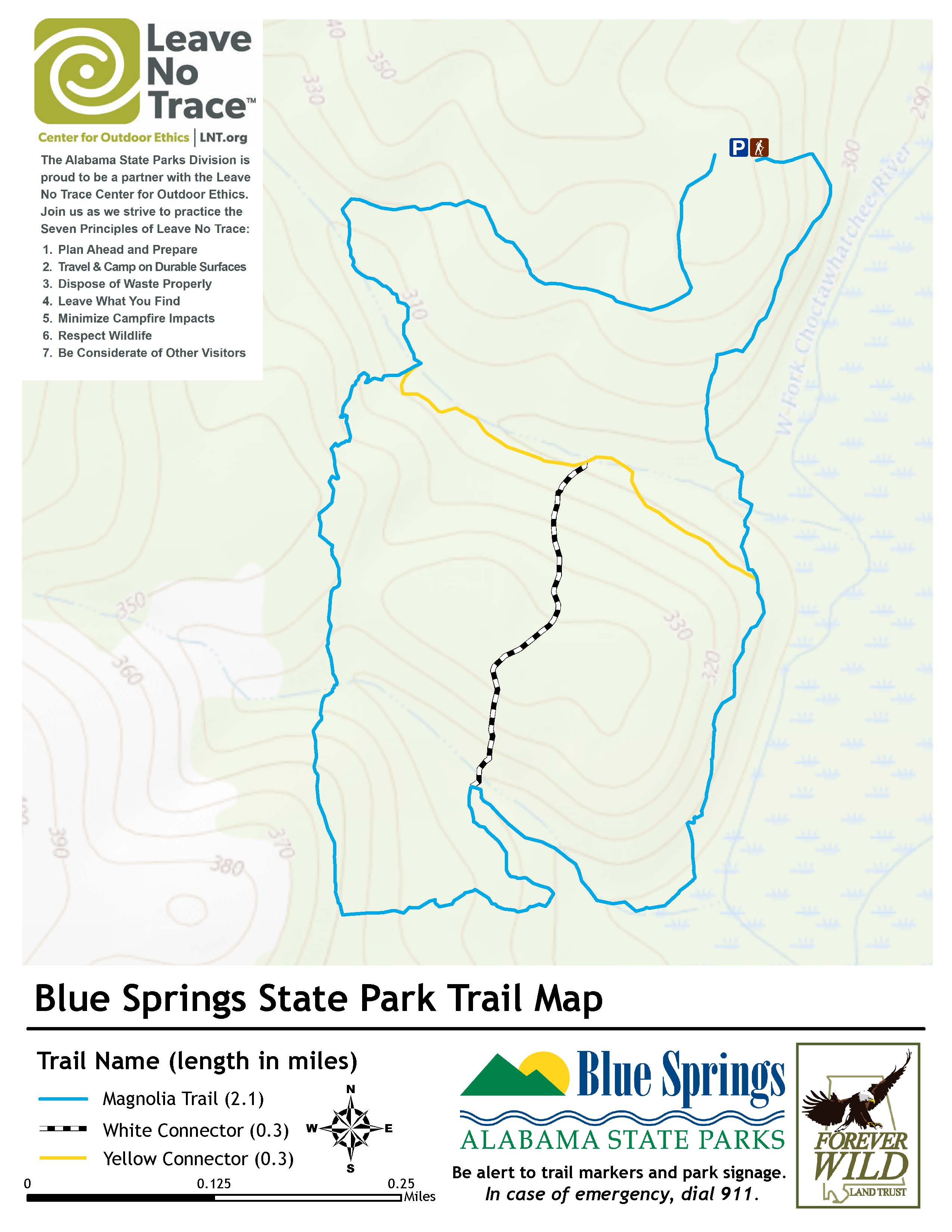
3047351 | Kirbert | Trails in Blue Springs SP are approximated based on park map: https://www.alapark.com/sites/default/files/2020-01/blue_spings_trail_map.jpg Ideally, someone should GPS track these trails and map them more accurately. |
||
|
|
1417178 | Kirbert | According to a flyer picked up in the park, there are a LOT more trails here than shown! Besides the Black Creek Trail, the Jeep Hill Loop, the Moonshine Ridge and the Whatley Trail, there's also the Bluff Trail, the Cascade, Leftwich, Pathkiller, Dog Hill, G-Force, Witch's Brew, Creek Path, Rooster Ridge, and a whole bunch more of the Drift Mine. I can't find a digital version of this flyer. One way or another, someone needs to map all these trails. |
||
|
|
289440 | Kirbert | The "Lakeside Trails" in this vicinity need to be mapped. |
||
|
|
2152254 | Kirbert | Is there a roadside park here? USGS topo map says there is, but it also routes Ernest Pridger Road differently. |
||
|
|
2191236 | Kirbert | Somebody with time on their hands could draw ponds in Silver Lake WMA until the cows come home. Then when they're tired of that, they could fix the edges of Lake Seminole and the Flint River, as those are simple sawtooths that don't truly represent where the water's edge is. |
« Previous | Page 1 | Next »