Loading...
Relation: الجسر (7080257)
Version #9
added boundaries in Beirut
Tags
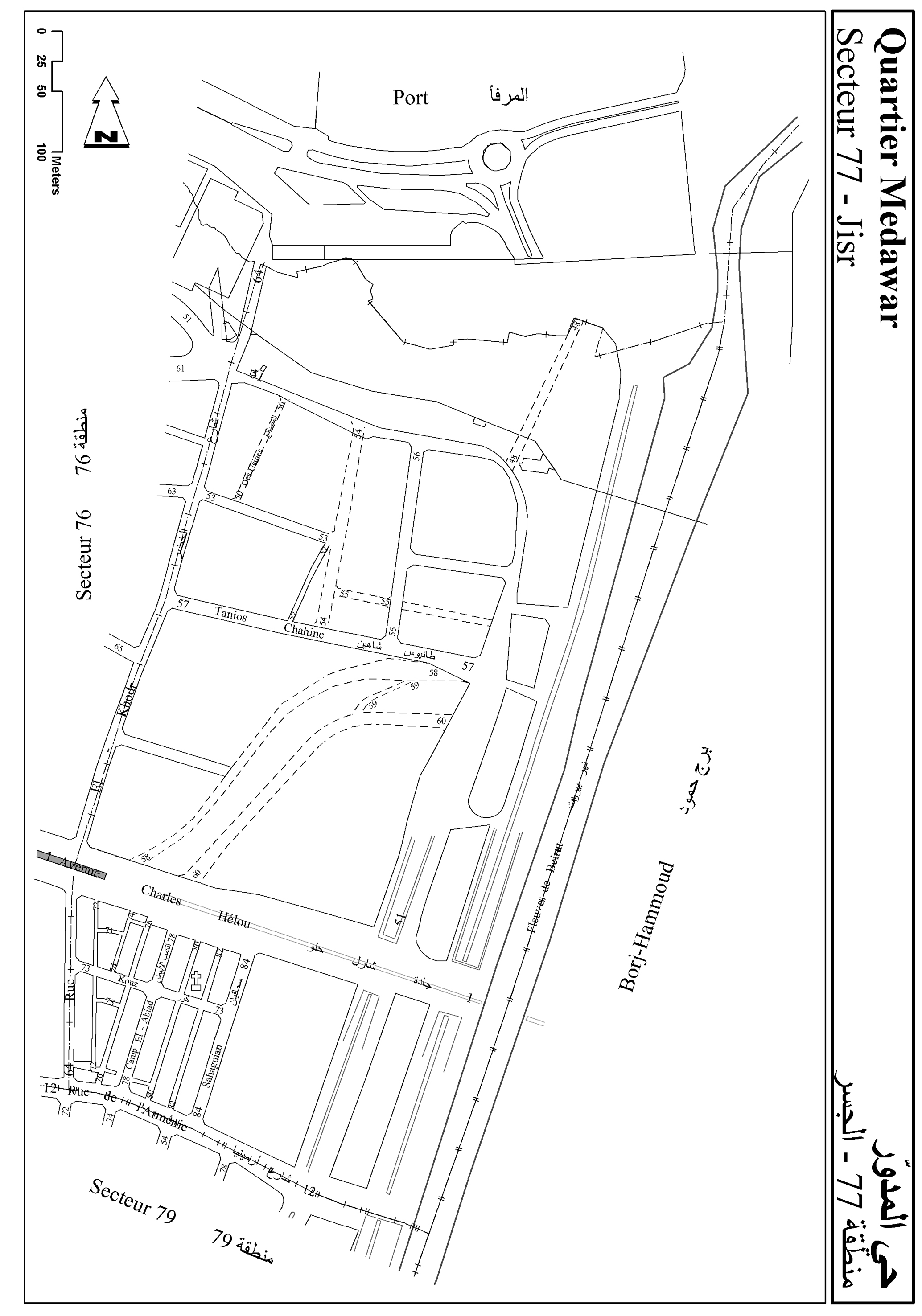
| _ref | 77 |
|---|---|
| admin_level | 8 |
| boundary | administrative |
| name | الجسر |
| name:ar | الجسر |
| name:fr | Jisr |
| source | http://wiki.openstreetmap.org/w/images/a/a7/77_Medawar_Jisr.jpg |
| type | boundary |
Members
15 members
- Way Rue Khodr (480993415) as outer
- Way شارع الخضر (454333509) as outer
- Way شارع الخضر (26328291) as outer
- Way شارع الخضر (470421888) as outer
- Way 481059826 as outer
- Way 481069482 as outer
- Way 277424327 as outer
- Way نهر بيروت (481059827) as outer
- Way شارع أرمينيا (25367224) as outer
- Way شارع أرمينيا (452148074) as outer
- Way شارع أرمينيا (261545578) as outer
- Way شارع الخضر (26328344) as outer
- Way نهر بيروت (480991281) as outer
- Way 229278164 as outer
- Way نهر بيروت (26705195) as outer
Welcome to OpenStreetMap!
OpenStreetMap is a map of the world, created by people like you and free to use under an open license.
Hosting is supported by Fastly, OSMF corporate members, and other partners.
| https://openstreetmap.org/copyright | https://openstreetmap.org |
| Copyright OpenStreetMap and contributors, under an open license | |