Loading...
Relation: Red Footpath (5956332)
Version #5
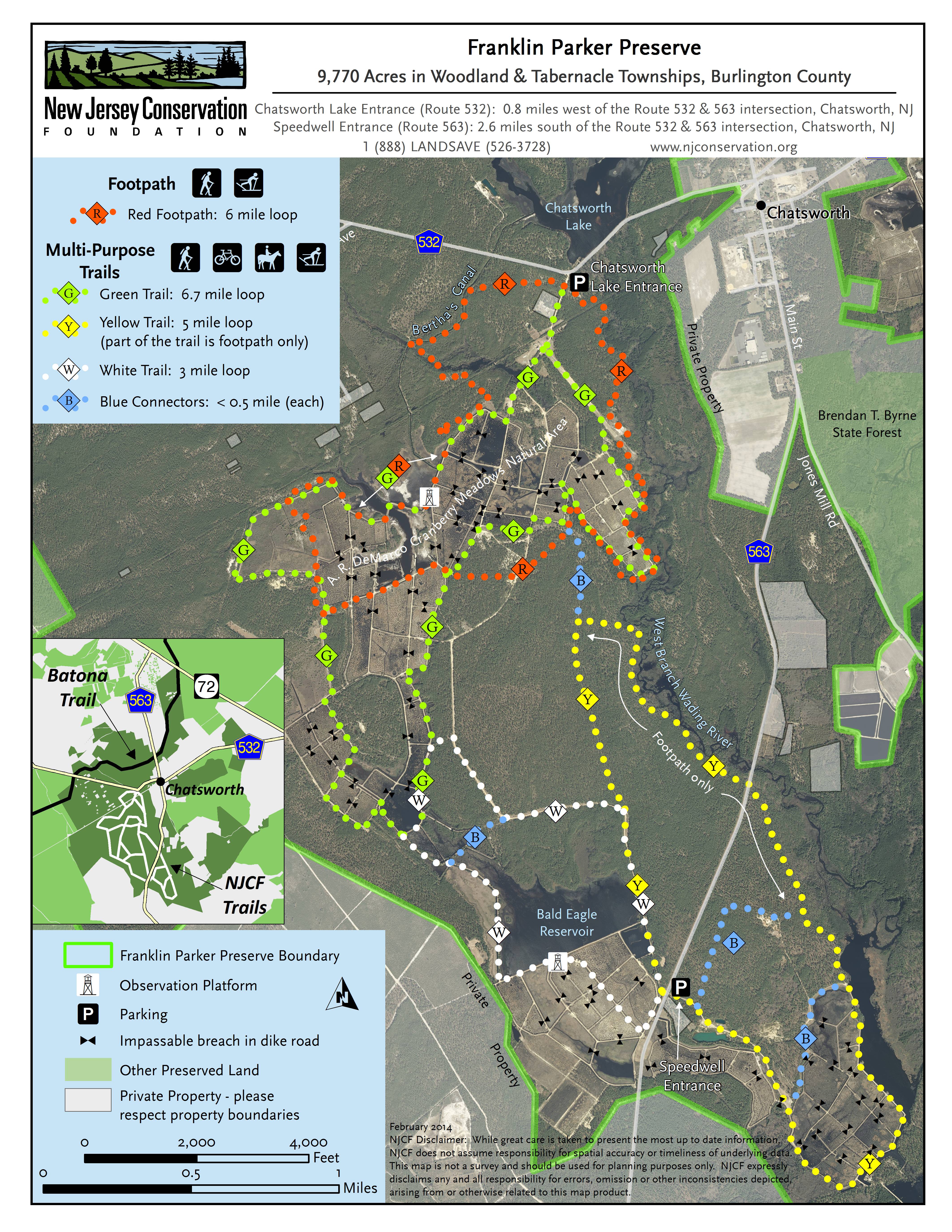
The Franklin Preserve/DeMarco bog walking and biking routes were missing "local" designations, which prevented them from rendering in OpenCycleMap.
Tags
| colour | red |
|---|---|
| description | Franklin Parker Preserve - Red Trail |
| distance | 6 miles |
| name | Red Footpath |
| network | lwn |
| operator | New Jersey Conservation Foundation |
| osmc:symbol | red:red |
| route | foot |
| source | https://www.njconservation.org/wp-content/uploads/2018/11/FranklinParkerTrailMap-color.jpg |
| symbol | red square or diamond |
| type | route |
| website | https://www.njconservation.org/franklinparkerpreserve.htm |
Members
17 members
- Way Red Footpath (359607768)
- Way Red Footpath (1207312767)
- Way Red Footpath (1207312766)
- Way Red Footpath (1207312769)
- Way Red Footpath (1207312768)
- Way Green Trail & Red Footpath (359607766)
- Way Red Footpath (359612455)
- Way Red Trail (359612448)
- Way Green Trail & Red Footpath (396637297)
- Way Red Footpath (359612450)
- Way Red Footpath (359612453)
- Way Green Trail & Red Footpath (359612452)
- Way Red Footpath (359612454)
- Way Green Trail & Red Footpath (359612437)
- Way Red Footpath (359612443)
- Way Green Trail & Red Footpath (359612445)
- Way Red Footpath (359612447)
Welcome to OpenStreetMap!
OpenStreetMap is a map of the world, created by people like you and free to use under an open license.
Hosting is supported by Fastly, OSMF corporate members, and other partners.
| https://openstreetmap.org/copyright | https://openstreetmap.org |
| Copyright OpenStreetMap and contributors, under an open license | |