Loading...
Relation: Obervinschgauer Panoramatour (3200015)
Version #5
url eingefügt
Tags
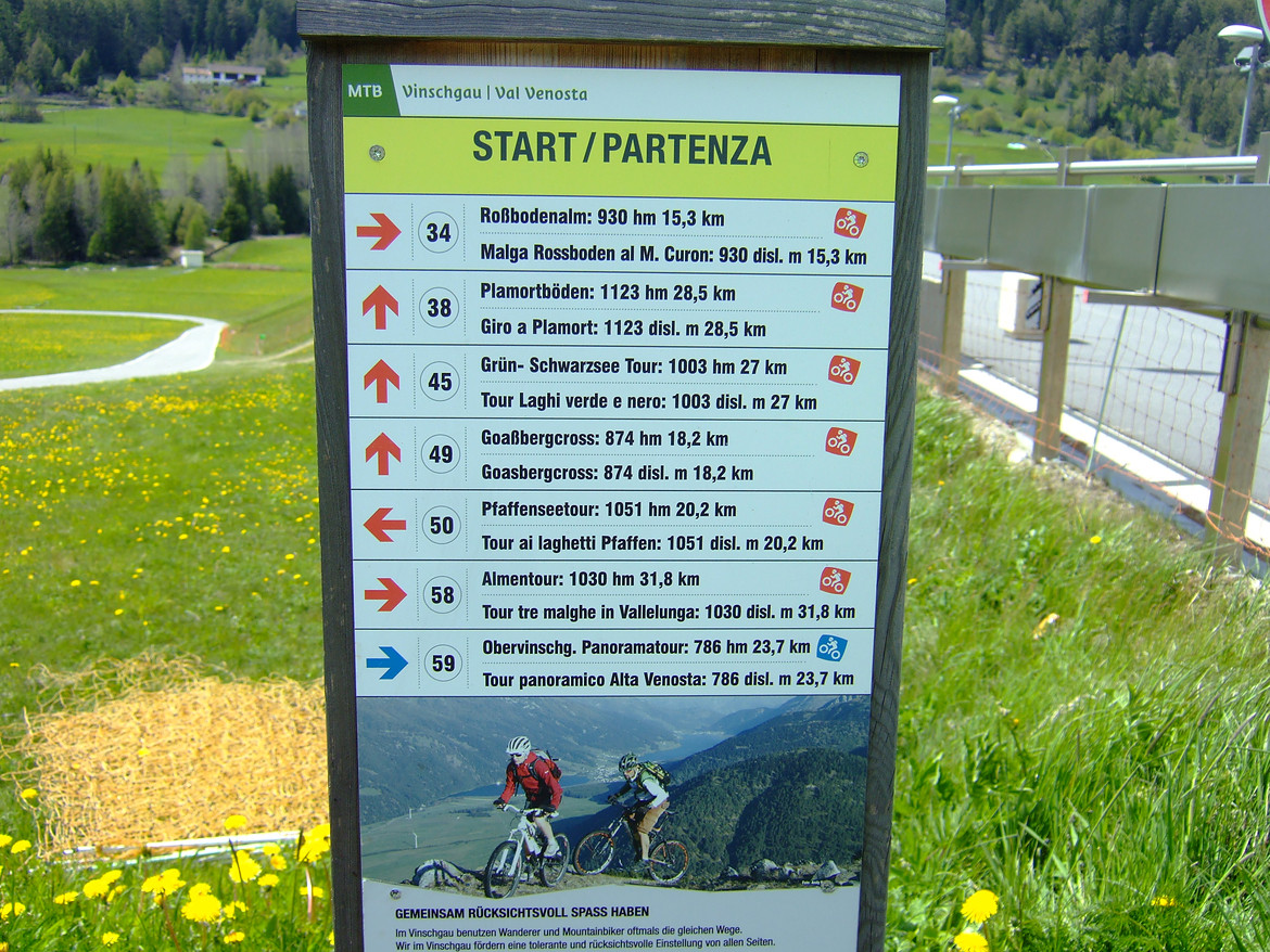
| ascent | 786 |
|---|---|
| distance | 23.7 |
| name | Obervinschgauer Panoramatour |
| network | lcn |
| note | incomplete |
| ref | 59 |
| roundtrip | no |
| route | mtb |
| type | route |
| url | https://fstatic2.mtb-news.de/f3/20/2008/2008450-9fykdaxxc53f-dscf1581-large.jpg |
Members
26 members
- Way GS/SC46.11 (132688553)
- Way LS/SP103 (230787460)
- Way LS/SP103 (230787462)
- Way LS/SP103 (237483035)
- Way Kohlplatzl (26362623)
- Way Totwasser (232980908)
- Way Erzgrube (232980905)
- Way Kührastweg (186334351)
- Way GS/SC46.11 (38241355)
- Way GS/SC46.11 (237483038)
- Way GS/SC46.11 (237483034)
- Way Seelochweg (34287396)
- Way 34301659
- Way 186334348
- Way 186334347
- Way 310235835
- Way Muntatschinig/Gemassen - Monteschino/Gemassen (186334339)
- Way Muntatschinig/Gemassen - Monteschino/Gemassen (26803216)
- Way LS/SP105 (418976421)
- Way 317550358
- Way Matscher Weg (27580428)
- Way Matscher Weg (317550336)
- Way Rabein (27580427)
- Way Vinschgauer Radweg (237325376)
- Way Vinschgauer Radweg - Pista ciclabile della Val Venosta (237324549)
- Way Vinschgauer Radweg - Pista ciclabile della Val Venosta (419437042)
Welcome to OpenStreetMap!
OpenStreetMap is a map of the world, created by people like you and free to use under an open license.
Hosting is supported by Fastly, OSMF corporate members, and other partners.
| https://openstreetmap.org/copyright | https://openstreetmap.org |
| Copyright OpenStreetMap and contributors, under an open license | |