Loading...
Node History: Nickelskreuz (3117150869)
Version #6
fix invalid flickr links
- Edited by chris66
- Changeset #151709810
- Location: 50.1640279, 8.3922894
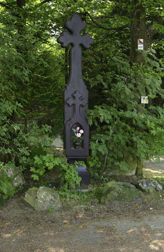
Tags
| historic | wayside_cross |
|---|---|
| image | https://live.staticflickr.com/1301/561972945_0877a43e11_o.jpg |
| name | Nickelskreuz |
| source:image | flickr © Michael Mertens |
Version #5
updated tracks, buildings and landuse according own GPS tracks.
- Edited by Hermann001
- Changeset #117980618
- Location: 50.1640279, 8.3922894
Tags
| historic | wayside_cross |
|---|---|
| image | https://live.staticflickr.com/1301/561972945_0877a43e11_o.jpg |
| name | Nickelskreuz |
| source | https://www.flickr.com/photos/125134384@N03/51897111831/in/album-72177720296871965/ |
| source:image | flickr © Michael Mertens |
Version #4
Besseres Bild mit Herkunftsangabe.
- Edited by fkMohr
- Changeset #70477901
- Location: 50.1640210, 8.3923303
Tags
| historic | wayside_cross |
|---|---|
| image | https://live.staticflickr.com/1301/561972945_0877a43e11_o.jpg |
| name | Nickelskreuz |
| source:image | flickr © Michael Mertens |
Version #3
Name, Bild-Link & Quelle hinzugefügt.
- Edited by fkMohr
- Changeset #70477361
- Location: 50.1640210, 8.3923303
Tags
| historic | wayside_cross |
|---|---|
| image | http://vve-eppstein.de//files/richard-hofmann-weg-10.jpg |
| name | Nickelskreuz |
| source:image | Fotogruppe Kulturkreis Eppstein |
Version #2
Wegweiser zwischen Eppstein und Eppenhain
- Edited by Cachologe
- Changeset #57794762
- Location: 50.1640210, 8.3923303
Tags
Version #1
Wege und POIs um Eppstein
- Edited by HeinerSchaefer
- Changeset #25925528
- Location: 50.1640073, 8.3923115
Tags
Welcome to OpenStreetMap!
OpenStreetMap is a map of the world, created by people like you and free to use under an open license.
Hosting is supported by Fastly, OSMF corporate members, and other partners.
| https://openstreetmap.org/copyright | https://openstreetmap.org |
| Copyright OpenStreetMap and contributors, under an open license | |