Loading...
Node: הר מירון (275295939)
Version #19
Copy wikipedia=he:* tags to wikipedia:he=*
- Edited by zstadler
- Changeset #149993764
- Location: 32.9977837, 35.4137268
Tags
| alt_name:en | Mount Meiron |
|---|---|
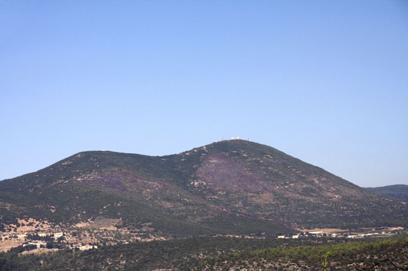
| description | הַר מֵירוֹן (ערבית: جبل الجرمق, (ג'בל אל-ג'רמק)) הוא ההר הגבוה ביותר בשטח ארץ ישראל ממערב לירדן. |
| description:he | הַר מֵירוֹן (ערבית: جبل الجرمق, (ג'בל אל-ג'רמק)) הוא ההר הגבוה ביותר בשטח ארץ ישראל ממערב לירדן. |
| ele | 1204 |
| gns_ref | -780671 |
| image | https://upload.wikimedia.org/wikipedia/he/2/25/Burnt_mt_meiron.JPG |
| name | הר מירון |
| name:ar | Jebel Jarmaq |
| name:ar-Latn | Jebel Jarmaq |
| name:en | Mount Meron |
| name:es | Monte Merón |
| name:fi | Meronin vuori |
| name:he | הר מירון |
| natural | peak |
| source | GEOnet Names Server (gns) |
| wikidata | Q540520 |
| wikimedia_commons | Category:Mount Meron |
| wikipedia | he:הר מירון |
| wikipedia:he | הר מירון |
Welcome to OpenStreetMap!
OpenStreetMap is a map of the world, created by people like you and free to use under an open license.
Hosting is supported by Fastly, OSMF corporate members, and other partners.
| https://openstreetmap.org/copyright | https://openstreetmap.org |
| Copyright OpenStreetMap and contributors, under an open license | |