
Dual carriageways, divided highways… Whatever you call them, this is what they look like:
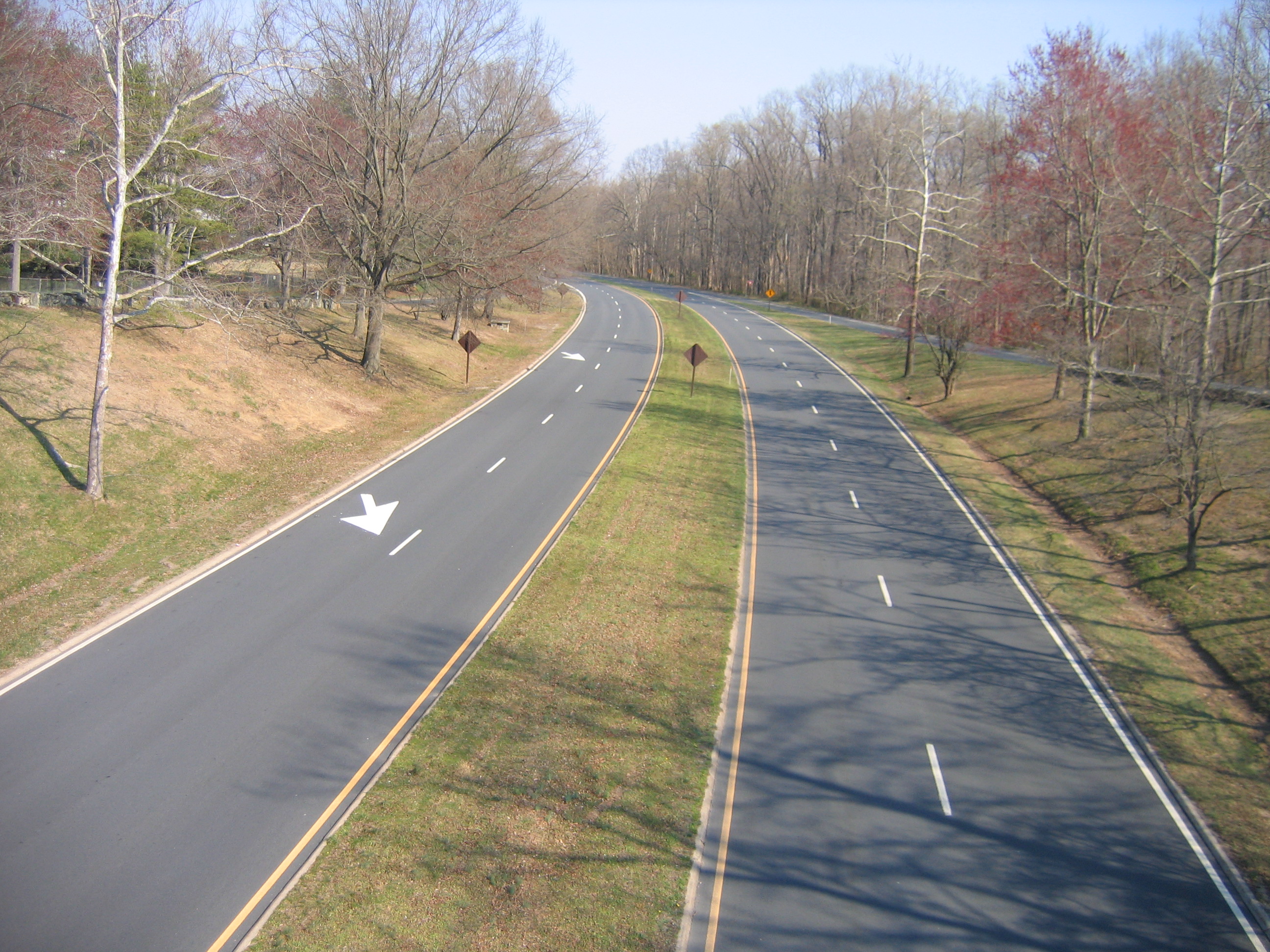 Image: Wikipedia
In OSM however, they are often mapped like this:
 Screenshot from JOSM, showing Bing imagery
This is surely better than nothing, but what we really want to see is an accurate representation of the road as it is in reality. Not only because we’re perfectionistic OSM mappers :) but also because there are practical implications to this simplified representation.
Here is an obvious example. Say you need to be at the place by the pink arrow, and you’re coming from the southeast there:
 Annotated screenshot from JOSM, showing Bing imagery
If this road were mapped as a single way, any navigation app would tell you to just turn left, which is clearly not an option. Also, turning on to the main road, navigation could tell you to turn left which is equally impossible.
There are still a lot of roads in the United States that are mapped as single ways but are in reality divided highways. Here at Telenav, where we use OSM for the Scout navigation app, we want all these roads to be properly mapped as dual ways. This is pretty tedious work (perhaps I will spend a separate diary entry on some of the mappy-grappy details) which is probably why it is not done in the first place, so our internal editing team has taken this on themselves.
 Plenty of
 fixme=dual carriageway around Memphis, Tenn. (Overpass Turbo). Map ©OpenStreetMap contributors
We don’t use any magic to identify the candidate ways. We just search the OSM database for fixme tags that have a value of dual carrigeway or some variation thereof. This gave us a total of around 6,000 ways to look at. Prioritizing trunk and primary, we were able to limit this to around 1,500 ways to look at for now.
We expect to complete this work by mid-February, and once we do, anyone using OSM data for navigation will see much improved results for the affected areas!
As always, if you encounter our work on this project in your area, please share your feedback, using the great new changeset comment feature for example. Or just drop me a line!
Discussion
Comment from pnorman on 27 January 2015 at 19:28
Surely you mean in the unedited US? ;)
Comment from pnorman on 27 January 2015 at 19:29
Surely you mean in the unedited US? ;)
Comment from Baloo Uriza on 27 January 2015 at 20:15
Oh man, dual carriageway mapping (or the lack of it) drove me fucking bonkers when I first started editing Tulsa. The big divided boulevards now have (and have had for a couple years now) full mapping of the medians with service stubs at driveways. (U-turns are generally allowed in Tulsa, but at the time I was driving a bit of a boat, which requires a bit of extra planning; now I got a Kia and I can swing these much easier, though it does make me wish I had a U-turn signal).
Comment from ToeBee on 28 January 2015 at 01:11
I wrote a blog post about dual carriage ways way back in 2011. Honestly not sure if it is worth the bits it takes to transfer any more but for what it’s worth…
http://ksmapper.blogspot.com/2011/03/dual-carriageways.html
Comment from escada on 28 January 2015 at 10:05
I usually have to do the opposite in Belgium. I have to change 2x2 lanes only divided by a white line that are mapped as dual carriageways to 1 way for both directions. This is needed when there are places where you allowed to cross the central line to access houses on the opposite side.
Comment from Rovastar on 28 January 2015 at 11:49
Sadly the most painful part of this is if these roads are part of relations. If a dozen bus routes are linked to a single stretch it is a complete pain to even try to fix the relations. I know at times I have just given up.
Comment from Vincent de Phily on 28 January 2015 at 14:04
Makes you wonder how those fixmes aere added in the first place. Did the tiger data mention “dual carriageway” but only provide a single line ?
Once you’ve exhausted the mundane, maybe you can use the magic of aggregated gps traces to find which side streets are only turned into from one driving direction.
Comment from Pieren on 28 January 2015 at 17:18
When I see your profile’s image, mvexel’s, I’m interested to know if your are the son of Chuck Norris.This striking resemblance, it’s disturbing….
Comment from kucai on 31 January 2015 at 15:17
maybe that single line is tagged with the new ‘obfuscate me’ tagging: lanes= divided, divider yes, median yes, grass yes, forward 2 lanes, reverse 2 lanes. Lordy, how i hate trying to decipher all those tags..