
Mapping touristical POI with MapComplete and the Flemish touristical agency 'Visit Flanders'
Posted by Pieter Vander Vennet on 14 March 2022 in English.Last week, we launched a new OpenStreetMap-based website: “Pin je Punt”.
This application -based on mapComplete- was commissioned by the flemish touristical agency Visit Flanders. The application is a map viewer and map editor, which requests information about charging stations for ebikes, bicycle rental, benches, playgrounds and a few more POIs.
Why?
This project was started for two reasons:
- No one in Belgium does know where all the charging stations for bikes are
- There are five different, provincial touristical offices. They all keep their own database of POI as benches and bicycle rental. ‘Visit Flanders’ (which is responsible for the five smaller ones) wants to unify and integrate these databases. And where better to store all the data then on the biggest geodata repository?
This project builds upon MapComplete, which aims to be an easy-to-use map viewer and editor.
The launch
The project is live since the 7th of march, the (dutch only) project page can be found here
A former radio presentator made an advertisment video as well, which can be seen on youtube (dutch only). As far as I know, this is the first professionaly made commercial which asks to contribute to OpenStreetMap!
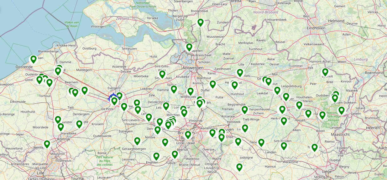
There has been quite a few edits done by now too:
The “import” tooling
As mentioned, these touristical offices already have quite a bit of data, especially about benches and picnic tables - but also a few playgrounds are known. For this project, the agency wanted to get all this data into OSM.
Importing these datasets (after some cleanup) wouldn’t be the best idea, as the data isn’t very fresh anymore. We opted for a different approach: a new note was created for every missing datapoint. These notes are loaded by MapComplete and shown when appropriate. A contributor can open MapComplete, and then confirm that a bench, picnictable, toilet or playground is effectively there. If it is, they are invited to slightly move the item to a more accurate position using the best available aerial imagery in the region. If the item is missing or duplicate, this can be marked as such and the note is closed too.

For now, this approach has been quite a success: from the 871 created notes, 87 have been handled already - some of them by long-time community members before the official launch; other by new contributors in the first days since the launch.
A big disadvantage of this approach is that we are spamming the notes. This can be frustrating for contributors who try to respond to every note, especially notes from newcomers to give a welcome feeling to them. For them, I created another MapComplete theme showing the OSM-notes. This one has advanced filtering fuctionality, to hide import notes, but also to filter notes created by someone, not created by someone, created before or after some date, ….
A second drawback is that some of these notes will be open for years. For this, we provided some tooling which shows all the import notes of a certain campaign with the option to close them all at once. When the project is ended (e.g. in one year time), we can close all remaining notes at once.
All information about the imported dataset is available on the wiki
At last: contributors with >5000 changesets can use the import helper page on mapcomplete too.
If you have a dataset about POI that are supported shown by one of the official themes, you can upload it if it is thoroughly cleaned, attributes are correct OSM-tags, the data is in geojson or csv format and your local community is informed and consented to the import.
The helper page will help you review the values, check the locations, remove duplicates from earlier open notes, remove points that are close to already existing points and finally upload it.
Discussion
Comment from joost schouppe on 21 March 2022 at 08:25
Worth mentioning that Visit Flanders became a Corporate Member of OpenStreetMap Belgium during the process. They came to us with the idea to make a significant donation, because they thought it was the right thing to do.
Comment from tordans on 22 June 2022 at 09:13
Hey, I know I am late to the party but I talked to a friend about the broader topic of importing external data just now and this notes-based-import-technique came up. So I wanted to finally write down my comment about the notes approach used for this project.
My take: I think a MapRoulette integration would be a far better approach than using OSM Notes this way.
In general, I fully agree that we should use a review-process to check this kind of data before adding it to OSM. However, the tooling of OSM Notes is not great right now (which is why tried to compensate with the MC-Notes-Theme, I guess), so adding a lot of notes for “imports” does not scale at all.
On the other hand MapRoulette is a great tool in our eco system that allows to manage the status of such external data pretty great. The process you describe for notes …
… would just as well work for a MapRoulette project/challenge and task. The tool is very flexible in they way it can be configured; quite stable; maintained; and has an API to integrate it into external apps like MapComplete.
FYI, I created this ticket a while back to track the status of integration of MapRoulette in other tools https://github.com/osmlab/maproulette3/issues/1737.
Comment from Pieter Vander Vennet on 22 June 2022 at 09:42
Hi @tordans,
There are definitively drawbacks to this approach of notes and MapRoulette would indeed be better (but is harder to setup).
I do agree that it doesn’t scale very well beyond a few 100 points per city; but within that reach it does work well. But for bigger datasets it’ll be too much.