After a dearth of enthusiasm, I got off my lazy ass and did all missing slices in the northern half of my one-man cake.
At this stage, the only thing missing are the bus stops (which usually require to acquire a fairly large amount of data each, so I haven't done much with them yet).
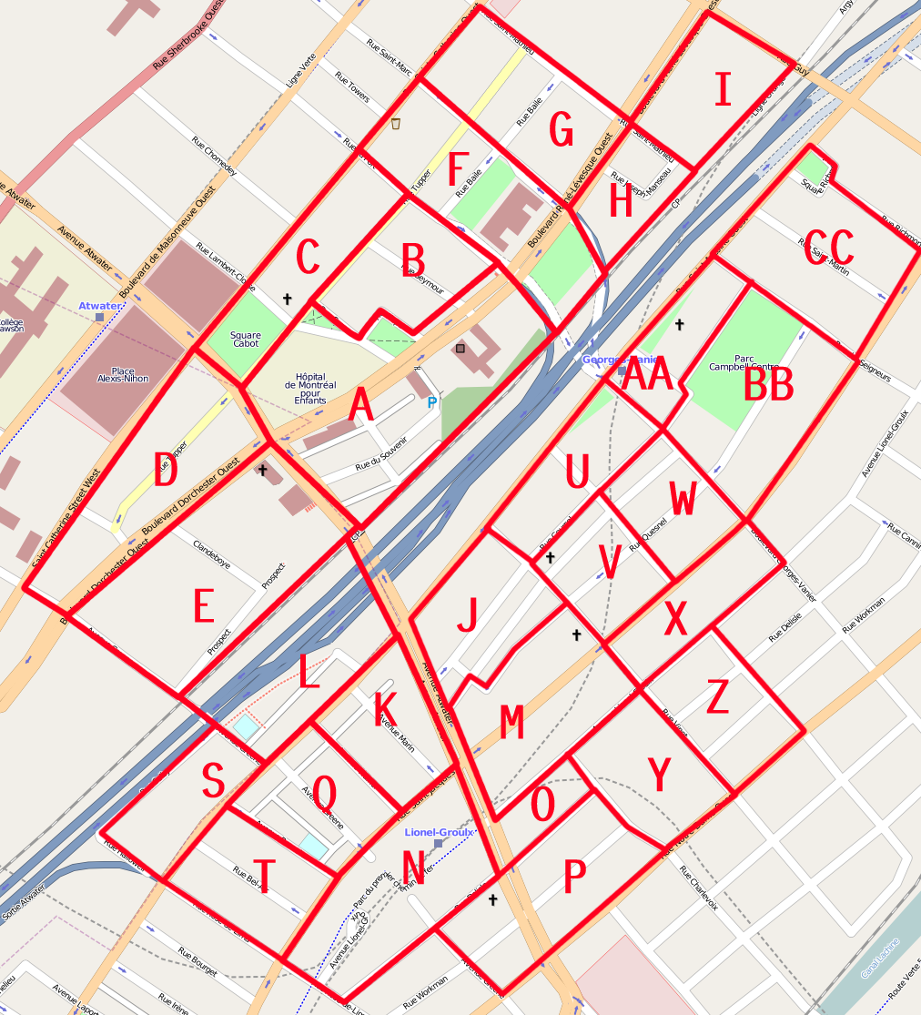
-Slice H is going to undergo fairly major revision at some point in the future if a project to construct condos on the 1800 René-Lévesque lot goes through. That building used to face a street that no longer exists, hence why its entrance is on Joseph-Manceau, and the façade toward the highway. Otherwise its only odd feature is that Canada Post says there is a 1055 civic number on Saint-Matthieu, which I have not found, and also that there are no addresses actually located on Joseph-Manseau street. While looking for stuff, I also learned that the formal name of the jardin des Sculptures is "Esplanade Ernest-Cormier"
-Slice I was... interesting. It's got some pretty tightly packed up addresses, what looks like a private park-like thing (which is actually public access AFAICT. It's misleading because I do not map much urban furniture), and a missing street (Amesbury Avenue). Many postcode-owning buildings too. There's a weird dirt road going off behind the SPVM's Southern Logistic center, with a purported "920, Guy" CP address marked, but it's not recognized by Canada Post.
-Slice G had a lot of boring residential house numbering, but the alleyways were sometimes difficult to transfer from my notes to the map.
-Slice C, which I had expected to be by far the hardest, turned out to be easy EXCEPT where the alleys (part of which actually ran as a tunnel through Complexe Du Fort), which were a proper nightmare to map and transfer on data. You'll notice a small highway=path segment. This is because although the pavement is continuous, this is a small space between the corners of two buildings where a normal motorized vehicle would certainly not fit.
Location: