Loading...
Node: Dolmen de La Pierre Cesée (7596218670)
Version #7
removed site_type= as transitional simultaneous tagging with archaeological_site=, as discussed in https://community.openstreetmap.org/t/implementation-of-new-tagging-scheme-of-archaeological-site/7850
- Edited by ChillyDL
- Changeset #138540695
- Location: 47.5690124, -0.3941694
Tags
| archaeological_site | megalith |
|---|---|
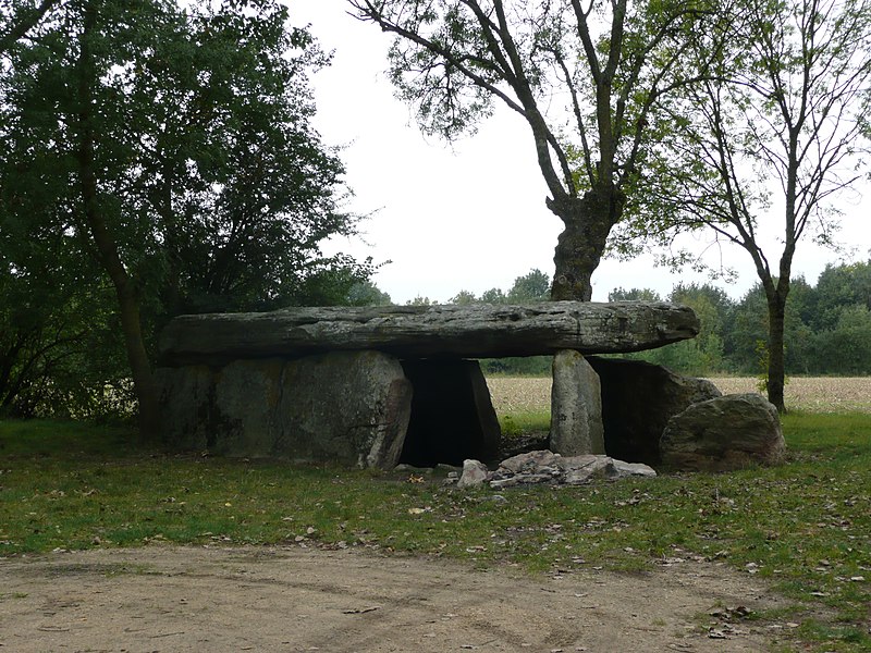
| description | La chambre mesure plus de 7 mètres de long pour 3 mètre de large. Elle est couverte d’une seule table de couverture (8,80 m de long pour 3 m de long). |
| historic | archaeological_site |
| historic:civilization | neolithic |
| image | https://p.monumentum.fr/main/49/pa00109362-dolmen-pierre-cesee.jpg |
| inscription | L'édifice est classé au titre des monuments historiques en 1910. Le dolmen de la Pierre Cesée est un dolmen angevin. |
| megalith_type | dolmen |
| name | Dolmen de La Pierre Cesée |
| wikidata | Q3034093 |
Welcome to OpenStreetMap!
OpenStreetMap is a map of the world, created by people like you and free to use under an open license.
Hosting is supported by Fastly, OSMF corporate members, and other partners.
| https://openstreetmap.org/copyright | https://openstreetmap.org |
| Copyright OpenStreetMap and contributors, under an open license | |