
SteveC recently started a Kickstarter campaign for a GPS Art Poster. Since my country is not included, I decided to check the tracks around my OSM patch.
The image below shows all the publicly available traces in OSM (not all of them are mine but most are) and also some I didn’t uploaded over Marikina City. I probably have more lying around SDcards and in my GPS internal memory.
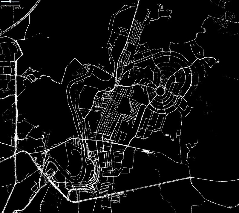
The image does gives you a personal story of your mapping expeditions.
-
The “low-res” tracks along the circular roads (northeast) were one of my earliest mapping for OSM. Back then, I was using an old eTrex without an SDcard slot. It would take around 2 hours of walking to fill the internal memory. To download the data, I hacked an old serial cable mouse and a plastic card (very similar to this rig) because buying the Garmin serial cable is almost half the price of the device.
-
The tracks made by my students (6 years ago) for an end of term mapping project is still very visible and were never replaced by a much better trace.
-
Someone (not me) must have forgotten to turn his/her GPS off and then uploaded the point cloud without any post clean-ups.
-
The lonely trace in Provident Village was when I visited a fellow mapper and delivered one of our GPStogo unit he is planning to use for a mapping expedition.
-
The large blank patches (center west) are private subdivisions where you are not allowed to enter unless you show an ID or you have an official car sticker. I never bothered cycling inside those posh subdivisions.
What’s your GPS track story?
Discussion