jesolem's Diary Comments
Diary Comments added by jesolem
| Post | When | Comment |
|---|---|---|
| Introducing OpenStreetView | @descilla Thanks! Good comments. Quick replies and then I think we can move Mapillary feature discussions outside Martijn’s announcement post, to the Mapillary forum or issues.
Thanks for caring. |
|
| Introducing OpenStreetView | @Richard True and valid comment regarding metadata and we are looking into options there. As far as I can see there is no license granted for metadata on OSV either and with no API for the metadata, how are you going to get it? @hbogner I hear you. |
|
| Introducing OpenStreetView | @metatech Good questions! @mvexel Your statement about Mapillary is an open platform for all people and organizations with an interest in contributing and using street imagery. See my thoughts on Mapillary and OSM if you want to understand the thinking. The API is open, the images have an open license, we give all images and data to OSM. Currently we have over 250 integrations where people are using Mapillary for map editing, research, travel blogs, and more. The three top ones are all OSM integrations: 1) The Mapillary JOSM plugin Telenav could have used Mapillary for editing OSM just like Mapbox and several other companies do. For free, forever. @mvexel The failed ScoutSigns attempt failed because you downloaded the result of over 1M traffic sign API queries to Telenav servers, outside of OSM, and not because of lack in commitment to OSM from Mapillary’s side (which is what you’re hinting at). (Disclosure: I am one of the founders and the CEO of Mapillary.) |
|
| Mapillary on the road | Great writeup! |
|
| Mapillary | Hey everyone, I too would love to see a JOSM plugin for Mapillary! No reason to stop at iD integration, JOSM would be a huge win for the community. We currently don’t have the resources in house to do the work but would be happy to help. Just let us know what you need! We could possibly help sponsor dev time too. Let us know what we can do: hello@mapillary.com /Jan Erik (I’m a Mapillary founder) |
|
| Which camera for capturing 'Street View'? | Nice post Martijn I have both a Garmin VIRB and a GoPro Hero3. The GoPro wins on image quality. The color balance is not great on the Garmin when riding against the sun (I know I shouldn’t do that btw). When it comes to mapping for Mapillary, the VIRB wins for me. Not requiring an extra GPS to sync against, and all EXIF tags in place straight off the camera. I wrote up my process here: http://blog.mapillary.com/update/2014/06/16/actioncam-workflow.html I use a GoPro mount when biking.
The web uploader, although recently improved, is a little sketchy with long sequences. We are working on scrips and API for upload. I’m one of the “Mapillarians” mentioned above, you can give us feedback at hello@mapillary or GitHub. |
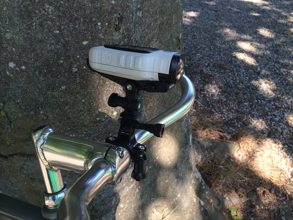 This works great as the little display on the VIRB points upward so I have a nice preview that helps me align the horizon.