
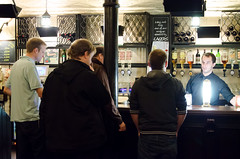
I didn’t organise a London OpenStreetMap meet-up in a while. The last one was in ye olde cheshire cheese last month. As usual Alex got some great photos, and me… slightly less so (on flickr)

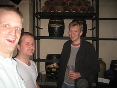
I really like this pub, but it is a bit loud and echoey when it’s crowded like this. We shouted some interesting conversation at each other though:
Derick was thinking about how to build a tool for vandalism/mistake detection, i.e. a tool which analyses edits as they come in and flags up ones which seem a bit bogus. Some basic heuristics should be quite easy, but he was finding some limitations with the basic API calls for retrieving objects, areas, and changesets. In particular you can’t easily identify an edit which moves a node, or get the location where the node has moved from. This information would be interesting to display for a particular changeset, it could even be added to the changeset displays on the website somehow, but at the moment the old location of a node requires a history call (for each node you’re interested in). Obviously there’s more intensive solutions involving syncing with diffs or crunching the history dump data, but perhaps seeing where a node has moved should be easier.
At work I’ve recently come to the end of a project to develop a native iPhone app, and weirdly I’m itching to develop something else, even though I don’t really like apple’s closed platform, and I had a lot of struggles learning iPhone development. Maybe it’s because of those struggles. So we talked about ideas for simple OSM apps. At the moment there’s quite a few ideas which would still fill a gap. It seems weird to me that MapZen POI collector remains the best OSM editor for iPhone… even though in many ways it’s really not that good. Although the simplicity is awesome, and I actually think limiting to POIs rather than geometry is a good move, this kind of app could be extended to include OpenStreetBugs reporting / finding, and maybe offline operation, in terms of not needing an internet connection to load the background maps, and also storing changes for review and upload later. There’s also “gaps in the market” for more simple non-editing apps using OSM data e.g. for local search. As usual I’m talking about these things, but probably won’t get around to doing anything.
We talked about remapping needed in London. Derick’s been heading out and knocking off a few priority areas. There’s still a few tube line related problems, and most importantly we were noting that some pubs need to be re-mapped!
We also talked about London mapping in relation to Alex’s proposal to armchair map more building outlines. I’m supportive of the idea provided it’s done carefully. If this sounds horrific, and you despise all armchair mapping ideas, I have to tell you your opinions are not currently very well reflected in the comments there, or on the ‘armchair mapping’ wiki page discussions. As for the opinions in the pub, I think I actually missed this conversation (mainly because it was too loud, and I was shouting one-on-one with somebody else at the time). What was the conclusion? Anyway it’s always good to have some map printouts spread over the table. Alex brought some along to discuss buildings coverage, including an interesting one highlighting those buildings which have not been touched, and are presumably of a low accuracy, since bing imagery superseded yahoo’s.

Things did quieten down. In fact towards closing time we suddenly had the place to ourselves and had a good intense brainstorming session on the topic of OpenStreetMap events in London. How to attract new folks to our pub meet-ups? I think the overriding conclusion was that we need to try mix things up with some different event formats. We need to do presentations and mini-OSM-conferences. We need to do things at the weekends sometimes. We need to have training/workshop sessions for new editors, as well as more technical developer events. Or we need to just meet in cafes and libraries instead of pubs on occasions.
I’ve certainly pondered these things plenty, but I’ve rarely deviated from the tried and tested pub formula. I feel like other things would require at least two or three people to say “I’m in” much more positively. Other types of events tend to require some more complex logistics. The venue in particular. I always thought the easiest way to achieve the same thing, would be to piggy-back on other people’s events. There’s certainly enough generic tech meet-ups, hack events & presentation events etc in London that we can go along to and hijack for our own purposes. So I’ve tried to post some of these as listed OSMLondon events (the one’s I’m thinking of going to myself) but generally with limited buy-in from everyone else.
But perhaps this summer we will experiment a little more. I’ve already broken the mould a little bit by setting up a wiki page called “London/Summer 2012 events”. That’s right! This summer it’s not a “Mapping party marathon”. It’s a set of hopefully varying types of event.
Now obviously I should have set up a pub meet-up for the “end of the winter”, but license change shenanigans and various other announcements have created a disturbance in the force and my powers have been weakened… and right now I’m on holiday in Brazil! I’m getting a good summery feeling right now (too hot!) but this means that the London summer events 2012 will have to be kicked off by somebody else. How about it OSMlondoners?
Discussion
Comment from Dr Kludge on 11 April 2012 at 02:35
It would be interesting to have a Summer building focus here in the US too as a way of morally supporting your prepartion for the Olymics. It will be interesting to see what you come up with.
I am sure that the armchair mapping is an issue with some mappers. As for me, I never really got the GPS thing going. In addition, the US Tiger import gave me a large amount of data to begin with that needed correcting. I understand the Yahoo ground truth verses, Bing ground truth and the big difference between the two at times. I am not sure how good GPS ground true is for some of the non-commercial devices available to mappers? All in all, armchair mapping is all that I have ever done because of the available Tiger import data as a starting point.
Now in addition to the armchair mapping, I go take pictures of areas that I am interested in. I have 3500 pictures on my cellphone. The pictures allow me to add additional information to the tracing effort. For example, walks along the light rail line have resulted in this area build up http://www.openstreetmap.org/?lat=33.469163&lon=-112.073748&zoom=18&layers=M. Chuckle: the fringe area around the Phoenix Zoo kind-of made it into a map of the week image. I traced all this area in from aerials and used pictures to remember information when I visted this area during a three day class http://www.openstreetmap.org/?lat=33.448403&lon=-111.957292&zoom=18&layers=M. I still have information on picutures that hasn’t been mapped yet.
It would be great to figure out how to bootstrap mapping events like you guys have in Europe.
Comment from Pgd81 on 11 April 2012 at 09:19
As a new mapper, the Armchair Mapping debate intrigues me. Obviously I’m not familiar with the history, but presumably access to Bing imagery has changed the game somewhat. Are there “degrees” of AM? For instance, without a GPS device the only way I can currently map is to visit a place, take photos/make notes/remember stuff, then use those pics/notes/memories when I get home to trace areas and ways using Bing (I don’t map things if I can’t clearly trace, or at least confidently infer, their outlines). Is that considered “better” than simply tracing a building miles away from you that you have little or no actual knowledge of? Or are both considered AM?
Comment from dcp on 11 April 2012 at 10:44
Don’t knock the armchair mapping too much. It depends on the imagery available. For an example of excellent up-date-imagery see BING for Portugal. It is from 2011 and extremely detailed. My GPSmap 60CSx is nowhere as accurate as Bing. Local knowledge is still essential for the POIs and of course the only way to tag properly is doing proper survey work. I caught one guy who declared paths as highway=unclassified in Portugal but he did not understand the error of his ways. That is not a pun! I only wish I had such imagery available for my home area. Here the Garmin still comes into its own!
Comment from pfr on 13 April 2012 at 06:45
London is a bit tricky for armchair mappers, seems the bing imagery is quite a bit offset in places. For example, at Putney Bridge zoom 19 from oct/2011 are significantly offset from zoom 20 images from april 2008.
Which of these should one use? Gps points do not help much, and this is a problem all over London: pre-existing buildings are all offset differently, possibly yahoo images were differently aligned also. The offset should at least be determined to a reasonable amount, verified and armchair mappers informed about it, to avoid further confusion and misplaced buildings.
Comment from Wynndale on 13 April 2012 at 18:39
I use the OSM database of stored GPS tracks to calibrate Bing imagery. At the moment zoom level 19 is accurate and 21 is offset; a few months ago it was the other way round.