
Elephant mapping in Notting Hill
Posted by Harry Wood on 24 May 2010 in English. Last updated on 8 June 2010.Before you read any further... Tomorrow night we're mapping around Fleet Street Sign up! sign up!
A couple of weeks ago we had a evening pub meet-up and mapping session in Notting Hill. Matt picked the pub, and gregory drew the cake diagram. So that was great. I got a bit of an organising holiday. If anyone fancies doing either of those things in future, please let me know... or just do it! Other tasks include setting up the wiki information, setting up listings on upcoming.org and other places, and doing a fun little diary entry about it afterwards. But wait! I forgot to do the fun little diary entry! OK here goes...
The weather was rather pleasant, and I'd somewhat cheekily opted to map a slice which was already thoroughly mapped, just because I fancied going to take a look at Holland Park. I'd never been there before. So had a quick peek:


Then I rushed off to the pub. But on the way I mapped an elephant to appear on gregory's elephant map. Multi directional machine tagging!
And here is Gregory the elephant mapper himself, having fun mapping:
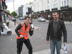
He was there with pontofisso, an Italian geo-dude. Hopefully Gregory gave him a good demo of OpenStreetMap mapping.
I reckon our pub meet-ups should be a good opportunity for people working with geo technology to find out more about OpenStreetMap (and anyone working in geo tech should be interested) The gatherings are pretty informal and the mapping is sort of nit-picking details at this stage, so you may prefer "bigger" mapping events or hack weekends... but for a little intro and chat with some OpenStreetMap people, why not pop along one evening. For example...
Tomorrow night we're off to Fleet Street to Ye Olde Cheshire cheese. This is partly because my sophisticated blob analysis reveals this to be a priority area, but mainly because it's one of our favourite pubs (look how happy we were last time we were there).
All the details on the wiki. Come join us!
Discussion
Comment from Wynndale on 24 May 2010 at 19:04
A potential talking point: How many building outlines should we import from StreetView?
Comment from LivingWithDragons on 24 May 2010 at 20:09
I made the elephant page URLs even nicer now, http://www.livingwithdragons.com/elephants/215 but not sure why your photo isn't showing there.
I think I need to work on my action pose so I don't scare off any more new comers.
Wynndale, I didn't add any building outlines in Notting Hill, but will add all the buildings for my slice before I heard out tomorrow. The mailing-list discussion you link to is how many should we import for areas we'rre not going to ground-survey.
Comment from Harry Wood on 24 May 2010 at 23:59
yeah it's an interesting discussion. From the StreetView outlines I've seen though, I'd say tracing fuzzy yahoo outlines would achieve better results in the city centre. Around Fleet St for example, it's mostly solid orange. Yahoo tracing followed by taking a look on the ground to clear up any confusions, seems to work well for me, and is actually quite fun (compare what you saw from the sky, with what you see at streetlevel, and puzzle through how it matches up) Of course yahoo is nowhere near UK-wide, and in less dense areas StreetView might be better, but I've heard reports of some pretty glaring inacurracies in the StreetView buildings. Anyway ...we'll discuss it, yes!
Comment from Harry Wood on 27 May 2010 at 16:01
Update. Gregory's elephant map now includes a textual list: http://www.livingwithdragons.com/elephants/list