Antwelm's Diary
Recent diary entries
Based on geohasing. App called ' 'Cheaper GPS' on iPhone AppStore..

Tons of snow outside,
tons of things to do inside..
Started clearing dupe-nodes a few days ago, by using JOSM and:
http://matt.dev.openstreetmap.org/dupe_nodes/
Already top #22 on the list of heroes and villains of duplicate nodes (http://matt.dev.openstreetmap.org/dupe_nodes/heroes.html).
Found a couple of JOSM bugs related to this work, but not sure how to formulate a bug-report..
Been to town today and trying out Mapzen on the iPhone. Nice app for on-the-go POI'ing, but should be a bit more open to what you could add. Maybe an 'advanced mode', so I could enter tags pr typing instead of being restricted to pre-programmed values..
Why I use my GPS for other things than navigating..
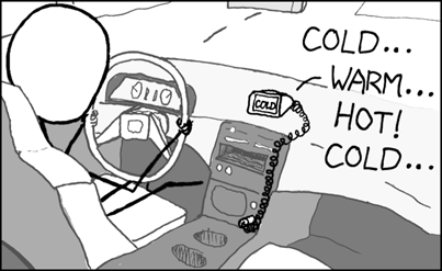
LOL

Finishing up Stavanger, Norway
Posted by Antwelm on 22 July 2009 in Norwegian Bokmål (Norsk (bokmål)). Last updated on 29 July 2009.Almost finished. How does a town get declared COMPLETE ?
Here be dragons:
Hundvåg Ø + some N
Tasta N
Kvernavik
Gausel
Mariero
Vaulen
Jåttå
some @ Forus
some @ Sola (E+N)
Rennesøy+øyene
Although not technically Stavanger:
Randaberg CBD
Smeaheia
Lura
My little brother has taken OSM to another level. We call it COASTWALKING (see pic) and should keep him occupied for a lifetime. Especially since we live in Norway, with a coastline of 83281km ... (!!!) ... ;)
Apart from tha, our area (Stavanger, Norway) is coming along nicely, with the two of us drawing !

My little brother (http://www.openstreetmap.org/user/gormur) has bought a GPSr and joined in the effort of mapping Stavanger (Norway). He's already done Stokka (see below), and done loads of linting in the area.
I'v been convinced to try out the desktop editors (JOSM & Mekaartor). Not sure which one I'll end up with, but Merkaartor seems way nicer coming out of the box..
Did a 15km bikeride after nightshift at work.
Some uncharted territory and some fiddeling and some additional streets downtown..
Redrawn some forests, commercial areas etc to better reflect RL. Added the Ullandhaug and Byhaugen tunnels (both major and on E39).
Started twittering to #OSM
What about yourself ? :)
Done some rides recently in uncharted territory. Some wake-nights and more drawings are completed :)
Outlines and major roads @ Hundvåg coming along nicely:

Did a 25km bikeride on the outskirts of the island Hundvaag before last nights nightshift. Even found a huge military area I didn't know about.
This is how the island looked b4 I started:

Did a 15km bike-run after self-defence course @ work today (ehh... Yeah, we need it..) in uncharted territory.. Also managed to pick up a GeoCache on the way ;)
Sitting here drawing roads, paths, forestes, lake, parks and schools in the area of Aasen and Kristianlyst, while watching 1'st season of 24 :)
More and more drawings :)
Redrawn coastline for Sølyst and Grasholmen and done the roads around there.
Did some coastline work there ages ago also, which hasn't been loaded to the servers yet. Guessing the coastline-updates are considerably less frequent ???
Also did some more of the outer harbour-roads in town.
Did go for a little drive today and uploading two more traces from that, not sure if Im bothered drawing them out now though..
Some more of Old Stavanger, a cemetry, more interconnecting roads..
Drawn some forested areas, added some snippets of roads + corrections inc in a few additional traces. Drawn the hospital.
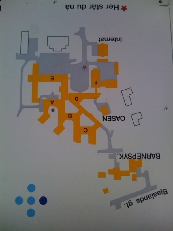
Roughly drawn the hospital and a nearby school, using pictures and knowledge (it's my workplace).
http://i32.photobucket.com/albums/d6/Antwelm/SUS1.jpg
http://i32.photobucket.com/albums/d6/Antwelm/SUS2.jpg
My hometown of Stavanger, Norway was unmapped when I joined here 10 days ago. Clicking here you can see how the same screen looks today, and below U can see a zoom of the CBD as pr today:

All done with a couple of 'old' traces, but mainly traces I'v done back and forth to work over the last week..
Today I added cycletracks @ Vaaland and a whole heap of other corrections+additions..