GPSMash update - Support for NMEA import, data cleanup updates
Posted by Alexander Avtanski on 5 August 2013 in English.Hello,
I just finished testing the latest update (1.3) of my GPS logfile handling tool GPSMash. The new features in version 1.3 are:
- import of NMEA logfiles
- improved track cleanup algorithm
GPSMash is a command-line Windows application that can repair broken GPX files, clean-up, organize, and analyze data, convert to various formats for visualization, etc.
Here is a sample video using data processed with GPSMash:
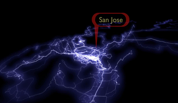
Click to play video: http://youtu.be/hAvHgBFEOAc
If you are interested, you can download it from my site:
Any feedback is welcome.
Regards,
Alex
Discussion
Comment from Stalfur on 5 August 2013 at 19:14
Very interesting, nice visual output. Looks like something that could help me with introducing OSM to people, am about to finish mapping (buildings and their numbers, streets, sidewalks, paths) my hometown and want to present it with a bit of flair to show the work behind it (quite a few .gpx files used to help make it better) and to try and get official sources to release data for it (fire hydrants and other).
If I do manage to do something with it I’ll let you know!
Comment from Alexander Avtanski on 5 August 2013 at 19:33
The visualization in the video was done with Blender (freeware 3D modeling tool). GPSMash was used to load GPS tracks, clean-up the data, and combine them into a single .X3D file, suitable for 3D modeling.